Nav Bar

About     ♦   Foraging     ♦   Backpacking     ♦   Trail Food    ♦   Wild@Home    ♦    Links    ♦   Demeter's Wild @ Home Store

Emergency Essentials/BePrepared

Appalachian Trail Day 132 - Ridge Top Campsite to Upper Goose Pond (Mile 1,532 to Mile 1,555)

I couldn't fall asleep for quite some time last night. The last time I looked at my watch was 9:43 p.m., and I woke with first light since I forgot to pack my buff.  Nature's alarm clock had me up and moving at 5:10 this morning.  Although I could have used another hour or two of sleep, I feel pretty good this morning. I pack up in the pre-dawn light, and I'm on the trail at 5:50.

I look ahead and set up a meeting point with my dad 4.7 miles up the trail in two hours, which should be reasonable considering that I am ridge walking this morning.

The trail meanders up, down, and around large rocks in a burned out hardwood forest. I pass a couple views, but the haze is thick this morning. At 6 a.m. it's already 75°F, and today promises to be hot, with a solid chance of thunderstorms this afternoon, so I plan on making as many miles as I can this morning.

Two miles into my hike, I pass the Thomas Leonard Shelter and can hear the chatter of people packing up for the day.  I'm glad i didn't try to push here last night in the dark. The hike here wasn't bad in the light of day,  but it could be treacherous at night. 

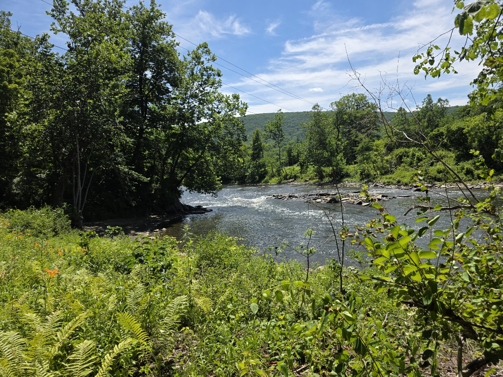
From here the trail becomes mature hemlock woods once again, and the descent is quite easy for the next mile and a half. I pass by a beautiful rocky gorge with lots of moss covering the rocks, and ferns everywhere. 

Less than an hour later I cross two roads and see my dad parked in a parking area beside Massachusetts Route 23. I get up to the car and drop my pack on the ground. He hands me a Mcdonald's breakfast sandwich and leftover teriyaki chicken and broccoli from the day before, and I eat both greedily. I empty my pack of everything I won't need today, fill my water bladder to the brim, and grab food for the day plus a Powerade for good measure. 30 minutes after arriving I am back on the trail heading north.

The temperature Is getting quite hot and muggy, and with no breeze, and temps of the 80s with this humidity, I am dripping with sweat. i keep wondering when this hot weather will break. But I would rather deal with heat than rain or cold.


The trail rises steeply for 500 feet And then levels out at it travels around Benedict Pond, a shallow man-made lake that has a walking trail around the perimeter. 

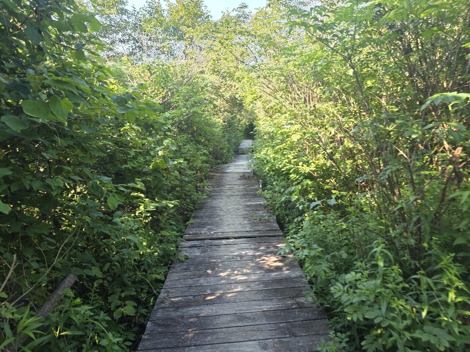
I cross a lot of bog bridges through this section. I can't imagine how wet and mucky this area must be after rain. 

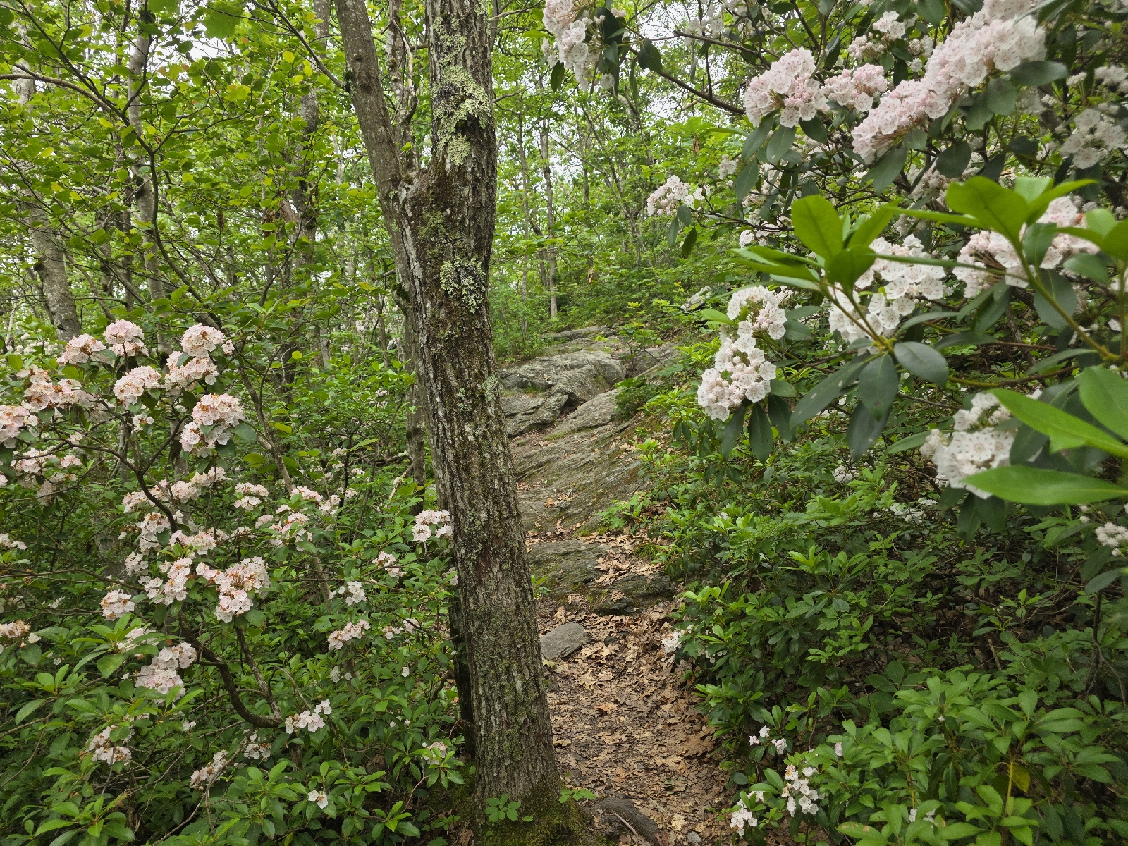
Leaving the pond,  the trail climbs through a forest of beautiful hardwoods with lots of waist-high ferns carpeting the understory. The birds are chirping lazily and I pass a few day hikers with small backpacks, out for a stroll around the lake.

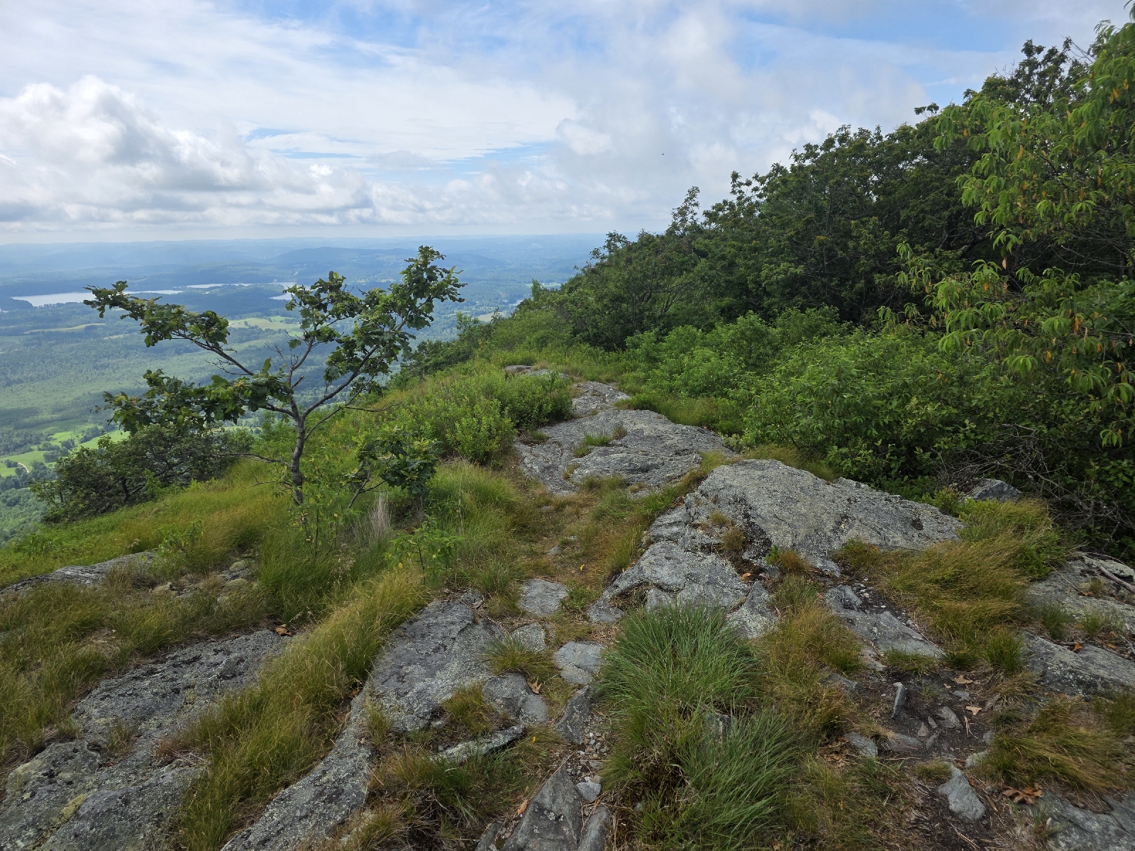
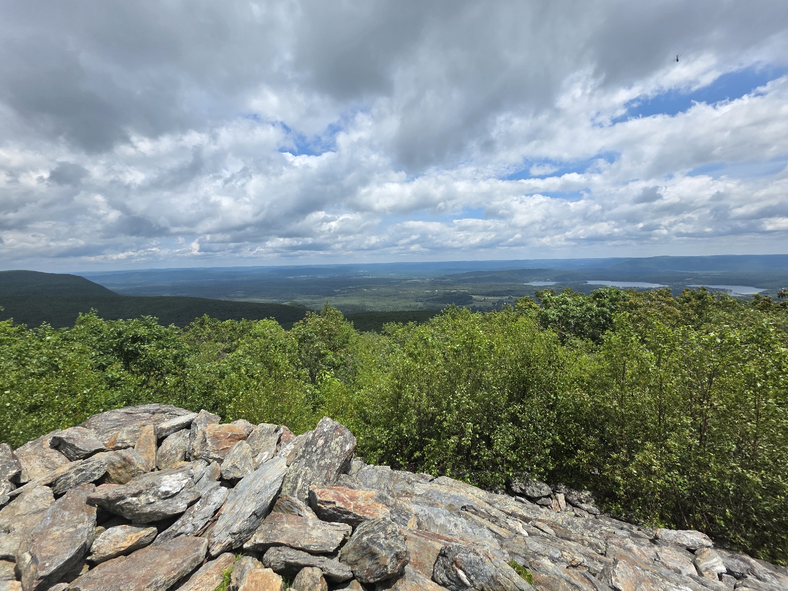
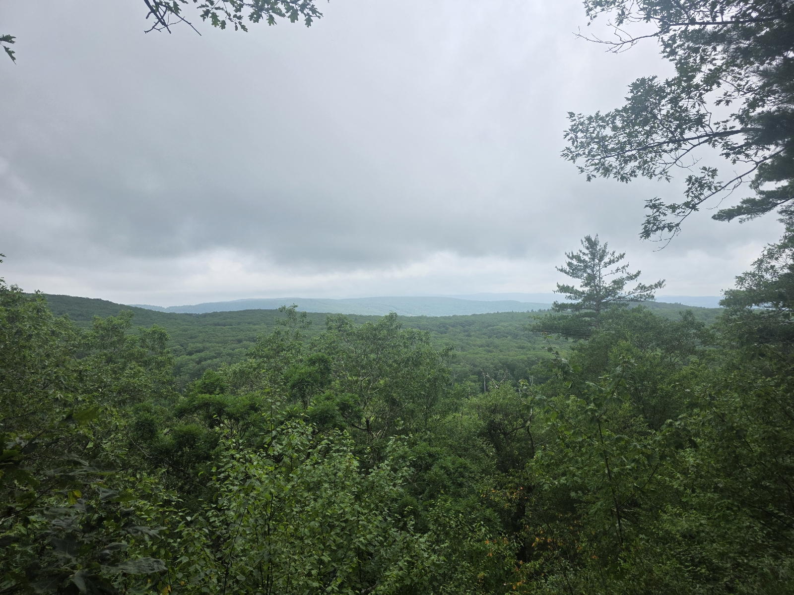
My hike is on the ridge top for the next four miles. There are few things to see up here except for the pond below, but it's still pretty. 

I pass the two Wilcox Shelters - two separate shelters a couple miles apart - and I'm pleased to see a couple of streams. I'm doing okay on water, but I stop to splash water on my arms and legs. The water is not very cold but it is refreshing nonetheless.

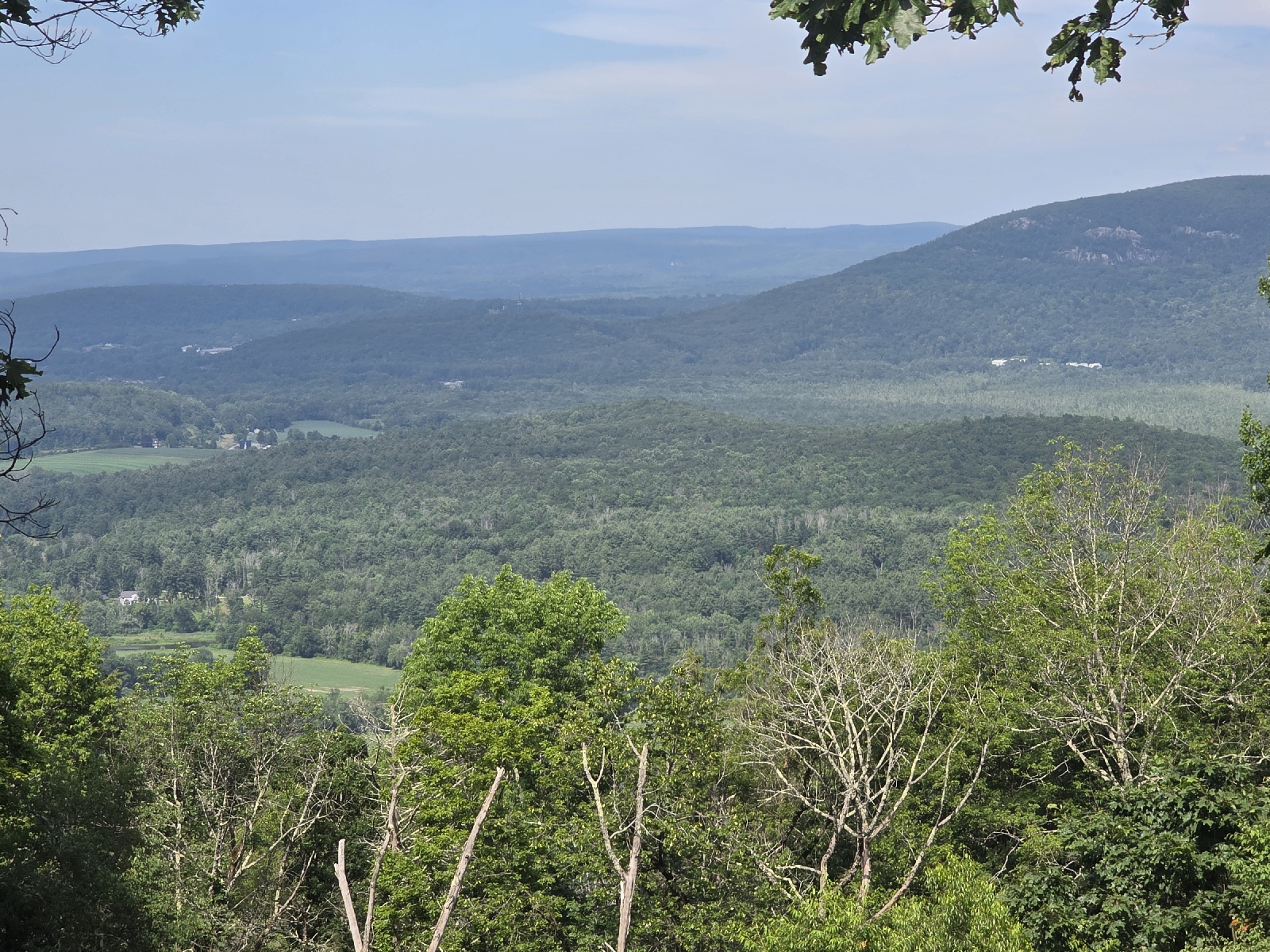
I stop for lunch on the side of the trail before descending for the next mile-and-a-half down to a stream near the community of Tyringham. The trail then turns sharply uphill and for another mile I go up and over the ridge for an okay view.  I don't really see the point of the climb; just another PUD (pointless up and down). I look at the FarOut comments and see that many other hikers feel the same.


The trail comes out at Jerusalem Road and a short walk down the road Is a trail store, which a small shed outfitted with a refrigerator and Wi-Fi. I don't stop because I'm on a mission; I'm meeting my dad in another 1.5 miles to gather my backpacking kit. I've done 16 miles and I'm not really sure where I'm going to spend the night, so I will meet him at the last road crossing before I head up towards Upper Goose Pond.

I sit in the air conditioning of his vehicle for a moment, enjoying the cold air for a few minutes, but feel the need to get back on the trail because I want to get settled before dark tonight. I load up my pack with three liters of water, a Powerade, and refill my bear canister before shouldering my pack and bidding dad goodbye until tomorrow. He is staying at a motel in Pittsfield, and as I travel north I am getting closer to his location. 

The next section of the trail entails a 1,000 foot climb over the next couple miles. This is probably one of the few times since Pennsylvania that I haven't had a super steep and straight uphill. The incline cuts across the side of the mountain on a groomed trail, for which I'm thankful because I am hot and getting a little worn out. I do have to stop a few times to sip some water and catch my breath.


As I near the top another hiker comes up behind me. His name is K2 and he is through hiking. He started in mid-march, and told me he's putting in a long day because he was going to stop at the last designated camping area, but when he read through the trail register he noted reports of recent bear activity in the campsite, so he I elected to continue on to Upper Goose Pond. I tell him my name and he said he has seen it in the trail registers.

I make it to the top of mountain at 5 PM, and I am pleasantly surprised to see that I have maintained a two mile per hour pace,  even with a fully loaded pack and after 19 miles. At this point I am five miles from Upper Goose Pond  and even though I'm tired and I've slowed down a bit, I think I can easily make it before dark. 

Upper Goose Pond is a mecca in the wilderness for hikers, with a donation based cabin perched on the edge of a scenic pond, with canoes and a small beach for wading. It's considered a must-see stop for hikers,  and if I have serious FOMO, so I push on, even though i pass several spots where I could set up my camp. 

The hike is going well; the trail is easily navigable and the rocky sections are very short. I develop a deep ache in the sole of my right foot causing me to limp on occasion.  The way it's coming and going I'm wondering if it's nerve pain.  I really hope that I don't screw myself up doing this many miles today, which may make hiking more difficult tomorrow.

One mile from the pond, K2 passes me again. Im surprised tobsee him again, imagining he would be there already. He tried to do a shortcut but he had to turn around and come back to the trail, so he just got an extra bonus mile.

I am slowing down considerably, minding every step I make to keep from hurting my feet any further.  The sun is starting to set when I make it The cabin period. There are About 10 people milling about  around covered picnic take behind the cabin. John, the caretaker, greets me warmly and tells me that I can make myself comfortable In the bunk room or go to one of the tent platforms to set up for the night. I tell him I have a hammock and he tells me to pick any two trees that are suitable.

I get set up and join the group at the table.  People introduce themselves but I am so exhausted I know I won't remember any of their names tomorrow. All I want is some nourishment and to clean up and go to bed. 

I grab some cheese and crackers from my bear can, and munch on my light dinner while talking with the other hikers. They obviously know each other very well,  and I enjoy listening to their banter. I want to make more of an effort to stay at the shelters for the remainder of my hike so I can get to know some other hikers. 

The light is waning and several hikers retire to the bunk house, while others retreat to the front porch. I go down to pond, where I wade in at the little beach. The water is cool and refreshing, but not overly cold. I would love to stay in longer, but I need to get to bed. I get out walk back to my hammock and I am immediately drenched with sweat from the humidity. 

I put the finishing touches on my camp and jump into my hammock while getting attacked by mosquitoes. I lay there for a moment just enjoying being still. Today was the longest day I have ever hiked in my life; over 25 miles with the side trail to the cabin, and 6,000 feet of elevation gain!! I ache and cramp all over, my muscles will talk to me tomorrow,  for sure. 

By 9:20 I am out.

Today's Stats: 24.6 miles, 5,960 feet vertical gain
Trail Stats: 1,555 miles, 303K gai 

Appalachian Trail Day 131 - Guilder Pond to Campsite (Mile 1519 to Mile 1532)

I had a lovely visit at home where I bade farewell to Kelly.  She's been such a delightful hiking companion for the last month, and we have spent so much time together recently that it will feel weird to not have her hiking with me.

I'm not entirely alone however.  My dad has been wanting a little adventure, so he is returning to the trail with me so he can support me along my hike for the next two weeks. We've had some amazing hiking adventures together in places like Peru Nepal, not to mention a few times hut-to-hut hiking in the White Mountains. Although dad can't do the strenuous hikes with me anymore, we can share some of this experience together.

A new partner in crime isn't the only thing new; on this trip I am bringing three new pieces of gear. The most notable is a new backpack. I love my Osprey Eja, and it has served me well since I picked it up at Neel's Gap in Georgia four years ago when I was only 30 miles into my Appalachian Trail journey. The old girl still has some life in her, but Osprey has come out with a pro version that has some of the features that I love about the Eja, but with upgrades that I think are far superior.  One is the lighter DWR fabric. It's also 8 ounces lighter and with a much improved hip belt and better adjustability. 

I also bought some new shoes, trading it the Topos for Altras. I used to wear Altras all the time but disappointed by how quickly they lost their cushioning and wore down, so I switched to Topo's for the last couple of years. Unfortunately those haven't served me very well on the rocks, so I decided to go back to the Altras so I could have the benefit of a full rock plate in addition to a couple more millimeters of cushioning. I think I'm going to be okay with buying shoes more frequently if my feet feel better at the end of every day.

The last piece of gear that I am starting out with is a bear can. I swore I would never break down and buy one, but the lack of bear cables or bear boxes in some states, along with all my bear sightings, have changed my mind. Plus, I absolutely hate doing a bear hang so much, in fact, that I am willing to carry the extra two pounds from here on out.

We make the six and a half hour drive without incident, other than a little bit of traffic, and at 2:30 I say goodbye and set out north from Guilder Pond, now officially in Massachusetts. Ten states down and only four to go! 

The days of easy ridge walks, where I can hike 17 or 18 miles and only gain 2,500 feet are long behind me.  The FarOut app shows that the elevation gain and loss has increased steadily since leaving the Mid-Atlantic, where the average elevation change is 274 feet per mile. The section comprised of New Jersey, New York, and Connecticut is 361 feet per mile.  This new section of Massachusetts and Vermont is 428 feet per mile. I don't even want to look ahead to the New Hampshire/ Maine section!

The day is beautiful, with the temperature in the mid 80's, and a lovely breeze is blowing on the mountain.

I'm not on the trail for five minutes before I take a blue blaze side trail to the edge of the pond. It's beautiful, and much bigger than it looked when I was here a few days ago, where I could only see 50 feet or so Due to the poor visibility. A large group of people are on a rock, splashing in the water with kayaks floating nearby.

I head north generally downhill,  to Mount Bushnell, two miles from the pond.  The views are less than stellar due to the haze from the heat.

Leaving Bushnell, for the next two miles the descent is tricky with the steep rocks. I prepared myself mentally beforehand, as the FarOut comments talk about how horrific the descent is. I don't think it's the worst that I've had, but I can see how it would be pretty awful In bad weather. 

At the bottom of Mt. Bushnell, the trail opens up to on Jug End Road; a narrow country dirt road. I am thrilled to see a water cache;  containers of water that a Trail Angel has left next to the trail.  Most of the water sources are reported to be dry for the next nine or ten miles, and I am certainly concerned about the scarcity of water,  especially given how hot it is.  A  phone number on the side of the jug, asking for a text if the water gets low, and I text my thanks to the person who provided it. I drink a half later and pour another one for later. 

Soon after leaving jug End Road The trail emerges onto a pasture where the trail becomes a long series of plank bridges over the marshy ground. The ground beneath is not very wet right now, but I can see very deep footprints In the mud, like someone actually post holed up to mid-calf recently. 

I grab some blackberries while cruising by some bushes on the edge of the field. The pasture is a riot of common milkweed (Asclepias syriaca), wild carrot (Daucus carota), and wild grape vines, with some black-eyed Susan mixed in. Butterflies and dragonflies are flitting about, making for am idyllic scene.

The trail Crosses another road and re-enters a beautiful mature hemlock woods.  The breeze is lovely and I'm reveling in the coolness of the shade when I realize that my hiking pole feels really weird. I look down and see that the tip section of my one of my poles is completely missing.  The clamp worked its way open and it must have completely slipped out at some point In the last mile. I know I had it when I came down Mount Bushnell. I start to backtrack but realize how futile it is.

I continue through the hemlocks enjoying the sound of a woodpecker tapping on a tree nearby. I'm making good time and right now I can pull off a few 20-minute miles and hopefully make it to the shelter tonight.

The trail is quite flat for the next four miles, however I'm in the sun and I'm feeling really hot although I make some really good time, stopping only for the amazing and plentiful trail magic at every road crossing. There are no water sources for another five miles and 1,200 foot climb. I realize I might be cutting it close with getting a camp set up before full dark. The gift of the water is allowing me the flexibility of setting up camp a little earlier than  hiking into the shelter at ten o'clock tonight.

I pass a monument commemorating the site of Shay's Rebellion of 1787, an armed urprising between the townsfolk and government in protest of high taxes, before walking through corn fields.


The best trail magic is a cooler freshly filled to the brim with Gatorade and soda. I grab a Gatorade And hold the ice cold bottle against my neck. I've decided that Massachusetts hands down has the best trail magic per mile so far of any state!

For the next mile the trail meanders along the Housatonic,  which is more like a sizable stream this far north than the river we hiked next to foot so long in Connecticut. I am bummed i can't get through the thick brush to get water. However my disappointment turns to relief when the trail comes to a bridge to cross the river, because a sign states that the water is contaminated with pcb's and fish from the river are unsafe to eat. Guess I will rely on trail magic for my water. 

The trail leaves the flat of the road and river and I start to climb up. It's now 7:00 p.m., and I need to start thinking about where I'm going to camp. I want to follow the rules and camp at the shelter areas, but there is no way that I'm going to make it to the next shelter before full dark, and some of the comments about rock scrambles without visible blazes to mark the way make me a little nervous. 

The only problem is the water. I've been staying hydrated, but I'm not carrying much more than a half liter at a time. So far I am glad accepting the generosity of the strangers who provide the water, but I don't want to take advantage of that generosity and not have enough water for other people who come by behind me who may need it. I make a decision to get just enough water at the next road crossing if there's a cache, and then set up camp somewhere up the ridge when the light wanes to the point that I have 10 or 15 minutes to set up my camp.

I am struggling up the hill, having to stop several times because of the heat. Plus I'm just tired; I've been up since 4:00 a.m., drove for half the day,  and hiked without stopping for the last 9 hours. When I reach the last road crossing, I am thrilled to find a water cache. I drink a half liter and then grab an extra half liter for the night.

By 8:00 p.m., I've hiked another two miles and gained another 600 feet when I reach a stream that was reported to have water a few days ago,  but it is dry as a bone. The woods are burned out from a recent fire, so I have to continue hiking for a stretch before I find a suitable spot to set up.

I am on top of the ridge and thankfully this is the coolest spot in the area due to the breeze. While I set up, I get absolutely attacked by mosquitoes. I call home to let everyone know I'm okay. I skip a real dinner for some snacks because I'm tired, and the idea of hot food in this heat is very unappetizing.

I am laying in my hammock at 9:00 p.m. listening to the whine of the mosquitoes trying to find a way through the bug net.

Good night.

Today's Stats: 12.6 miles,  1,942 feet gain
Trail Stats: 1,532 miles,  297K feet gain


Appalachian Trail Day 130 - Guilder Pond to Salisbury, Connecticut - southbound (Mile 1519 to Mile 1507)

I wake a few minutes before my alarm is set to go off at 5am. I slept fitfully last night: it was warm even with both air conditioners and two fans. I had some really weird dreams, too. Maybe it was from the physical exertion,  or the crazy amount of food I had right before bed.

I brush my teeth and wake up Kelly and we're on the road at 5:30 to get her vehicle, which is still parked in Kent. We will return here to Salisbury to leave the truck, and then drive to Guilder Pond, to the north in Massachusetts and hike back to Salisbury. 

We decided last night to do this hike southbound so that we could save some time this morning, wanting to get on the trail as early as possible because of the high risk of thunderstorms this afternoon. 

Today is bittersweet, as we will finish Connecticut and be in Massachusetts, but this will be our last day hiking together,  as our month of hiking together has come to an end and Kelly needs to get home. She scored a permit for the John Muir Trail in California,  so she will be doing that for three weeks.

One of the cool things about hiking southbound is that we will likely run into a number of people that we know. It will give Kelly an opportunity to say her goodbyes. She is really hoping that we run into Ladybug, but there's a chance that Ladybug is already too far up the trail.  Kelly sent her a text message,  but has yet to receive a reply; not surprising with the spotty cell service on the trail. 

We pull into Guilder Pond and we are instantly blown away by how pretty it is. The mountain laurel is in full bloom here and the is so much of it! I haven't seen this much mountain laurel in one place since I hiked the burned out ridgetop in Pennsylvania the day before I met Kelly last month. 

Adding to the beauty of the blooming mountain laurels, the pond is shrouded in mist that rolls across the pond, and dead trees stand like skeleton-looking sentinels around the pond perimeter. The tableau is a little eerie, but spectacular nonetheless.

We leave the serenity of the pond behind as we climb 500 feet up Mount Everett. The climb is fairly easy by AT standards,  and when the trail levels out a sign marks the summit.  

The view is nonexistent; the peak is in the clouds, and it looks like it could rain at any moment. We keep trucking to get as many miles as possible before the precipitation starts, as all these rocky summits will be treacherous in the rain.

The trail down is comprised of steep,  smooth rocks. Steps assist our descent, made from quartered logs attached to the rocks with long spikes. The wood is soft in places so I so walk with care.  

The mountain laurel show continues onto  the next peak.  I never knew the shrub to have much of a scent, thinking it was only pleasing to the sense of sight.  However, there is so much of it here I can't deny the light floral aroma permeating the woods. The fragrance is lovely, and combined with the pretty flowers covering the trees and littering the ground like huge snowflakes, I am distracted enough that I have to concentrate on the trail underfoot, not the trail surrounding me. 

We ascent to Mount Race is an easy 500' feet over the next mile. We gain the summit and see two figures walking across the rocks, coming towards us. We are thrilled to see it is Ladybug and Fatal! 

The four of us chat excitedly, happy to see one another. Ladybug is surprised to see us,  remarking that she thought we were ahead of her. We say we are surprised to see them,  thinking they were ahead of the pond where we started today.  I say I'm amazed that she is hiking this early,  as she is more of a late riser. She says Fatal has been a good influence,  kicking her out of camp earlier than usual.

Ladybug and I trade numbers, since we are both getting off trail for the weekend too see family.  We hope to connect when we return in a few days. The trail keeps getting harder and it's nice to have a hiking partner. Kelly gives her a hug goodbye and we separate to continue the hike. 

When we arrive at a huge rocky overlook called Mount Race Ledges, just off the summit of Mount Race, we are provided with a spectacular and expansive view to the east, where the land looks to level off. A body of water is visible to the southwest that I believe is Washinee Lake, bordered by low tree-covered ridges. The mountains is this region are more rounded humps than craggy peaks, and they extend south and north from our location. 

In the short time from leaving Mount Everett, the clouds have lifted and we can even see a little blue in the sky! The rain has yet to materialize and for a moment the sun peeks out for a moment. We are delighted when we check the weather forecast,  to see that the outlook has significantly improved do the day. Now,  we are looking at thunderstorms after 6 p.m., long after we plan on being done with our hike. 

The trail continues over the Ledges, coming precariously close to the edge of the mountain,  where the ground drops off sharply.  The high vantage freaks me out a little,  and I hug the inside of the trail, even though it's wide and flat on the rocks, with little risk of a slip in the dry weather. 

After leaving the Ledges, the trail descends gradually, losing one thousand feet over the next 2.5 miles, walking through a stunning mature hemlock woods the entire way down.  The needles from the dense stand of trees make a nice soft brown carpet underneath, lovely to walk on. 

We cross a gorgeous stream that has a stone slab serves serving as a bridge. This would be a gorgeous place to camp and Kelly marks it on her map for when she returns

Soon after crossing the stream the trail starts downhill and we see Toad, and a half-mile later we run into Tad and Earthstar. He says the hike up Bear Mountain is absolutely gorgeous. We say our goodbyes and move on. 

In another mile we reach a gorgeous stream called Sages Stream, and we filter enough water to last us the rest of the day before rock hopping across the water to start uphill. A sign says we are standing on the state line! We are entering back into Connecticut, so we won't officially finish the state until we arrive back on Salisbury. 

The trip up the falls is amazingly beautiful.  The water is so crystal clear that we can see the bottom even where it looks deep enough to stand in. Small waterfalls and cascades flow down the rocks, and overhangs of rock, carved out by years of fluvial force, look like small caves. 

We stop and take lots of pictures and when we do hike, we don't get far until we stop again to look at another beautiful water feature.  A man walks towards us and we see Planet Caravan.  We talk a few minutes before saying farewell.

A short time later the trail veers away from the stream and the incline becomes more steep, taking us past a sign stating we are at the Connecticut- Massachusetts border.  We are confused, because we already passed another sign that said the same.  Oh well, we take another quick celebratory picture and after another few minutes we reach the base of the rock scramble up to the summit. Late Start is heading down and he greets us by saying "I hate Bear Mountain," and soon after we see why.

The rock scramble up is challenging,  but in a fun way,  although I see why anyone heading down would have a very difficult descent.  The rock is almost vertical in spots and very smooth; making it difficult to find handholds. The climb goes up for about two hundred yards and we gain elevation quickly. When we reach the summit I am thankful for a light breeze.


We remark about how fortunate we have been to complete this hike in such beautiful hiking conditions, but a quick look at the weather forecast tells us that thunderstorms are moving in. We still have 6 miles to go to reach town, but thankfully it's mostly downhill with two thousand feet of descent. 

The trail is fairly easy in places and the trip goes quickly. We drop to Salisbury about 2 hours after leaving the summit. We take the short walk to the hostel and decide to take showers now; we are gross with dirt and sweat and we don't want to make the trip home stinking up our cars.

We leave the hostel and as we are driving the 45 minutes to Guilder Pond the sky let's loose with a very swift moving and heavy thunderstorm. The storm moves directly over Mount Everett as we drive up the valley directly below the mountain. Flashes of lightning are over the summit and we both jump when a lightning bolt strikes the ground close to where we are driving. I have my eyes on the road, but Kelly jumps and explains that the lightning hit a tree next to the road. 

We are so thankful that we are off the mountain, but express concern for our hiking friends who may still be up there. Everyone else should be off except for Late Start. We are hopeful that he hiked fast and got down before the tempest hit the ridge.

By the time we retrieve Kelly's car the storm has abated somewhat.  The rain is now steady but not heavy and we start our drive home. 
Today's Stats: 12.3 miles,  2,264 ascent
Trail Stats: 1519.6 miles,  295K ascent 


Appalachian Trail Day 129 - Cesar Brook Campsite to Salisbury, CT (Mile 1487 to Mile 1507)

At 5:40 the sunlight brightens the sky to the point where I am awakened even with my buff covering my eyes. Kelly is already up.  She states she didn't sleep well, probably worried about the hike into town in the rain tomorrow morning.  We start packing methodically, but without haste. We are almost ready to hit the trail when nature calls and I take a side trail, expecting to find just the right spot in the woods, when I come across the perfect outhouse.

Unencumbered by the dark and claustrophobia-inducing tight walls of a traditional privy, this is the perfect throne for any queen. I only wish it were facing the other direction so I could take advantage of the sunshine coming over the ridge.


We are on our way at 6:50 and immediately start uphill. Nothing like an incline first thing in the morning to get the blood pumping. One mile and 600 ft later, we crest a ridge and descend another mile when we come to a stream. It's going to be blazing hot today so my intention is to camel up and drink a half of a liter at every water crossing, in addition to the 1.5 liters in my pack, reserving that for the challenging vertical climbs.

We collect water and head up our second hill of the day, where we go through a wider, easier version of the Lemon Squeezer,  through which we don't tear up the sides of our backpacks.  In 2 miles and another 600 feet we reach the Pine Swamp Brooke shelter, which we pass without stopping, as it's on a side trail.

For the next six miles we hike up and over ridges. We've been passing through a lovely pine forest for the last three miles and the ground underneath is wonderfully soft, cushioned by the pine duff. The day is getting hot, and by the time we've done almost 7 miles, we have climbed  over 1,700 feet. The trail rewards us for the effort with a beautiful view of the valley below, with Bear Mountain and the Southern Taconic Range in the distance.  The Lime Rock Speedway is in the valley, and cars are visible circling the track. 

The trail descends 1,000 feet and leaves the woods to cross US Route 7. We skirt the edge of a pasture, and as we walk along the edge I find a mulberry trees full of ripe fruit. We go a little crazy picking handfuls of mulberries and stuffing our faces with the fresh fruit, staining our hands and lips a dark purple. 

For the next few miles the trail is delightfully flat as we walk along the Housatonic River once again. I was really worried that once we were off the mountain we would be much hotter, but it's actually cooler due to a really nice breeze.

The trail emerges onto a road and I pull out my umbrella to shield me from the intense rays of the midday sun. The roadwalk only lasts 10 minutes before the trail returns into the woods to continue along the river upstream.

The trail comes out at an electrical station and we have to get on a road for a short while. A man with a stop/slow sign is waiting to direct oncoming traffic through a road construction zone. As we walk up, the slow side of his sign is pointing towards us, and Kelly remarks that we can't walk any slower. He turns the sign to stop and asks if that is better for us, and I respond we only stop for Gatorade. I was only joking, but then he says that he has a Gatorade for us and he gives us one out of his cooler. It's  delightfully cold and we split the bottle. What a nice gesture! Giving us his cold beverage on such a hot day.

We chug the Gatorade and walk over a bridge once again. On the left Is a picnic area that's reported to have a dumpster, so we walk over to drop off our trash. While we are there we see Toad sitting at a picnic table in the shade of a tree. We decide to sit with him and eat lunch. 

Lunch and trash taken care of, we jump back on the trail and within minutes take a side trail down to a gorgeous roaring waterfall called, simply enough,  Great Falls. We shed our backpacks and some clothes and I sit in the cool water. The water isn't very cold and it's the perfect temperature for me to sit on a submerged rock and cool off, splashing water all over to get the sweat and dirt off. 

Refreshed by the dip, and with hunger and thirst satiated, we throw on our packs and jump back on the trail. It is almost three o'clock and we have a thousand foot climb to get up the next ridge in the 90° heat. 

A short time later we reach a sign that marks the 1500 mile mark. Only 694 miles left to get to Mt. Katahdin!

Three miles and 1,000 feet later we are on top of Mount Prospect, which offers a decent view to the north. I don't tarry,  because I'm sweating so badly that I think I'm melting, and the air is stifling without a breeze. 

Leaving Mt. Prospect, the trail meanders along the ridge until we reach the side trail to the Limestone Spring Shelter. We originally planned on stopping here for the day, but now we both agree on continuing on to town, which means over 20 miles today. We are tired, but feeling up to the additional four miles and extra vertical gain. 


We play hopscotch with Toad, who plans on going into town for a beer at a tavern.  He mentions it each time we pass him or he passes us, which makes us giggle about priorities.  He is lounging by a stream eating when we pass and I spy the most amazing golden oyster mushrooms.  I really wish I had a bag or some way to transport these beauties. 

The drop into Salisbury is very steep as advertised, but not crazy, boot-scooting steep.  The path is disorienting because the trail literally goes straight down in some places.  I am trying to focus on each step down and not get distracted, but I can see the trail just beyond where I walk even though it's much farther down the hill, like the trail is folding back on itself. I have to shake my head a few times and refocus on each footfall, because I really don't want to fall here. Fortunately, the trail remains dirt, which is good; rocks would certainly be harrowing to go down in poor weather.  We are glad to be making this descent on a good-weather day.  

The trail levels off fairly quickly, and we are happy to have that part of the day behind us.  Even though the drop was indeed steep, it wasn't ridiculously so, and I am glad we are done just for Kelly's sake because I know it was stressful for her. 

We make the .7 mile road walk to Maria McCabe's House, the hostel which is our home base for this section.  Kelly asks if I would like to go back to the Boathouse for dinner again tonight, but it's already 5:30 and by the time we both shower and start laundry I will be so hungry I think I will gnaw my arm off.  7 pm is just too late for dinner.  She agrees and we decide to head straight over to the market for some ready-made deli food and then get cleaned up. 

At the market, we see Tad, Toad, and Earthstar out front, drinking sodas and packing their resupply into their packs.  Toad decided to skip the tavern, and they are all going to continue on the trail to make some more miles to the next shelter.  We say goodbye and head back to the hostel with a delicious assortment of deli foods to eat. 

On arrival we are delighted to see Dirt and Late Start, and meet a new face; Peanut, who will be sharing a room with Kelly and me. The house a a flurry of activity with hikers showering, eating dinner, and working at one of the provided computers.  I shower and sit down with Dirt to eat my fried chicken, when he offers me the most delicious pesto and bacon pizza.  He encourages me to take more than one slice, and I end up eating three, in addition to all the tomatoes and peppers from his sizable salad (he doesn't like the veggies).   

Stuffed to the gills, my hunger satiated, I say goodnight and sit in bed to type this up.  Kelly comes in a short time later with Late Start's shirt, which he tore on the trail and would like to salvage.  She stitches it up for him and then we say goodnight. 

Today's Stats: 20.5 miles, 4,400 feet gain
Trail Stats: 1,507 miles, 293K feet gain


Appalachian Trail Day 128 - Kent, CT to Cesar Brook Campsite (Mile 1473.2 to Mile 1487)

We wake, pack our things, and make a cup of coffee before returning to Kent to continue our trek.  For once, everyone in the hostel is up as early as we are, so we don't worry about waking the other occupants while we pepare for our departure. The sun is rising as we pack.

I leave my truck here in Salisbury, where we plan on returning within a few days. This next section from Kent to Salisbury is only 34 miles, but with more than 7,000 feet of vertical gain, we are packing three days of food. I feel good this morning, but that's a lot of vertical in this heat, especially with full packs. I plan on chugging lots of water and eating tons of salty snacks for the forecasted 90°+ of the next two days. 

We drive back to Kent and we are on the trail by 8:20. We are only a hundred yards from the car when I look behind and see a figure walking towards us.  I can't make out the person, but I recognize the bright pink top and day-glo yellow shorts. Zen is behind us, and Kelly and I wait for them to catch up. 

We chat for the brief roadwalk, and we say goodbye to Zen and follow the trail back into the woods. Zen continues into Kent proper,  where the visitor center offers showers to thru hikers. Apparently the townsfolk got sick of the hikers stinking up the establishments, so they entice hikers to clean up first.

The climb out of Kent is steep and makes me work hard to breathe for the first mile. I am feeling well and make the hike up without stopping; a good potent for the day to come. The weather is perfect,  with a temperature of 75°, and the sunny blue sky overhead has a few clouds floating by. 

The beauty is slightly bespoiled by a pile of dirty toilet paper on the side of the trail.  We are both grossed out and pissed off.  Friendly PSA: if you're not going to dig a cat hole, at least walk off the trail a few feet and use sticks to push your poopy toilet paper into the ground so I don't have to look at it.

We are always picking up small bits of trash on the trail,  but I always draw the line at paper products because I don't know what body parts it may have touched. Of course, in this case it's obvious where this paper has been, so we leave it just the same.

Just beyond the mess is Caleb's Peak, an overlook with beautiful views of the Housatonic River down in the valley below. Two women are at the top with a gorgeous Aussie shepard. We chat for a few minutes and start to walk away when two young men walk past and tell us to have a good time in Kent. Wait! What? I reply that we are northbound and that's when we realize we are headed in the wrong direction.  I'm so glad they said that, or we may have gone way more than a few feet out of the way!

Less than a mile of easy ridge walking later the trail continues to another beautiful overlook called Saint John's Ledges, where we are treated to some more gorgeous views to the east. The views aren't expansive today, but we are really enjoying them nonetheless. 

Leaving Saint John's Ledges the trail descends abruptly and we rapidly lose 600 feet with a half-mile of knee-jarring, big rock steps.  The descent is really slow due to the size of some of the rocks. I plant each pole firmly, move one foot down, then reach with a pole further down before planting the other foot. I frequently think that if a pole gives out that i will tumble head over teakettle and be waking up in an ICU somewhere in rural Connecticut, and I am grateful when we make it down without incident. 

Once we reach flat ground, the trail follows a gravel road that parallels the Housatonic River for three blissfully flat miles. The gorgeous walk is elevated by the delightful weather.  A light breeze riffles the leaves of the oak trees overhead.  

Families are picnicking along the other side of the river; the shrieks of people playing in the water and the mouth-watering smells of barbecue reach across the wide expanse. I fantasize that we will walk by one of these groups and they will ask us to join them, but alas, no one is on this side of the river but us hungry hikers. 

Instead of a nice hot dog or hamburger, we stop for a break at Stony Brook Creek, which has beautiful clear cold water cascading down to the river, and we soak our feet in the stream while eating our lunch. A man walks by who looks familiar. I ask his name and he says "Late Start." 

He says he remembers us as well, but we can't remember when we met.  Then it hits me that we met him back at Delaware Water Gap almost two weeks ago.  We chat about the heat and the amazingly beautiful trail here, and he says goodbye as we finish our snack.

As soon as my feet are so numb that I can't feel my toes, I get out and dolefully replace my damp sweaty socks and my even sweatier shoes.  I would love to relax by the pretty stream for the remainder of the day,  but it's time to get moving. Fortunately the soak in the icy water was very exhilarating, and we still have two miles of this beautiful river walk before we start climbing again.

The climb up is slow but steady, as the temperature is rather hot without a breeze on this side of the ridge. As we near the crest, the trail makes a sharp ascent on some rocks that require a little scrambling, but nothing too crazy, thankfully! 

Once we summit the ridge we are rewarded with the most welcome breeze. The vista is not that great but the gentle wind is heaven-sent and worth all the effort that it took to get here. We stand in the shade for ten minutes and I am comfortably chilled by the time we leave the viewpoint. 

What goes up must come down and as soon as we cross the ridge we start down quite steeply and the trail travels over smooth rocks that would be a nightmare in the rain. I'm glad that today is sunny, even though it's too hot.  From the whipsaw elevation changes, we are obviously ridge hopping today

At the bottom the trail crosses Connecticut Route 4 which leads to the town of Cornwall Bridge a few miles away. We cross over the road and a sign is posted that this creek crossing is extremely dangerous after periods of heavy rain. Photos demonstrate how to safely cross the stream during high water, and a map highlights a road walk that  curcumnavigates the stream altogether if necessary.  

As we approach the stream,  I see a man laying in the water, submerged up to his neck. It's Tad, and he says hello as we approach.

We are fortunate that the rocks to cross the stream are not submerged, as is often the case, as the FarOut comments report. We easily rock step across it. 

Earthstar Is sitting on some rocks on the other side and we stop to talk to Earthstar as Tad gets out of the water. Right now Kelly and I are shooting for the next campsite which is only 2 miles and 700 feet of elevation away. We will decide when we get there if that's where we're stopping for the night or if we're going to continue on. 

Kelly and I head up the next ridge from the stream and a short time later Tad and Earthstar catch up to us and we hike together for the next couple miles. Tad tells me his name is short for "The Amazing Dad." 

We go on to discuss how the state of Connecticut forbades us from camping anywhere other than a designated campsite, but many of these campsites are loaded with huge dead trees that could kill someone without notice. Tad mentions that he ran into a ridge runner at the last shelter and complained about the number of widowmakers scattered throughout the camping area. The ridge runner basically  shrugged their shoulders and said there was nothing they could do. I suggest to Tad that he send letters to the higher-ups. If someone gets injured at least it's a paper trail saying that they were aware of the danger. 

We arrive at the campsite and Kelly and I decided this is a great place to stop for the night. If we continue to the shelter it's only  another 3 miles, but it is an additional 1,500 ft of climbing, and while we are in good spirits, we would like to stop here. There's a beautiful stream nearby for water, and large flat sites for a tent, even though there are a great number of dead trees throughout.

We start setting up as Tad and Earthstar have a snack. They say goodbye and say they are heading to the shelter, where many of the dead trees were recently cut down. We are happy to be staying here tonight, and are thrilled to be in camp and set up before 5:00 p.m. for once.

I go down to the stream and sponge off in the cool clear water and Kelly and I sit on some rocks and enjoy a leisurely dinner. We discuss our plans for tomorrow and then put away our food bag and bear can in the provided bear box. The mosquitoes are now coming out in force so we retire to our camps which are right next to one another

I am enjoying laying in my hammock and just being still.  The temperature is too hot for my top quilt, but I am comfortable in my sleeping shorts and T-shirt. For the next 2 hours we chat from the comfort of our bug-net protected camps and send each other pictures and discuss our intentions for the rest of our hike. 

The weather forecast is for a high chance of rain starting tomorrow night,  and Kelly expresses her concern about the hike down to Salisbury. The elevation profile shows a precariously step descent,  but we have no idea whether or not it's rocky or dirt; we have encountered enough slippery rock slopes at this point to be worried.  I am too tired to think on it further,  and I say goodnight just as the light starts to dim the woods. I put on my earplugs and pull my buff down over my eyes.

Today's Stats: 13.2 miles,  3,100 feet gain
Trail Stats: 1,487 miles,  289K feet gain