

I brush my teeth and wake up Kelly and we're on the road at 5:30 to get her vehicle, which is still parked in Kent. We will return here to Salisbury to leave the truck, and then drive to Guilder Pond, to the north in Massachusetts and hike back to Salisbury.
We decided last night to do this hike southbound so that we could save some time this morning, wanting to get on the trail as early as possible because of the high risk of thunderstorms this afternoon.
Today is bittersweet, as we will finish Connecticut and be in Massachusetts, but this will be our last day hiking together, as our month of hiking together has come to an end and Kelly needs to get home. She scored a permit for the John Muir Trail in California, so she will be doing that for three weeks.
One of the cool things about hiking southbound is that we will likely run into a number of people that we know. It will give Kelly an opportunity to say her goodbyes. She is really hoping that we run into Ladybug, but there's a chance that Ladybug is already too far up the trail. Kelly sent her a text message, but has yet to receive a reply; not surprising with the spotty cell service on the trail.
We pull into Guilder Pond and we are instantly blown away by how pretty it is. The mountain laurel is in full bloom here and the is so much of it! I haven't seen this much mountain laurel in one place since I hiked the burned out ridgetop in Pennsylvania the day before I met Kelly last month.
Adding to the beauty of the blooming mountain laurels, the pond is shrouded in mist that rolls across the pond, and dead trees stand like skeleton-looking sentinels around the pond perimeter. The tableau is a little eerie, but spectacular nonetheless.
We leave the serenity of the pond behind as we climb 500 feet up Mount Everett. The climb is fairly easy by AT standards, and when the trail levels out a sign marks the summit.

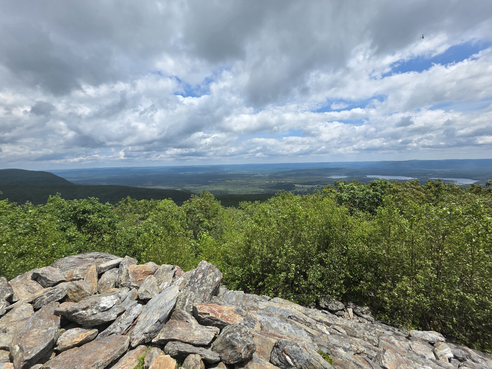
The view is nonexistent; the peak is in the clouds, and it looks like it could rain at any moment. We keep trucking to get as many miles as possible before the precipitation starts, as all these rocky summits will be treacherous in the rain.
The trail down is comprised of steep, smooth rocks. Steps assist our descent, made from quartered logs attached to the rocks with long spikes. The wood is soft in places so I so walk with care.
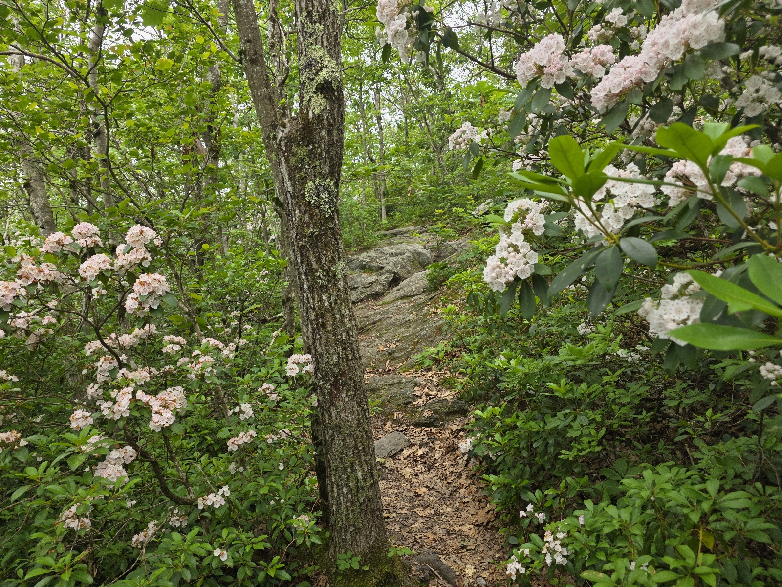
The mountain laurel show continues onto the next peak. I never knew the shrub to have much of a scent, thinking it was only pleasing to the sense of sight. However, there is so much of it here I can't deny the light floral aroma permeating the woods. The fragrance is lovely, and combined with the pretty flowers covering the trees and littering the ground like huge snowflakes, I am distracted enough that I have to concentrate on the trail underfoot, not the trail surrounding me.
We ascent to Mount Race is an easy 500' feet over the next mile. We gain the summit and see two figures walking across the rocks, coming towards us. We are thrilled to see it is Ladybug and Fatal!
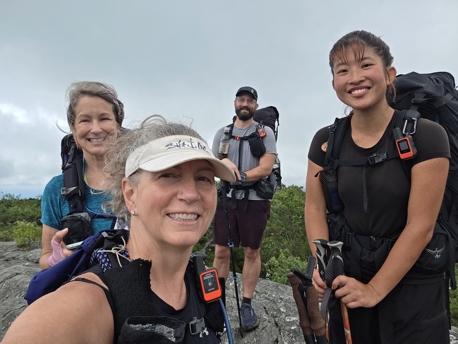
The four of us chat excitedly, happy to see one another. Ladybug is surprised to see us, remarking that she thought we were ahead of her. We say we are surprised to see them, thinking they were ahead of the pond where we started today. I say I'm amazed that she is hiking this early, as she is more of a late riser. She says Fatal has been a good influence, kicking her out of camp earlier than usual.

Ladybug and I trade numbers, since we are both getting off trail for the weekend too see family. We hope to connect when we return in a few days. The trail keeps getting harder and it's nice to have a hiking partner. Kelly gives her a hug goodbye and we separate to continue the hike.

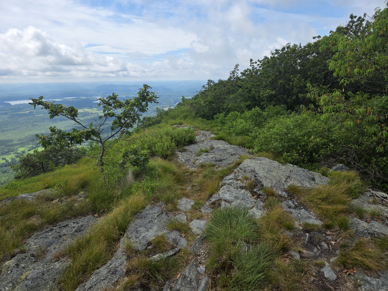
When we arrive at a huge rocky overlook called Mount Race Ledges, just off the summit of Mount Race, we are provided with a spectacular and expansive view to the east, where the land looks to level off. A body of water is visible to the southwest that I believe is Washinee Lake, bordered by low tree-covered ridges. The mountains is this region are more rounded humps than craggy peaks, and they extend south and north from our location.

In the short time from leaving Mount Everett, the clouds have lifted and we can even see a little blue in the sky! The rain has yet to materialize and for a moment the sun peeks out for a moment. We are delighted when we check the weather forecast, to see that the outlook has significantly improved do the day. Now, we are looking at thunderstorms after 6 p.m., long after we plan on being done with our hike.
The trail continues over the Ledges, coming precariously close to the edge of the mountain, where the ground drops off sharply. The high vantage freaks me out a little, and I hug the inside of the trail, even though it's wide and flat on the rocks, with little risk of a slip in the dry weather.
After leaving the Ledges, the trail descends gradually, losing one thousand feet over the next 2.5 miles, walking through a stunning mature hemlock woods the entire way down. The needles from the dense stand of trees make a nice soft brown carpet underneath, lovely to walk on.

We cross a gorgeous stream that has a stone slab serves serving as a bridge. This would be a gorgeous place to camp and Kelly marks it on her map for when she returns
Soon after crossing the stream the trail starts downhill and we see Toad, and a half-mile later we run into Tad and Earthstar. He says the hike up Bear Mountain is absolutely gorgeous. We say our goodbyes and move on.
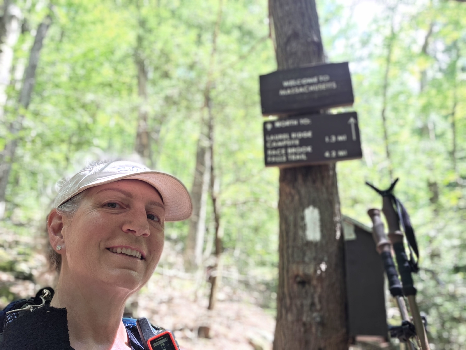
In another mile we reach a gorgeous stream called Sages Stream, and we filter enough water to last us the rest of the day before rock hopping across the water to start uphill. A sign says we are standing on the state line! We are entering back into Connecticut, so we won't officially finish the state until we arrive back on Salisbury.

The trip up the falls is amazingly beautiful. The water is so crystal clear that we can see the bottom even where it looks deep enough to stand in. Small waterfalls and cascades flow down the rocks, and overhangs of rock, carved out by years of fluvial force, look like small caves.

We stop and take lots of pictures and when we do hike, we don't get far until we stop again to look at another beautiful water feature. A man walks towards us and we see Planet Caravan. We talk a few minutes before saying farewell.

A short time later the trail veers away from the stream and the incline becomes more steep, taking us past a sign stating we are at the Connecticut- Massachusetts border. We are confused, because we already passed another sign that said the same. Oh well, we take another quick celebratory picture and after another few minutes we reach the base of the rock scramble up to the summit. Late Start is heading down and he greets us by saying "I hate Bear Mountain," and soon after we see why.

The rock scramble up is challenging, but in a fun way, although I see why anyone heading down would have a very difficult descent. The rock is almost vertical in spots and very smooth; making it difficult to find handholds. The climb goes up for about two hundred yards and we gain elevation quickly. When we reach the summit I am thankful for a light breeze.
The trail is fairly easy in places and the trip goes quickly. We drop to Salisbury about 2 hours after leaving the summit. We take the short walk to the hostel and decide to take showers now; we are gross with dirt and sweat and we don't want to make the trip home stinking up our cars.
We leave the hostel and as we are driving the 45 minutes to Guilder Pond the sky let's loose with a very swift moving and heavy thunderstorm. The storm moves directly over Mount Everett as we drive up the valley directly below the mountain. Flashes of lightning are over the summit and we both jump when a lightning bolt strikes the ground close to where we are driving. I have my eyes on the road, but Kelly jumps and explains that the lightning hit a tree next to the road.
We are so thankful that we are off the mountain, but express concern for our hiking friends who may still be up there. Everyone else should be off except for Late Start. We are hopeful that he hiked fast and got down before the tempest hit the ridge.
By the time we retrieve Kelly's car the storm has abated somewhat. The rain is now steady but not heavy and we start our drive home.
Today's Stats: 12.3 miles, 2,264 ascent
Trail Stats: 1519.6 miles, 295K ascent
No comments :
Post a Comment