Nav Bar

About     ♦   Foraging     ♦   Backpacking     ♦   Trail Food    ♦   Wild@Home    ♦    Links    ♦   Demeter's Wild @ Home Store

Emergency Essentials/BePrepared

Trail Days 2022 - Damascus, VA

We are back on the trail!  Trail Days in Damascus yesterday, with the obligatory dance around the bonfire, Bongo drums beating out ferverish rhythms while a flame dancer tosses his double flaming stick into the air and grabs it one handed then swirls it around his body.  No containers of alcohol are allowed, but that has not stopped the imbibing. Solo cups are everywhere and the smell of weed permeates the air.


Penny met a hiker she has been following on Youtube. New Shoes, harmed for his habit of burning through more shoes than anyone has seen on the trail, chronicles his story via a Youtube Vlog.

We circle the bonfire a couple times then head to our much quieter corner of the park for the night. Sleep is slow coming, as the drums can be heard until midnight.

The next morning we pack up. The shuttle driver we secured to drive us the 2.5 hours to Hiawassee has backed out at the last minute!!  Frantic, I scroll through my emails to find another.  Kate. I text her, explaining the situation.  Very last minute, but this getting desperate!  There are shuttle drivers aplenty, but they are always booked in advance. Finally Kate gets back to me with a hefty price. I jump on it!

We spend the morning checking out the vendors. Penny loves looking at the wares and chatting up the owners.  We make some minor purchases and put our names in for many of the raffles offering free, normally expensive gear.

We cover miles of ground walking from one side of the town to the other, returning to the camp to heat up one of our freeze dried meals to
save money for our shuttle.  We caught some cute Iittle pouches at the Gregory Pack giveaway. Headed over to main Street for the hiker parade. This is a tradition where hikers raid the local thrift store for the silliest clothes they can find. After they wear them for the weekend, the clothes are returned to the store to be resold to next years hikers. There are a lot of men in dresses, frilly blouses, and big
hats. The town residents started the tradition of soaking the stinky hikers with hoses and water guns in order to rid them of the stench of 400 miles of trail.

Appalachian Trail Day 5 - Neel's Gap to Low Gap Shelter (miles 31.3 to 42.8)

Sunrise at Neels Gap

Neels gap sunrise
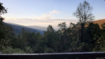
The view from the balcony


Neels Gap
Lots of packs waiting to go on a hike


Day 5 of Amy and Penny's Amazing Appalachian Trail Adventure (A&P's AATA)!  We spent the night at Neel Gap after the most amazing shower and clean clothes! Because of our shower and spending spree we had to set up in the dark up the hill from Mountain Crossing store. We were able to charge our phones and batteries for the next 3-4 days of backpacking.


appalachian trail
This is my happy place!!

The store opened early and gave the backpackers free coffee!! We were off at 9 am with an "easier" day of 11 miles with no significant climbs, but lots of rolling hills. The weather was overcast and we tried to outrun the rain, but with no luck. The rain started during the descent of Cowrock Mountain. Thankfully the rain was a steady trickle rather than a downpour, but the slippery trail conditions made us hike slowly. The fog made the views non-existent, but we still had fun.
Cowrock Mountain

Penny and I felt like we were dancing on the trail with our new packs! We saw very few hikers other than a group of 3 women out of Tesnatee Gap. We talked animatedly with the Southbounding on the side of the hill, all sporting our Garmin Satellite devices, and Penny had the same AT buff as 2 of the women, so we had to take pictures!


We made it to Low Gap Shelter right before dusk. There was a nice man at the shelter who had a fire started, which was impressive given the wet conditions! 3 other women and another man showed up, part of a group from Northern Virginia. The girls are definitely outnumbering the guys on this section! Turning in 9pm for a 6am wake up!


11.5 miles, 4556' elevation gain. Trip total 51.6 miles, 24, 660' elevation gain (more than Mt. Everest base camp so far!!) 

Appalachian Trail Day 4 - Woody Gap to Neel's Gap ( Mile 20.5 to 31.3)

We woke up from a lovely warm night's sleep and packed in the dark.  Woody Gap is a large parking area off a busy scenic highway running through Chattahoochee National Forest.  One benefit of the close proximity to a road is the pit toilet. The downfall of being so close is the noise. Normally, mornings along the Appalachian Trail are relatively quiet and relaxed.  This morning, however, car doors have been slamming, groups have been heading north for the last hour, and the occasional horn beeps to alert the departing hikers that their car door is indeed locked. Since further sleep is out of the question, we get up and break camp.  

The sun breaks over the ridge around 7:30 am, and we hit the trail with the sole intention of making it to Mountain Crossings before 5pm.  The Crossings is a full-service hostel and store directly on the trail. We can shower, wash clothes, and resupply without hitching into town.  We are almost out of food and fuel.  Penny really needs a new pack.  And we all really need shower and clean clothes. The thing is we have to hike 11 miles over Blood Mountain!

Preacher Rock
Preacher Rock, Georgia

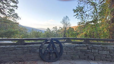
So, down the trail! Perhaps I should say up the trail, because as soon as we left camp we started gaining elevation and that was the theme for most of the day.  Preacher Rock was a mile north. We stopped briefly to take in the gorgeous views as the sun is rising. This view is the reason so many people arrived at the trailhead before dawn. LOTS of young'uns camped here last night. 

At Jarrard Gap I took a little wash in the spring and dried out my wool clothes in a patch of sunlight before heading up Blood.  The funny thing about wilderness: you won't see a soul for hours and the minute you decide to take off some clothes you have three people coming up a seldom used side trail, catching one in a state of deshabille. 

Crossing a stream
Mick crossing a stream

The weather is perfect for a walk in the woods!! The leaves are starting to turn colors and the crunch of leaves under hiking shoes is perfectly fall-like. The temperature is mild enough to allow hikers to wear shorts and t-shirts.  The hike is rough because we ar on day 4 without a break, and Georgia is no joke. I am feeling the physical demands of the trail in my feet and back, but still having fun! 

We talk to other hikers going in the opposite direction. I met a family doing an overnight at Slaughter Creek. Continued the trudge up Blood listening to the latest Dune book on Audible. Figured out how to use the facilities on the side of the mountain without having backpack and body slide down the hill!  Had a delightful Spam snack on Blood Mtn with about 20 others. The shelter is rock and very cool looking but kind of creepy. The nearby privy area is disgusting from overuse and absolutely choked with wads of toilet paper on the ground (I have yet to use a privy EVER on the trail!!))

View from Blood Mountain
Resting my weary feet on Blood Mountain


Blood Mountain
The perfect trail snack


blood mountain georgia
Blood Mountain selfie

blood mountain


Daybreak, a Sobo (Southbounder) who was at the hostel last week, arrives and said my trail fam is about 20 minutes ahead.  If I hurry I can catch up!  The descent is steep and seems to go on forever. But then the noise of the road is audible.  Motorcycles and muscle cars make their way over the ridge with engines gunning and mufflers popping.  The road came into view and suddenly Mountain Crossings is here!  The parking lot is packed with cars and motorcycles. Food! Shower!! Laundry!!! Nirvanaaaa!


Penny getting her shakedown


I survived my shakedown

Penny got a pack shakedown by Creepy. A very nice guy who is anything but Creepy, hence his trail name. A shakedown is when someone goes through your pack and takes out anything not absolutely necessary or recommends a different product that is lighter weight.  The store then sends home (at the hiker's expense) any unnecessary equipment. Penny gets a new pack. Creepy has a medium-sized box half full of clothes and other items. Almost every time Creepy turns around, Penny takes something out of the box and hides it. I am dissatisfied with my choice of pack on this trip, and Penny's new pack is small, compact, and comfortable!  I decide to buy one as well as a new ultralight rain jacket. Creepy doesn't take anything out of my pack during my shakedown. 

Today we did 11 miles, 2753 feet of elevation gain, and spent over $1000!

Time for a break!!


Appalachian Trail Day 3 - Hawk Mountain Shelter to Woody Gap (Miles 8.1 to 20.5)

We are up and packing at sunrise, which is 7 am. The Hawk Mountain shelter area is on a ridge, with dappled sun shining through the sparsely-leaved trees. The best alarm clock ever!  The sky is cloudy, the temp cool, and the wind, which howled through the night, continues to blow. Penny is the first one up and halfway packed. I pack quickly, moving fast to stay warm. Within 20 minutes I am ready to head down the trail, as the other hikers start emerging from their tents.  Woody Gap is 12.4 miles down the trail. 

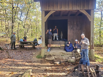
Hawk Mountain Shelter
The sun cresting the ridge at Hawk Mountain


Penny is heating water for coffee. Something new on this trip on this trip for me is forgoing my morning Joe for 2 instant coffee packets mixed with chocolate protein powder and nido milk powder. A pint-sized plastic mason jar with lid and a blender ball mixes the concoction perfectly.  A perfect breakfast to drink while hiking! 

The first one on the trail! Just before leaving, I said to Penny "make sure you take a left at the trail intersection." So what happened?  In my pre-caffeinated morning stupor, I charged right up Hawk Mountain.  Thankfully one can traverse the entire flat-topped ridge in five minutes!  After a half mile of walking around the top of Hawk in circles, realizing there are no blazes (the 2 inch by 6 inch white rectangles painted on regularly-spaced trees), I turn on my Garmin to discover the trail is back down towards the shelter. Arriving back to the trail junction, I went from first to dead last, earned an extra bonus mile, and hiked an extra couple hundred feet of elevation! Woody Gap is still 12.4 miles down the trail, and I just blew 45 minutes trying to find the trail at the top of Hawk mountain. 

Appalachian Trail
The Missed Trail Crossing

Down the trail, I caught up to Buttah (like butter but southern style), and Tiki. No, there names aren't really Buttah and Tiki, but on the trail everyone gets a trail name.  Some come to the trail with a chosen or earned name. My dad's trail name is "Crash," which doesn't need an explanation. 

Buttah and Tiki are fishing and kayak guides in North Carolina. Buttah has a sweet Aussie Shepard named Mick. Buttah is the fastest hiker in the group, but Tiki was struggling with a poorly fitted pack. He is new to backpacking, and understandably doesn't want to buy all the gear at once. 

Penny is also struggling with her pack. A bungee cord is keeping her stuff from falling out the top. She has stuff hanging EVERYWHERE! At one point there are 12 items jiggling and jangling, swaying back in forth like a metronome in time to her steps. Walking behind her can be hypnotising.  We are trying to find her trail name. She has so many gadgets that we toss around Gadget Girl and Gizmo, but we tabled the discussion because maybe she will get rid of some stuff (fingers crossed). She is planning on getting a new pack as soon as we get to Mountain Crossings at Neel's Gap.

Sassafras Mountain kicked my butt and the elevation gain is only 1,000 feet!  The wind was blowing hard and cold, numbing hands, face, and feet.  Maybe not having a real breakfast was a bad idea. I could stop for a snack, but I really wanted to get over the ridge and warm up. On the other side, near a road crossing (called a Gap in the south) someone left some water at the bottom, which was welcome as my water bladder is empty. After meeting up with several others who camped near us, we head up the trail. 

filtering water at a stream


We missed Penny at each crossing. Some guys were moving super fast up the trail, and they said they would keep a look out for Penny to let her know that she wasn't behind me. We ended up meeting at the Woods Hole shelter at lunch time. Eleven people are here that were at Hawk Mountain shelter last night. Two are choosing to stay and not continue.  Penny has been here for an hour. She thought I was ahead of her and left her! 

Looking back at springer mountain
The view south. Springer mountain is the one on the left


We get to Woody Gap as the sun is hitting the horizon. Buttah and Tiki decide to stay here and we share a level site near the Gap. We were so tired. We collected water down the hill and then went straight to bed after dinner. 

Today: 12.4 miles, total ascent 2779 ft

Woody Gap parking lot


Appalachian Trail Day 2 - Springer Shelter to Hawk Mountain Shelter (Mile 0 to 8.1)

SPRINGER MOUNTAIN! We are at SPRINGER freaking mountain! The Start of the Appalachian Trail! 

Let me say first we are thrilled beyond belief to be here,  however the outdoor camping experience last night was less than ideal. Lightening, thunder, and wind-driven rain so hard that water splashes a foot up against the down quilt under the hammock.

Last night I was up almost every hour until 3:30 am. Then I passed out 2 whole hours. Nobody up at 5:30 am. Back to sleep. 6:30 am - Penny is up but she takes an hour longer than me to pack up. Back to sleep. 7:30 am, everyone else is up and I'm the last one out of bed! Everyone was sluggish and slow to start, probably because of the stormy weather until the wee hours. The only dry items in my camp are my clothes I wore to bed and my top quilt. 

But we are elated! We have officially started the Appalachian Trail! We are AT Backpackers! The elements tested us and we are worthy!! Time for coffee!! 

Springer Mountain shelter appalachian trail


But first, we must pee in the trees where the other campers won't see us, filter water from a stream that is little more than a mud-soaked trickle, put on yesterday's wet and very cold hiking clothes, and break camp. All of this takes about an hour. 

We enjoy a casual breakfast and coffee at the shelter. The fire was revived for a brief bit of collegial sharing of the previous night. Some campers slept like logs, oblivious of Mother Nature's wrath, while some, like myself, reveled in awe at the fact a person can sleep outside on a mountaintop in a sub-tropical deluge with nothing more that some nylon and some very expensive down managing to keep us alive. Two braver souls chose the option of a firm roof over their heads in the shelter proper. They remained dry and somewhat less concerned of the lightening and wind, but they told stories of mice scuttling about their person in the night! I am not sure if I was jealous or grossed out. 

We left the shelter at 9:30, which is late this time of the year. Hiking in the fall means more time in camp due to the shorter days, but also means fewer daylight hours to hike. We must take advantage of the sunlight to make some miles. I'm okay with night hiking, even relishing the idea on occassion, especially when we have no great views.  Penny, on the other hand, prefers to be in camp before dusk so she can have her hammock set up. But I digress..

Parting from camp is both happy and sad. We made some friends we will never see again, but a few we will meet up with further on the trail.  Some we see multiple times per day, hopscotching as one or the other stops to refill our water, take a snack, or other necessary rest stop. 

The morning is cool and the clouds slowly part to offer the promise of a sunny day. We cross a stream multiple times, first on rocks, then on a log "bridge," then a real bridge almost choked by rhododendron.

Stover Creek Appalachian Trail Georgia
One of many Stover Creek Crossings


Today is a low mileage day as we build up our "trail legs." Only 8 miles, so lots of breaks planned. Our first break is at Three Forks. A pleasant junction of Stover and Chester Creek. I am unaware of the name of the third creek. Moreover, there are so many little creeks, were it Ten Forks I wouldn't be surprised. 

The sun is shining on a little picnic glade between the bridge and the road. We spread our wet gear out to dry while we filter water and snack on nut bars. Other hikers join us or pass us. I could stay right here for the rest of the day, but the trail calls...

Stover Creek Bridge Appalachian Trail, Georgia


Five more miles to Hawk Shelter. Gorgeous, but arduous because of the elevation change and the weight of our packs. 

Hammock Camping at Hawk Mountain Shelter


We spread out our wet clothes, hopeful they dry a little more before we have to redress for hiking in the morning. Mountain House dinner (just add water!) in front of the fire with about 15 other packers in and around the shelter. 

Today we hiked 8.1 miles with 1145 feet elevation gain. 
View from my hammock Hawk Mountain Shelter
The view from the Hammock


Just add water and fire

Happy Hikers


Amy and Penny's Amazing Appalachian Trail Adventure - Day 1 - Amicalola Falls State Park to Springer Mountain (Mile -8.1 to 0.2)

Penny and I had a wonderful pre-hike night at Hostel Around the Bend. After getting settled in our shared private room, we drove the 10 minutes into town for a burger and a brew at the aptly named Hiawassee Brew. The burgers were great, the beer even better.  

We were giddy with excitement for the start of our hike.  After a restless night of sleep, our shuttle arrived just as we finished loading our packs. Our driver, Frank, is a nice guy who gave us an informative drive of the area to Amicalola Falls State Park. We made a couple of stops (motrin and a replacement charging box for the phones) and arrived at the park around 11 am. We registered at the office, then took the obligatory pictures at the arch for the approach trail. 

Amicalola Falls State Park approach trail Georgia
The start of our approach trail in Amicalola Falls State Park, Georgia

The approach trail is 8.6 miles to Springer Mountain, which is the official start of the AT. One doesn't have to hike the approach trail - the option is to start at the Springer Mountain parking lot, which is about one mile north of the official start. Then one would have to hike south, spend a moment at the start, then backtrack the mile back north. Penny and I opted to get the whole experience by doing the extra 8.6 miles so we could look back at pictures and reminisce on our complete AT adventure. 

The trail started pleasantly enough. We ambled for all of one-quarter mile through woods on a gentle-sloped dirt path which paralleled the woods. Our amble quickly turned to a slog uphill on 675 wooden and stone steps. The weather was overcast and cloudy, and while the falls WERE beautiful, we joked about a better plan would have been to have Frank drive us to the park for a look and then to Springer for an easier start to the AT.  While we were suffering up the hill, all the other day hikers looked in wonder and amazement at the old ladies climbing up the hill with loaded packs. 

Appalachian Trail Section Hike
Amicolola Falls, Georgia

Penny had to stop and adjust her pack several times, as the pack was a recent purchase with a different suspension system than her other packs. The design was really cool, but she learned quickly that the pack was not going to work fully loaded for a multi-night backpack trip. We briefly visited the lodge at the top of the falls. We should have stayed here! The lobby is stunning! However, I hear the nightly rate is just as stunning, so maybe the hostel was better, after all! 

The lobby of Amicalola Falls Lodge

The sky turned ever more dark and cloudy, with a haze of fog turning to steady sprinkles for the next 5 miles. We followed the blue-blazed trail, climbing steadily to the Springer, excitement mounting. Finally, after 3,000 feet of elevation gain, and soaked to the bone, we crest a hill. Wait! The blazes ran out! We took a few minutes of scratching our heads before we realized we made it to the top! I was expecting lots of people milling about a small bald, appreciating the views of the distant valleys, however I as a little downtrodden to see a plaque set into the rock in a wooded copse. However, we celebrated the moment with a picture and entry into the logbook. 
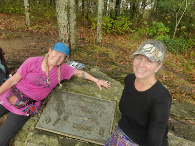
The Southern Terminus of the Appalachian Trail, Springer Mountain, Georgia


We continued the 0.2 miles to the Springer shelter. The shelters are curious respites from the vagaries of the trail, usually consisting of three sides, open to the elements but a shelter nonetheless. Most shelters also have a fire pit, water source (spring or stream), a privy set away from the water source, and picnic table. Other campers were already set up in and behind the shelter. Penny and I set up camp, then hung out in the shelter proper with the other 10 or so hikers which were in resident that night.  Some of the campers had been there 2 nights, making it a weekend. We enjoyed a roaring fire while eating our freeze-dried dinners and some campfire conversation until 9 pm, when the skies opened up. The rain and wind were amazing! 40 mph winds whipped the mountain all night, coming in sideways under the tarp. 

The Southern Terminus of the Appalachian Trail, Springer Mountain, Georgia
Springer Mountain Shelter the day after the deluge


Sign up to follow along as Penny and I continue our adventure!


Section Hiking the Appalachian Trail - Amy and Penny's Amazing Appalachian Trail Hike (Introduction)

For almost 15 years I read about the Appalachian Trail and dreamed of the adventure of a lifetime. 11 years ago I did the math and knew my youngest would be out of college, so decided 2021 was my year to hike. I originally planned on through hiking, but realized this isn't for me.

Firstly, the pandemic and life in general is preventing me from through hiking. I am a nurse in a hospital, and I am an essential employee in the setting of a pandemic combined with a terrible nursing shortage. Taking off six months to meander along the trail while my fellow nurses are drowning in the trenches makes my heart sad. However, my intentions aren't altogether altruistic. As the saying goes, I gotta make hay while the sun shines. Taking off six months when I have the potential to maximize my earnings is cool for anyone doing so, but just doesn't make sense for me. I do want to retire one day...

Secondly, I tend to get bored with the trail after a couple weeks. Hiking is a pure joy for me. Sleeping outside whenever I see an inviting forest glen or a spectacular view that begs me to hang my hammock so I may witness a breathtaking sunrise is absolutely liberating!! Hiking for weeks on end just seems more like a job than a fun thing to do.

Lastly, I miss my family too much. My husband. My grand baby. I just can't...

Last year, one of my hiking buddies asked me to show her how to backpack. For anyone who is unfamiliar with sleeping outdoors and carrying everything you need to survive on your back for days at a time, this may sound easy. Trust me - it's a lot harder than it sounds.

Backpacking the Appalachian Trail Maryland
Penny with backpack #1, AT in MD

We originally planned on starting June 2020 in Georgia, hiking north one two-week section at a time. Lockdowns on travel and resources all over the world changed our plan to local backpacking. We spent several trips exploring the AT within 3 hours of our homes, including the 42 miles across Maryland in 100* temps in 2 1/2 days. Penny played with her new gear, and decided to trade in a couple new purchases for more new purchases. Like her hammock, her tarp, her backpack, her sleeping bag. By the time we started the trail, I think Penny replaced everything but her stove and titanium cup! Man, she loves that cup :-)


Hammock backpacking Dolly Sods Wilderness
Penny with her new Hennessy Hammock in Dolly Sods

So this week is the start of realizing another bucket list hike for me. Penny and I left for Hiawassee Georgia. After 12 hours of driving, and a stop at Hiawassee Brew for some great local beer and a fabulous burger, we stayed at Hostel Around the Bend (previously Top of Georgia Hostel). Located east of Hiawassee, HATB is 0.6 miles from the AT crossing of Dick's Creek Gap. Recently renovated, this place is a very clean and peaceful respite from the town. 


Section Hiking Appalachian Trail Georgia Gear
All of this needs to fit into my Backpack!


One week of backpacking food
One week of food for the Trail


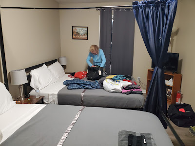
Appalachian Trail Hostel around the bend
Penny packing for the Appalachian Trail at Hostel Around the Bend