Nav Bar

About     ♦   Foraging     ♦   Backpacking     ♦   Trail Food    ♦   Wild@Home    ♦    Links    ♦   Demeter's Wild @ Home Store

Emergency Essentials/BePrepared

Appalachian Trail day 120 - Wawayanda State Park to Wildcat Shelter (Mile 1366 to Mile 1378)

I wake at 6:20, still tired but knowing my brain won't let me go back to sleep, so I get up. Kelly rouses soon after and we jump up to start packing our backpacks for backcountry camping for the next three days.  I need to clarify that Kelly jumps up. I am seriously dragging this morning from the strenuous hike yesterday and lack of sleep last night.

Our plan today is to drive to Bear Mountain State Park, 40 miles north to drop off Kelly's car,  then return to Wawayanda to start a three day backpack.

By the time we pack, drive to Bear Mountain, then drive back to Wawayanda, it's noon before we get on the trail. The good news is we can hike as little or as much as we want; we don't have to be anywhere specific at any predetermined time.

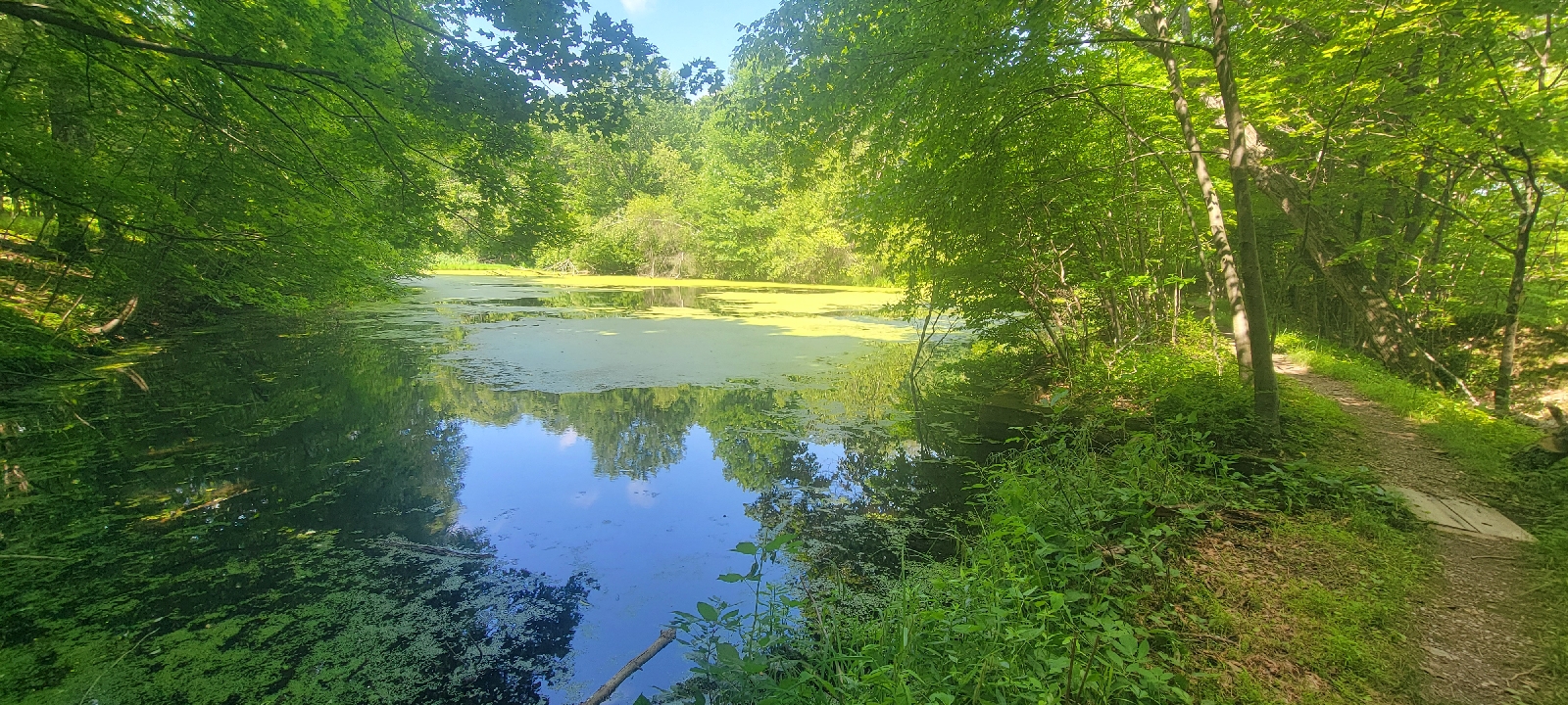
Back on the AT, the trail leaves Wawayanda State Park after passing by a lake dotted with water lily pads. The yellow flowers haven't yet bloomed, but look to be ready to open at any time.

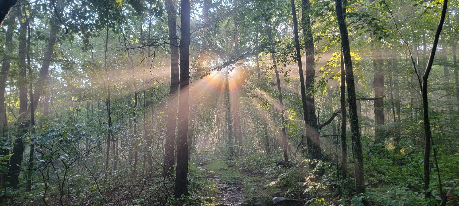
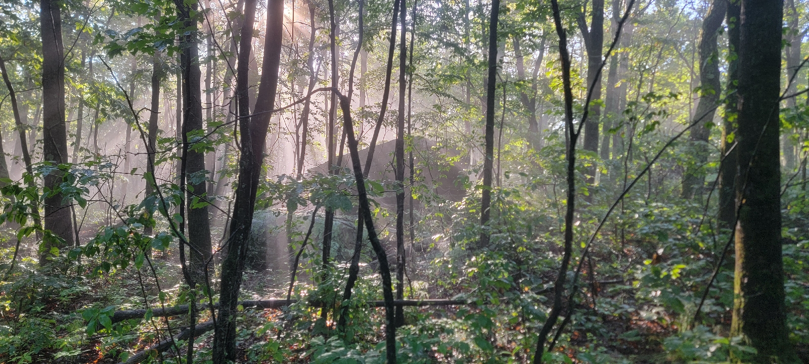
The trail is pretty level for the first three miles; a nice and smooth dirt path for that hour.  I am enjoying the easy trail, as the day is getting warm, and the air is thick with humidity. 
 

The woods are quiet today; the birds are silent and the only sound is from planes overhead and some cars on a road in the distance.  The only activity in the woods is that of an occasional squirrel running about, and at one point I smile from watching a pair of chipmunks chasing each other back and forth across the trail ahead.

We start hiking up on gently rolling rocky inclines which then descend to a nice woodland path.  The lower areas are wet enough to maintain skunk cabbage, jewel weed, and fern in the summer heat.

The trail starts to become more rocky and before we know it we are rock scrambling over huge boulders.  We arrive at a painted white line with N.J. on one side and N.Y. on the other. We crossed out of New York and into New Jersey!! Eight states down and four to go!!

The views from the rocks are incredible.  We are hiking on the ridgetop to the west of Greenwood Lake, a large mountain lake that glistens in the valley 700 feet below. Small clusters of homes dot the eastern side of the lake,  and boats are scattered all over the blue water. 

We are roasting in the hot sun and I am so  thankful to enter the shade of the woods,  thinking the rock scrambling is over,  but little do we know that it's just beginning. We go a little ways in some trees only to come out on the ridge for another exposed boulder climb.

We end up doing about 15 rock scrambles altogether,  but I lose count; there are so many.  My brain is too baked from the heat. At least we have some fresh white blazes to follow, so fresh in fact that we hear someone yell out "The paint is wet!"

A man and a woman with two friendly dogs are painting the 2-inch wide white blazes on the rocks to point the direction of the trail.  We thank them profusely for their service, and the woman tells us the best rock climb is yet to come. 

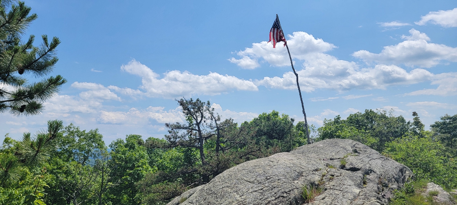
A short time later,  we come to a flag on a pole fashioned from a dead tree.  On a clear day,  hikers can see the Empire State Building from here, but today is too hazy for us to see beyond the next ridge.  We then come to a crazy big rock climb with a rebar ladder pounded into the rocks.  We get to the top successfully, and a short time later we are finally past the lake and the rock scrambles.

The exposed rock climbs behind us, we lunch by a stream and filter some brown water, rich with tannins from all the oaks in the woods.  We relax near the stream until the biting mosquitos motivate us to keep moving.  

We are walking down the trail when a big black shape appears on the trail in front of us. Another Bear! And this time there are two cubs

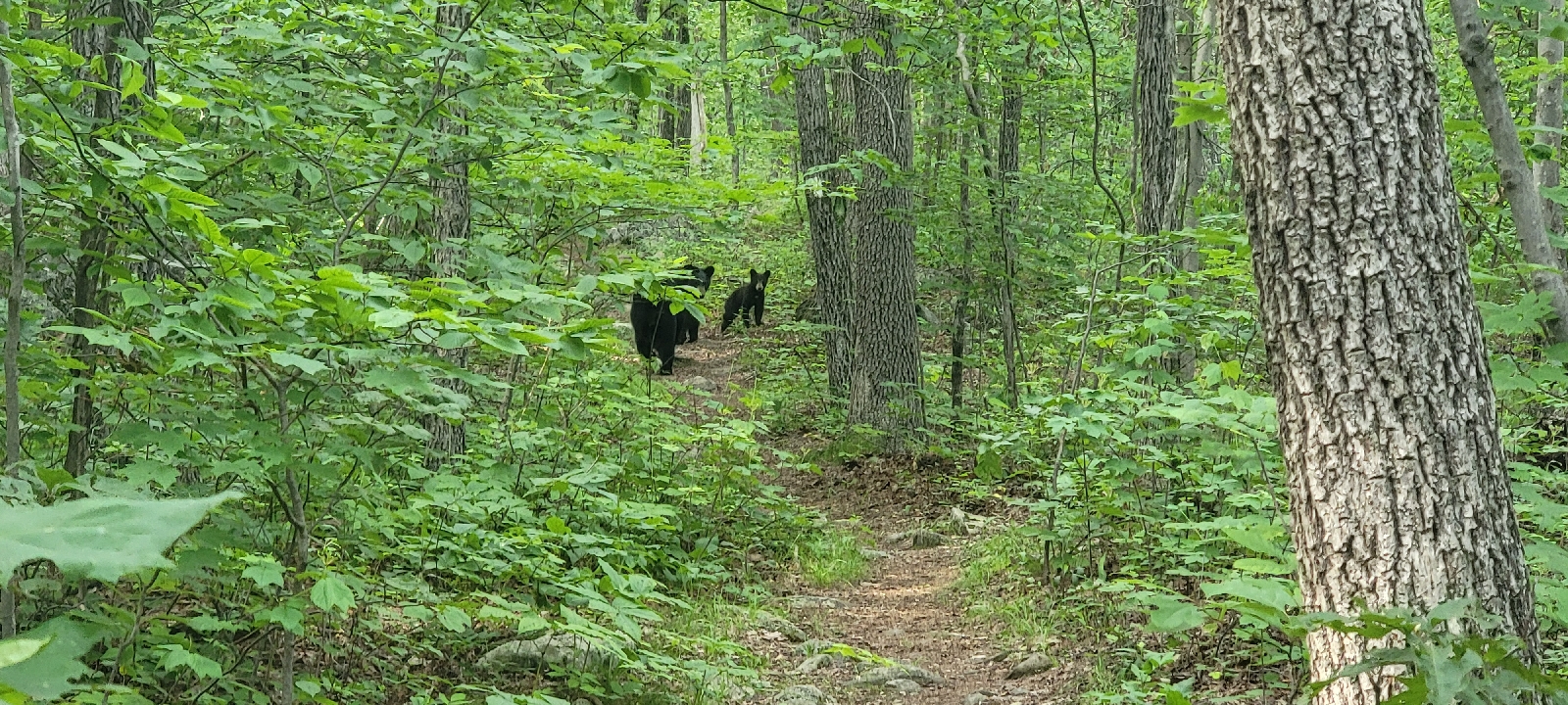
We take pictures and videos but at the same time we loudly implore the bears to please leave the trail so we can safely pass. The momma bear looks at us for a little while and eventually shoos her babies out of the trees, and they all move away from the trail and down the ridge. We wait a few more minutes until the coast is clear.  Exhilarated by the wildlife encounter, we have a bounce in our step even though we are getting tired. 

About a mile later,  we see two women walking road towards us. It's Ladybug! We are so happy to see her.  She has a friend with her that flew out from California to visit family and spend a week on the trail.

We ask Ladybug what she is doing walking south and she looks at us very confused. 

"What do you mean south?" She asks.  

We tell her we are going north and for a second I am worried that Kelly and I are going the wrong direction.  It ends up that Ladybug and her friend went into town for ice cream and got back on the trail going the wrong direction for almost a mile. They laugh about it, but I wonder that if we had not run into them, they could have walked for another mile before they realized they backtracked! 

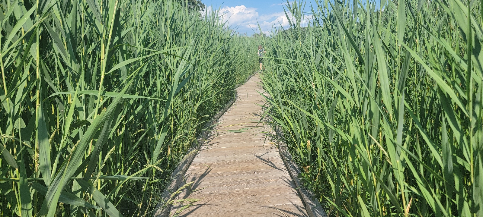
The four of us chatter for a couple of miles.  Her friend Molly has had a rough introduction to the trail.  Molly is covered in mosquito bites and they were caught in the storm that we witnessed two days ago from the top of High Point. The winds were reported to be over 60 miles per hour,  and they walked through shin-high water near the long boardwalk as tree limbs fell around them.

When we get to the last big climb and a rock scramble before the shelter,  Kelly and I walk ahead. The trail isn't easy,  by any stretch, but it is easier than the ridge walk.

We arrive at the Wildcat Shelter at 7 pm, so tired and hot,  but still in good spirits.  The shelter has a big tent area, occupied by two men who have their tents set up,  and Kelly and I claim our spots and are set up when Ladybug arrives. 

We all sit at the picnic table for a late dinner when two more young women show up.  Soon we are a group of six women of varying ages sitting in front of the shelter talking animatedly. 

I am putting away my food in my food bag when lightening bugs start illuminating the darkening woods around the shelter. We watch them for a few minutes,  but the rock climbs in the hot sun wore me out.

I say goodnight and put my food bag in the bear box - and big metal container bolted to the ground so bears can't get the food. The practice not only protects our food from the bears,  but more importantly prevents the bears from becoming conditioned to associating the food with people.   Undesirable bear encounters will eventually lead to dead people and dead bears.

I retire to my hammock, knowing that tonight is going to be too warm to sleep comfortably. The mosquitoes are going nuts, so I jump into my hammock and close the mosquito netting as quickly as possible.  

I set my watch to vibrate at 5 am tomorrow so we can get an early start in order to beat the heat, as the forecast is for 93F degrees with the heat index of 106.

Good night.

Today's Stats: 11.8 miles, 1,549 feet gain
Trail Stats: 1,378 miles, 269K feet gain


Appalachian Trail day 119 - Gemmer Road to Wawayonda State Park (1346 to Mile 1366)

We wake refreshed and the day promises to be gorgeous. The current weather outlook is for a much cooler day than originally expected,  with a high of 80F degrees. 

I really want to backpack, but we decide last minute to do a 20-mile slack pack to take advantage of the low temperature, combined with the fact that there isn't suitable overnight parking until the end of the 20 miles stretch we can cover today. 

We bustle around, reorganizing our gear and our cars before we leave the hotel, guzzling fresh coffee and grabbing a pile of food from the breakfast buffet to fuel our morning. 

We leave the hotel at 7:30 am, hitting a nearby Walmart to buy water and  electrolytes for the crazy hot days this week. 

The drive to Wawayanda State Park takes an hour, and with the drive back to Gemmer Road where we finished yesterday, we are on the trail for a late 10 am start.

Almost as soon as we start the hike, the trail crosses a mucky mess in the low-lying areas,  of which there are a lot. The trail takes us down to a pond, which is so flooded the trail reroutes around the pond and comes out on a country road before turning back into the woods. 

After passing the pond, we immediately cross another mud pit, but then we walk on a boardwalk of sorts, where the trail crews suspend 2 x 10 boards on 4-inch square pieces of lumber to make a bridge over the mushy spots.

When we get back onto terra firma, we walk on a near-level trail behind some beautiful residential areas. The terrain is so amazingly easy that we hike six miles in the first two hours.

The trail leaves the residential area behind and I am treated by a stiff cool breeze as we walk across pretty pastures of grasses and wildflowers.  I spy ripe blackberries next to the trail, and soon Kelly and I pick some for a small trail snack.

The trail leaves the fields and we come to a road. Confused, we look around for a blaze to point us in the right direction because we can't see a trail. We can't find a blaze because the road is the trail,  which we only figure out after consulting our FarOut app. 

The trail follows the country road, passing a few cute houses, and after a half mile, we enter the Wallkill National Wildlife Refuge. A bridge crosses the Wallkill River, swollen and brown with the thunderstorms last night, and a bench located beside the river look like the perfect place to stop for lunch. 

Kelly carried fresh berries for a treat, and while we enjoy lunch next to the river, a man passes by that is carrying a small backpack with all kinds of stuff hanging off of it, swinging like crazy. I see a jet boil stove and two pairs of shoes tied off. Nothing drives me crazier than things hanging off a pack!

After a nice break beside the river,  we hike another half-mile and happen to see a sign in front of a neatly manicured home offering trail magic.  A refrigerator and cooler are next to a bench under a carport, where the hiker with the swinging stuff is sitting and talking to a man, presumably the homeowner.

I squeal in delight because I am running low on water and we have a decent climb with no water sources for miles. We approach the men and say hello. 

The owner is named Birdfeeder because his trail magic is the birdseed and he puts it out and watches what shows up. 

I grab a cold root beer from the fridge and Kelly gets a Sprite as we talk to the men.  The thru hiker is Planet Caravan and he is from Georgia and started March 17. He explains his name is from a "trippy Black Sabbath song." 

I see Birdfeeder's car is tagged in New York. Confused, I say that thought we were in New Jersey. Birdfeeder  states that we are technically hiking in New Jersey,  but his house is in New York. 

Planet Caravan says goodbye and then Kelly and I do the same, depositing our cans in Birdfeeder's recycling bin. We sign the guest book and I top off my water before we leave, continuing on the road around Birdfeeder's beautiful property. 

The trail leaves the road a quarter-mile from Birdfeeder's house, and for the next two miles we follow a gravel path around the wetlands of the Wallkill National Wildlife Refuge, passing several mulberry trees with fruit ripe for picking. We grab some as we pass by.

The wetlands are comprised of several ponds and marshes that provide habitat for migratory birds.  There are no birds today, just some smelly hikers passing through. 

The wetlands are flat and open, and we can see Planet Caravan on the trail ahead of us for the 45 minutes it takes to walk around the refuge. The trail makes a 90-degree turn to the left and I see Planet Caravan in the distance turning and leaving the road. A few minutes later,  I see a big shape emerge from the woods where Planet Caravan just entered. 

"Bear!" I yell excitedly, pointing ahead to the road ahead. Kelly looks up and we both get out our phones to get a picture. The bear is heading away from us up the road, and even at this distance I can tell it's huge! We video the bear, watching it  lumber slowly on the road until it disappears over a nearby rise. 

I say it looks like it came out from where Planet Caravan entered the woods. We wonder if he scared it out. 

When we arrive at the area, we follow the blaze into the woods and see Planet Caravan standing on a boardwalk a short way up the trail. He says to be careful because he saw a big bear just now. We said we watched it walk down the road.

He pulls out his phone and we watch his video of the bear on the boardwalk maybe 50 yards in front of him, staring at him about 20 seconds before nonchalantly moving off the boardwalk and into the woods.

We all walk together for 15 minutes along the boardwalk until the trail leaves the wonderfully flat terrain and starts up a steep hill with several switchbacks. Planet Caravan quickly outpaces us as we head uphill for the next 1.5 miles.

The temperature has climbed considerably since we started this morning,  and I am sweating like crazy as I climb laboriously up the incline. I am so thankful for Birdfeeder's hospitality and that we took advantage of it. 

We pass the turn off for the Pochuck Mountain Shelter, but we don't want to stop again so soon, so we continue up the hill and the trail turns from a dirt path with rocks to straight up boulders, which we climb for another 300' of elevation gain until get to the top.

At the top is a rocky outcropping where we look across the valley to the west.  Kelly points out the High Point Monument on the ridge, where we were just this time yesterday and 14 trail miles ago! 

We take a few pics and then start down the hill, where we cross our halfway point for the day. 10 miles down, 10 miles to go.

We go down a very steep hill and come out of the woods onto a busy road crossing where several cars are parked on the shoulder.  A trailhead kiosk describes the trail is now a 1.5 mile boardwalk traversing the wetlands in front of us, with pictures displaying the boardwalk construction. 

The Pochuck Boardwalk is impressive, as are the wetlands we walk over.  Cattails grow along both sides of the boardwalk,  and I show Kelly how to harvest the shoots, which she doesn't like very much. 

I then show her how to eat the pollen, shaking the bright yellow powder off the male cattail shoot onto my hand,  which I lick off. She tries it and likes the taste much more than the shoots, and soon we are both covered in cattail pollen and laughing.

We.get off the boardwalk and cross Pochuck Creek on a cool suspension footbridge. The trail continues through the marsh, flooded by the thunderstorms yesterday, and our feet get wet from the ankle high water. 

The trail leaves the wetlands and crosses a cow pasture to head for a busy road crossing, where several cars are parked. We are now fifteen miles into our hike,  and it's been relatively easy, but we still have five miles to go and we have a doozy of a climb coming up.

The trail quickly becomes a boulder climb  for the next mile, which takes almost an hour. Kelly is ahead of me, and neither of us stop once the entire time for a breather, continuing our forward momentum until we get to the top, near a sign pointing to a view off the trail. By now it is 6 pm, and we really don't want to stop because we want to be off trail by dark, so we pass the view and keep hiking. 

We go down and up repeatedly for an indeterminable time, and both of are desperate for a break. We have only hiked an hour from the view point, but we are so spent it feels much longer.  We look at the map and see we only have another hour at most to reach the car, and only a few hundred more feet of gain for the day. 

At 8 pm, just as the sun is setting, we arrive at Wawayanda State Park,  where the truck is parked. We are blissfully happy, but exhausted.  Another 20 mile day in the books, but we are plum tuckered out. We did 4,000 feet of climbing today, about twice the elevation that we did on the other two 20-mile days, and I feel it!

We drive to get Kelly's car,  and by the time we check into the hotel, eat and take turns showering, it's 11 pm. 

Good night!

Today's Stats: 20.1 miles,  3,700 feet gain
Trail Stats: 1366 miles,  268K feet gain


Appalachian Trail Day 118 - Mashipacong Shelter to Gemmer Road (Mile 1334.8 to Mile 1349.5)

I wake up at the usual time, surprised to see no movement from Kelly's camp. I think we are both tired from the arduous day yesterday.  

I putter around my camp,  putting away what I can without disturbing my neighbor, when I decide to get my food bag out of the bear box in front of the shelter and grab some breakfast.  

There are two men talking at the shelter. One stayed in the shelter and the other camped out.  I join their conversation.  The one who stayed in the shelter is named 5 Lives because he has cheated death that number of times on the trail. In one instance , he had Norovirus so bad it caused a seizure and a heart arrhythmia. Then he walked through a patch of woods that caught on fire and he made it out after it became an active forest fire. Another time he was almost struck by lightening.

The other gentleman is from New Jersey. He backpacks the area frequently and stays here often.  I am looking through the logbook and see a familiar name. Martian signed it earlier in the month.  The man says he talked to Martian and more recently Babysteps! I hope I can catch up to a familiar face.

Kelly wakes and joins us.  She said it poured all night, but i didn't hear a thing, I slept so soundly. 

I need to finish packing so I leave them to chat while I go back to camp to cram my soaking wet gear into my soaking wet backpack. This is the worst part of camping in the rain.  Everything is wet and doesn't dry out,  which means the contents of a pack becomes quite ripe, especially when the temperature rises.

Even with lollygagging, we leave camp at the respectable time of 7 am,  just as the sun is starting to backlight the tree canopy,  the rays of sunlight penetrating the leaf cover and making the raindrops sparkle. 

Surprisingly,  the mosquitoes aren't too bad this morning.  5 Lives said he had to cover himself in deet last night to prevent an all out attack. Unfortunately,  our joy is short lived, because we get dive bombed as soon as the sun rises above the trees. This time I am prepared,  keeping the bug spray close at hand,  and I don't even have to stop and take off my pack. 

Two miles into our hike,  we make a very steep but blessedly short climb and walk by a rock ledge with a beautiful view of Lake Rutherford. The water sparkles in the morning light. 
We leave the nice view and the hike takes us over some really rocky areas and one that required me to use my hands to climb down. 

Drenched with sweat and bug spray,  we soon we come to a trail junction at High Point State Park, aptly named for being the highest point in New Jersey.  We veer off the AT to a nearby parking lot where we have a car parked. We will reposition our vehicles and then come back and slackpack another 6 miles. 
Two hours later,  we return to the Appalachian Trail, which follows the Kittatinny Ridge toward the High Point Monument. Built in 1928, the monument is dedicated to New Jersey's veterans. 

On the way to the monument,  the trail runs beside a viewing platform with amazing views of the 220-foot tower.  The AT veers away from the tower,  but we take a short side trail to the monument.  Kelly is working on visiting the high point of every state, and after this she will have 22 high points collected.

Kelly takes the narrow circular stairs to the top while I check out the signs on each side of the base, which shows what mountains, towns, and states I see from the vantage.  
Looking out at Sunrise Mountain, some really dark clouds are dumping rain on the spot we ate dinner last night.  Checking the radar, it looks like a thunderstorm is moving this way.  

Kelly comes out and we start down the ridge. The storm ends up narrowly missing the park, and instead unleashes some heavy rain and wind just to our east.
We start hiking fast down the ridge,  as more storms are expected in a couple of hours, and we have another four miles to get to the car.  

Most of the next four miles of trail are the easiest I have yet to experience on the trail.  After descending on wide switchbacks down the ridge, the trail remains relatively level as it winds through fields and residential woodlands criss-crossed with numerous small streams.  
The streams we cross saturate the ground at each crossing, causing some very mucky areas. Stepping stones are arranged so hikers can rock hop across the mud, but I still manage to step in some deep mud and my legs are disgusting with mud and grit and rivulets of sweat. 

We leave the bottom lands behind, but not before passing a small pond and crossing over mushy ground that is bordered by cattails. I show Kelly how to pull the inside of the cattail leaves out of the center so the tender inner leaves aren't contaminated by the water. I munch on the white bottom, which tastes like cucumber.
My need for foraging slightly mollified, we descend the last 50 yards to her car. A small covered stand holds a spiral notebook for hikers to sign.  Kelly walks ahead, and I stop to look through the recent entries and see that Terminated,  Grit, and Ladybug signed the book only yesterday! 

I sign our names and walk to the car,  eager to tell Kelly that we are closing in on some of our hiking buddies!

We drive to a nearby hotel, excited for a shower and clean clothes. We explode our disgusting smelling packs all over the room so the saturated gear can dry out.

Good night!

Today's Stats: 11.3 miles, 1,184 feet gain

Trail Stats: 1346 miles, 264K gain


Appalachian Trail day 117 - Tent Site to Mashipacong Shelter ( Mile 1314 to Mile 1334)

I slept so amazingly well last night. I left my under quilt at home in lieu of a sleeping pad to give me more flexibility if I choose to sleep in a shelter during rain.  I usually carry both if i am base camping for the weekend,  but since it's all about the miles, and miles mean less weight, I only have a sleeping pad.  My pad is a little heavy, but it kept me super warm and I slumbering like a baby on my floating mattress . 

I am awake at 5 am, but because of the rain I don't get up until 5:45. Kelly is already packed and taking pics of the flora until I finish and we leave camp at 6:20.

There is a high probability of rain today, but with the clammy humidity I don't wear my rain coat.  Every time the wind blows, the trees shake water down on my head, so I am soon quite wet, but the cool drops feel good.


The trail is lovely, traversing the ridge on an old forest road. Apparently a developer put in a roadway and prepared small clearings up here in order to sell home sites until the government bought the land for the AT.  

The trail then runs along a beaver bog.  I don't see any beaver, but one critter we see in abundance is mosquitoes. They follow us up the trail for quite some time. I want to take off my long sleeved sun shirt, but I'm leaving it on to protect me from the swarm.  The material is so thin that they get me anyway. I debate getting out my bug spray,  but by the time I stop to take off my pack,  they disappear. 


No day on the trail would be complete without some rocks. We rock climb on some really slick, worn rocks so we have to pick our way very carefully. Even though we exercise caution,  Kelly takes a spill. She slides rather than falls, and goes down on her right side. She gets up and says she is okay, but her right arm aches a little.  

We climb up and over several rock outcroppings that promise a beautiful view on a clear day,  but we just have to take everybody's word for it from the comment section on FarOut. 


We descend to a dirt road that leads to The Brink Road Shelter,  the first shelter for the last 22 miles. We decide to bypass it since it's 0.3 miles off the trail and we just loaded up with water at the last stream crossing.

The trail then ascends into a gorgeous hemlock forest that we walk through for the next two miles.  The hemlock sheds feel so soft underfoot, I wish I could walk on them all day.  


As soon as I crest the ridge,  I get absolutely assaulted by mosquitoes. They are worse than earlier today, and I don't waste anytime stopping this time to cover myself in bug spray. Shortly after, the trail passes a bog that is pretty much one big mud pit; the most likely breeding ground for all these mosquitos.

The trail climbs again and to the ridge and we are FINALLY rewarded with a view.  Granted, it's not much, but we can see a neighboring ridge and a lake below.  We are delighted and enjoy the vista for a moment. 


What goes up must come down, and so does the Appalachian Trail.  A lot. The trail drops down to cross a busy road at Culver's Gap. I am almost out of water because it's so freaking hot.  I have sucked down three liters and we only hiked 12 miles so far.  The next water source is four miles up another ridge, so when I see a gas station sign , I asked Kelly if she would care if we walked over so I can get a drink.

The gas station ended up being a strictly service station, but right next door was a tavern. I poke my head in to see if we could get a couple of iced teas. We smelled so bad that we waited on the front porch and the waitress brought them out to us. The tea was delicious and ice cold.

Our thirst satiated, we continued up the ridge. The 700 foot climb is fairly quick and easy,  and we are thrilled to have the best view yet in this area when we arrive at the Culver Fire Tower. 


We continue on to the stream at the bottom of a hill, about one mile from the fire tower.  We contemplate staying at the nearby Glen Anderson Shelter,  but it's only 3:30 pm. We have hiked 15 miles,  but we agree we should keep going. The next shelter is another 5 miles,  but there is no water between here and there other than a nasty beaver bog so we will have to carry water from here. 

I have been dying to soak my feet in a cold stream all day, so I Sit on a rock and soak my feet while I scoop and filter my water.  A young man walks up and with the look of a thru hiker.  I ask if he is,  and he replies affirmatively with a thick accent. He is from France, and his name is Vite, the French word for fast.  He started April 28 and he is already over 1300 miles! Just amazing.  He is doing 25 to 30 miles per day.  I think his name should be "Tres Vite!"

Our packs are now much heavier with the water, and we have another decent climb until the next shelter.  

We top Sunrise Mountain just as a peal of thunder rumbles nearby. A huge picnic pavilion magically appears right on the AT. We decide to hang out under the pavilion and let the storm pass. It's almost dinner time, so we make good use of our idle time to make dinner.  

We are almost finished with our dinner when a couple walks up from the nearby parking area. They thought this would be a great place to get stoned and watch a thunderstorm. We chat for a few minutes but we get going in the rain.

The rain persists for the next few miles. We hike with our umbrellas and the rain in and of itself is not a problem. The problem is with the freaking mosquitoes. They are worse than ever. Thankfully I left my bug spray where I could reach it while I'm walking, and I spray myself liberally.  Fortuitously we can go to town tomorrow, because I am going to use up all of my bug spray today at this rate.

Thank goodness we are almost at the shelter because I do not know what is worse: the mosquitoes, the pouring rain, the big slippery rocks that we climb over, or hiking 37 miles the last 2 days in soaking wet footwear. 

We finally get to the shelter at 7:00 pm. The mosquitoes are so awful that we cannot camp inside the shelter, because we will be eaten alive while we sleep. So we both decide to set up our camps to have the protection of the bug netting. 

Just as we are getting ready to set up, the sky lets loose and we get drenched. The rain does not stop the mosquitoes, and we put up our shelters as fast as possible so we can take cover under the bug netting.

It is now 8:30 pm and I am safely ensconced in my hammock.  I can hear the little buggers buzzing around, trying to gain access. 

We did our first 20 mile day with full packs, and I'm beat. Goodnight!

Today's Stats: 20.6 Miles, 2,756 feet gain
Trail Stats: 1,334 miles, 263K feet gain