Nav Bar

About     ♦   Foraging     ♦   Backpacking     ♦   Trail Food    ♦   Wild@Home    ♦    Links    ♦   Demeter's Wild @ Home Store

Emergency Essentials/BePrepared

Appalachian Trail Day 68 - Pickle Branch Shelter to Four Pines Hostel - Dragon's Tooth and a Broken Hand! (Mile 698 to Mile 706)

5/14/24

I awake with a renewed vigor this morning.  I slept incredibly well.  Yesterday I was on the struggle bus all day long, digging deep to find the motivation to keep hiking and pull myself out of my suffer fest, but I'm confident today will be much better. 

Almost all of the shelter residents leave at the same time.  There is one hiker still sleeping in the shelter, but no one is concerned about making noise while they pack up, not caring if he is awakened.  I find the behavior a little odd, but as we reunite with the AT, No Rush explains that they guy was a jerk and came in making a lot of noise last night.  Apparently, No Rush and Chopsticks had a bad experience with the hiker a couple weeks back, when the man took some drugs and then acted a fool at another shelter. Now it makes sense.

We arrive back at the sign, and I realize someone previously changed the distance to the shelter from 1/2 to 1/3 miles, but it certainly felt like 1/2 mile or more. The shelter area was a nice respite from the trail and I'm glad we went there and saw some familiar faces. 


Rain is in the forecast, and it rained last night, so everything is wet. I have on my rain jacket to protect me from the water dumping on me whenever I brush by a plant. 

The hike up the trail is easy, gaining 700 feet over one and half miles. We pass what is supposed to be a scenic view, but we are socked in by fog, and while we can see a little of the surrounding countryside. We have had so many gorgeous days and amazing views that I don't fret.  

The first big accomplishment of today is that we make it to the 700-mile point of the trail!! The last 100 miles have been challenging, to say the least!  We celebrate with a couple pictures around the "700" that someone made from sticks. 

We continue on the trail, shrouded in fog. The pawpaw trees lend to the prehistoric, tropical feel, which is appropriate as we continue on to Dragon's Tooth. 


The next big accomplishment of the day is reaching Dragon's Tooth, named for the big rock monolith that rises from the ridge top, extruding like a tooth, of course!  I have hiked up here a few times before, but never from this trail, so it's fun to be doing something new.  

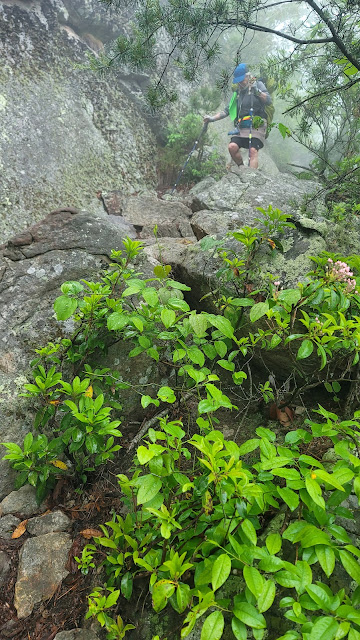
The hike up isn't difficult at all, but the hike down should be interesting in this weather. We walk over and between large rocks, following the white blazes painted on the sides of the weathered stone. This hike is challenging in good weather, but the rain makes everything very slippery.  I admonish GG to take her time and watch her step.  


I take a picture of GG with her head down, hiking down some stone steps with the aid of her hiking poles.  This is going to take us a while to get down, but at least we don't have too far to go.  Four Pines Hostel (and my vehicle) is only 2.5 more miles from here, so even if we take our time, we will get there mid-afternoon. Just after I took this picture, the trail became more like a stone slide than steps.  We had to toss down our hiking poles and slide down the rock so our feet could find purchase on a stone outcropping. I'm a little taller than GG, so I just needed to stretch.  GG, on the other hand, had to slide down the stone on her backside until her feet could reach the outcrop.  She yelled out and holds up her hand, her little finger of her right hand sticking out at a weird 90-degree angle. 

"I broke it!" she exclaims, grimacing and holding her wrist with her good hand. I am perched on a four-inch stone ledge and not sure which way to go.  She is now standing on a decent-sized square of flat earth but still needs to navigate this section.

"Can you take off your pack and hand it to me?" I ask, thinking that would make it easier for her to descend one-handed.  If we can just get off this little section of rocks, we can evaluate her injury and decide what to do. 

She awkwardly takes off her pack and I am able to grab it. A mother and son hiking up the same promontory is beneath me and waiting for us to descend before they can climb up.  They have witnessed the entire exchange and ask how they can help. I ask if they are able to grab her pack from me so I can help her down. 

They take the pack, and she passes me her hiking poles. She tries to get down one-handed, but I can hear her yelps of pain as she can't avoid hitting her injured hand. 

Once she is down, we survey the damage.  Whether it's dislocated or broken, it's definitely messed up.  The first order of business is to remove the silicone ring that is on that finger before the finger swells, and the ring cuts off circulation. Unfortunately, we don't have anything but little Swiss Army Knives that have the little scissors that pop out.  Great for cutting duct tape and opening dinner pouches, but not good for much else. 


I cut the silicone band slowly, GG crying out with each cut as I can't help but disturb her injured finger. I do make progress, however, and eventually get the band off.  Which is a good thing, because her finger is swelling up fast!  She is a trooper and says she can hike.  We try to peel some duct tape from our hiking poles, but it's old and lost its adhesive side. GG then cuts the finger out of her glove so that her finger is splinted by the ring finger.  

We make our way down the mountain very cautiously, albeit clumsily.  Of course this is one of the steepest climbs yet, and the wet rocks don't help much. I help her down as best I can, but unfortunately, she still has to do all the work. We get closer with every step, and from one of the overlooks, we can see my truck parked behind the hostel!

Normally when hiking, I ponder the answers to life's greatest mysteries, such as wondering why people hate Nickelback so much.  Yesterday I just finished the entire Dune series (audiobooks) for the fourth or fifth time and spent a great amount of mental energy trying to make sense of Frank Herbert's later books, like Dune Messiah and Children of Dune. Today, I am only thinking of making it to the truck, and what I would do if GG were unable to make it down. How quickly we go from happy-go-lucky to injured and stressed about our circumstances. 

Thankfully GG is tough as nails, and we finally make it to the road, which is a wonderful sight! We road walk a half mile to the hostel.  GG goes inside to change out of her wet clothes, but I just stand beside the truck.  I am packing everything in the bed when No Rush and Chopsticks walk up.  They prefer to go into Daleville, where they can get a hotel room and zero tomorrow in the rain, taking time to visit an outfitter and grab some real food.  They don't have any dry clothes, but I give them reusable shopping bags to sit on, so they don't get my truck all nasty. 

We drop them off at a hotel in Daleville, where we wish them luck.  We make the drive home.  GG calls her husband, asking him to make an appointment at the local orthopedist for tomorrow. She takes some ibuprofen and holds her hand against the window of the truck, which is cold from the outside temps.

GG went to the doctor the next day and she not only dislocated her finger, but she also has a fracture!! She is one tough old bird! She doesn't need surgery but will be in a cast for a while.

Goodbye for now, Appalachian Trail.  You kicked our booties, but it will be a very memorable trip indeed!

Today's Stats: 8.5 miles, 1877 feet gain, 2110 loss

Trail Stats: 706 miles, 162K feet gain


Appalachian Trail Day 67 - Trailside Campsite to Pickle Branch Shelter (Mile 683 to Mile 698)

I slept okay last night.  The wind picked up last night, but thankfully my tarp tie-outs stayed put.  I like to sleep on my side, but my hips have been hurting too much.  I'm sure I have something brewing in my hips; I need to see an orthopedist when I get home. In colder weather, I sleep with both an under quilt and a sleeping pad, which turns my hammock into a nice flat floating mattress.  I left the sleeping pad at home for this section in order to save weight, so I am slightly less comfortable, but it's still better than sleeping on the ground!

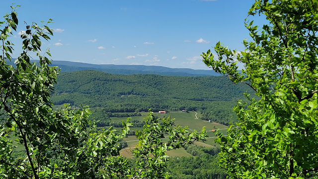
I depart slightly before GG by 7 am, and within a half mile I am at The Ledges, a smooth rocky outcrop with an awesome view of the valley to the east. The sky is not too hazy, and I can see Blacksburg to the south.  This is going to be an awesome day!

We have a lot of rock crossings, where the trail is a jumble of large rocks that require care when picking one's way across.  Some are stable, but some teeter when you step on them.  I am once again thankful for the cool morning air that keeps the rattlesnakes from coming out.  A hiker that passed us said there was a rattler on the trail last night just before the Sarver's blue blaze. 

Appalachian Trail Day 66 - War Spur Shelter to Trailside camp just past Sarver's Hollow Shelter (Mile 669 to Mile 683)

I get up for the day at 6:30am!  I can't believe I slept so darn long.  I wake up hungry, so I guess my hiker hunger is starting to kick in. GG is already packed and eating breakfast.  I make a shake and drink it while I'm packing, but I take a few minutes to stretch on my sleeping pad in the shelter before we head out, and we are on the trail by 7:45.  

This day is going to be beautiful.  The sun is shining through the tree canopy, illuminating the carpet of ground pines on either side of the trail.  Purple violets are everywhere, showy spots of color in the green and brown woods.  Little false strawberries, Duchesnea indica, are plump and although they have none of the flavor of a strawberry (as a matter of fact, they are tasteless), I can't help but pick a couple to munch on.  I see a lot of wintergreen (Gaultheria procumbens), a couple of which still have some berries, which I love to eat. 

Within 20 minutes I come to a road crossing.  This is where we originally planned on camping last night. But I am happy we stayed at War Spur.   

A popular saying on the trail is No Pain No Maine, and today we will feel some pain as we have a pretty big day of climbing in front of us.  We will have to do about 4,000 feet over two different ridges.  I try to keep my attitude positive and just enjoy the day as a start climbing Kelly Knob, which is a gain of 1800 feet over three miles.  At the top are Mother's Day greetings in rocks.  I forgot today is Mother's Day!  I call home and talk to my mom and my daughters while I have service up here, sure I will lose it again on the descent. 

GG and I meet for lunch at the Laurel Creek Shelter, where some hikers are just getting packed and leaving for the day.  After a quick bite, we navigate the big rocks across the winding creek just past the shelter. 


Reishi mushrooms


Crossing Laurel Creek

Two miles after leaving Laurel Creek Shelter, we hike into this lovely meadow.  A lovely, sweet, slightly spicy smell drifts on the wind.  I can't make out what it is, but I love it and want it to linger.  I stand under an enormous oak tree and could stay here all day in the shade with this delightful breeze. Instead, I take some pictures and continue to follow the white blazes across the rolling pastures. I pass by a thick stand of red blackberry canes covered in white flowers and realize this is the source of the wonderful smell. 

We cross Va Route 630 on a bridge over a wide shallow stream.  We consult our FarOut apps and discuss our camping possibilities for tonight.  The next shelter is a very steep descent down from the ridge from the AT.  The last thing we want is bonus miles that also require elevation gain and loss. But if we don't want to go to the shelter, this will be our last water source until the next shelter, another 10 miles from here. We don't think we can make it that far, so we decide to load up with water and camp somewhere on the ridge tonight. 


Now we get to climb another 2,000 feet, with an extra 6 pounds of water on our backs. Maybe it would be more prudent to just hike down to the water at the shelter the next time...

The first part of our hike takes us past the Keffer Oak, a 300-year-old oak tree at 60 feet tall, is the the second biggest oak on the entire trail.  The tree has a circumference of 20 feet.  We take some pictures and head up the mountain. 

The hike is literally climbing steps, as big stone steps are carved out of the hillside. We are rewarded for our efforts with beautiful views off both sides of the ridge. 

A turnstile in front of the Keffer Oak


The Keffer Oak


At around 4 pm we pass the blue-blaze trail to Sarver's Hollow Shelter.  We stopped for a second to confer with each other and just to make sure we are both on board with dry camping tonight.  GG and I still feel like staying on the ridge, especially after carrying all this water uphill for a couple miles, so we now need a suitable spot.  I would like to hike another 2 or 3 miles so we have less to go tomorrow, but GG said she is done and wants to set up ASAP.  The hiking spirits manifest her desire, and a couple of camping spots materialize 15 minutes later.  

We set up feet from the trail in established camping spots. The ridge is narrow here, and I tie my tarp down tight because the wind could get wild tonight up her on the ridge.  A couple hikers pass by as we set up and eat dinner.  Down the ridge to the west, someone is shooting a lot of rounds, and we hear the staccato of gunfire until dark.  

Today's Stats: 13 miles, 3793 feet gain, 2592 loss

Trail Stats: 683 miles, 161K feet gain

Appalachian Trail Day 65 - Peter's Mountain Trailhead to War Spur Shelter (Mile 657 to Mile 669)

I am up really early this morning, at 5 am, and want to pack for our shuttle back to Peter's Mountain Trailhead, but I don't want to disturb the people camping nearby.  I mean really nearby - like feet away.  The foot end of another hammock is hanging from the same tree my head is hanging from.  This place is packed tight!  I slept like the dead, because I didn't hear anything last night.  

I quietly take down my tarp and hammock and gather my belongings and carry everything to the picnic tables next to the kitchen and laundry area.  There, I pack my things and drink a cup of instant coffee with some sugar and milk left in the kitchen.  No name or date means up for grabs!  

More people start to wake and mingle about and GG comes around the corner, surprised to see I am packed. She said she slept really well in the bunkhouse, and she has her pack at the picnic table in front of the bunkhouse.  

Mike is our shuttle driver this morning and he is super prompt, arriving and opening the lift gate of the Tahoe at 6:59 am.  We drive back to the trail with another hiker who is doing the slackpack back to the hostel, and we are on the trail by 7:30 am. 


It's a chilly 45F when we hit the trail, but the day promises to be a beauty.  We hike along an easy pitch, paralleling and then crossing a stream when three hikers come from behind.  I know them!  They were at Wood's Hole a few days ago with us. They stayed in the shelter less than half mile south of the trailhead last night. We chat for a few minutes, before we have a climb of one thousand feet, and the thru hikers quickly pass us. 

On the hike up, I feel really weak.   I realize I didn't eat hardly anything yesterday:  a protein shake, an apple, and a mini snickers bar was all I had before the Chinese buffet, where I ate mostly vegetables.  No wonder I am dragging!  When we arrive at the shelter, four miles into our hike, I tell GG I want to stop and eat for a few minutes. We agree to meet at the next shelter 9 miles up the trail, to decide where we will stop tonight.  


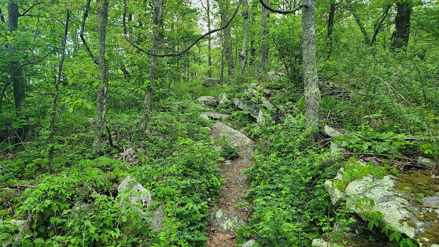
The trail is super rocky in places. This looks like prime rattlesnake habitat.  I am glad it's a little chilly outside, because the snakes will stay snug in their little dens and not come out to sun themselves on warm rocks. The trail continues to climb gradually from the shelter, and the rocks disappear, making for a nice hike. 

I pass several campers who stayed at a nice flat area in the woods.  They are finishing their packing and when I stop to filter water at a spring a short way up the trail, they have caught up to me and now there are a herd of people!  We chat a little before I continue up the trail.  

A short time later I come out of the woods onto VA route 613.  I see a bunch of hikers sitting in a circle on the edge of the road.  Trail magic!!  This puts a skip in my step!  I join the group and survey the magic which includes tangerines, cookies, donuts, homemade peanut butter balls and a cooler filled with soft drinks and cheese!  I indulge in two tangerines, a cookie, a couple of the peanut butter balls, and a soda.  The gentleman and lady who hosted the magic receive donations from the local Kroger and Food City, and we get a picture and sign a poster board with thanks for the donations.  What a wonderful lunch!

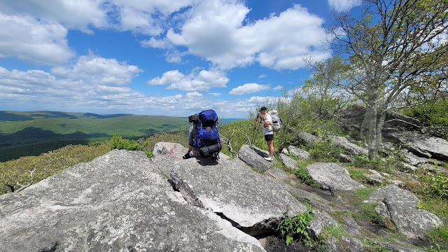
We stop a short 0.2 miles up the trail for a gorgeous view at a place called Wind Rock.  We take some pictures and marvel at the amazing views to the north. 
  
VA Route 613


Trail Magic!


The Wilderness to the North of Wind Rock


Wind Rock


Today is just beautiful.  The trail is a little up and down, a little left then right.  Just green and pretty.  Birds are chirping.  Lots of blueberry bushes and ferns line the trail.  GG and I walk together for a couple miles.  A hiker comes up from behind and we chat for a little while.  He says the weather changed from a 20% chance of rain to 60%, and we can see the clouds building to the west.  We will probably get wet at some point this afternoon, but for now I just enjoy the beauty and serenity of the woods.

A short time later I am walking alone and start to descend from the ridge. I turn off airplane mode to see I do indeed have service.  I call home and then check the weather.  Thunderstorms are to the northwest, and they are moving in FAST! I pull out my pack cover and put it on my pack and put my raincoat in the side pocket where I can easily grab it.  If I prepare for rain, it rarely comes, but this time it does when I am about one mile from the next shelter.  Thankfully it's not hard rain, and I deploy my umbrella. 

I am really enjoying carrying this umbrella. I think it may be a normal part of my kit from here on out.  I have a Velcro strap I can use to attach it to my pack, so I don't need to carry it. I need one of those silly stadium umbrellas that I can wear on my head. 


Pretty Azaleas


I arrive at War Spur Shelter and GG is surprised to see me.  She thought I was ahead of her.  The rain is still coming down, but it looks like it is clearing out.   There is a girl laying in the shelter, and we leave our packs inside to remain out of the rain while we check out the campsites.  This place has some wonderful campsites that are separated by screens of rhododendron, providing a lot of privacy.  I grab my tarp and stake out a site with two perfectly spaced trees near the shelter but blocked partially from view.  GG sets up in the adjacent site. Our timing is perfect, because hiker after hiker starts arriving.  

By the time we are set up, the rain has completely abated.  We sit at the picnic table to eat and have some very interesting conversations with other hikers about nutrition and macros.  One hiker has calculated his daily caloric requirement of 4,000 calories, what most of us are burning in a day, although some hikers will burn up to 6,000 calories daily!  He only eats nuts with raisins and cranberries for his fats and carbs and then supplements with protein and vegetable shakes throughout the day.  He is maintaining his weight and muscle mass but is lamenting the lack of nutrition from fruits and a variety of vegetables.  

I am fascinated by nutrition and love reading studies about macronutrients and trying to play with the right mix of protein, carbs, and fat to maintain health while on the trail.  I am impressed with the simplicity of his diet and wonder if I could stick to something so easy but mundane.   I could easily try it on a short section to see if it would be feasible for me, but I suspect I would crave more variety. I do share with him one of my Kencko smoothie packets, which are basically just freeze-dried fruits and vegetables, and he is intrigued and plans to get some to add to his protein shakes. 

We all say good night, and I tuck into my little haven in the woods, surrounded by at least 20 other campers. By 7:30 pm I am out like a light. 

Today's Stats: 12.8 miles, 2316 feet gain, 2710 feet loss

Trail Stats: 669 miles, 159K feet gain


Appalachian Trail Day 64 - Ridge Campsite to Peter's Mountain Trailhead - Back to Angel's Rest Hostel (Mile 651 to Mile 657)

I didn't sleep well last night.  I had a really hard time getting into deep sleep.  Every time I felt like I was drifting off, I would snap awake again.  Then, about 1 am, I feel my stomach clench and I unzipped my bug net and was just able to get my head over the edge of the hammock when I throw up.  I usually keep my backpack and shoes right under my hammock, but thank goodness I didn't last night. 

I go back to sleep again, only to wake up very thirsty at 3 am.  I drink some water and lay back down again.  My stomach clenches and once more I am trying to get my bug net unzipped, but this time I'm not so lucky and throw up on the side of my hammock and into one of my shoes.  Yuck! Thank goodness I have a Zofran prescription; I take one and put it under my tongue.

GG and I wake at 6 am.  My stomach is roiling, but I don't throw up again.  I judiciously sip water, knowing I will need it for the 8 miles and 1,000 feet of gain today, but I really don't feel well.  I take some vanilla powder mixed with coffee granules for my breakfast and sip on it as I hike.  


Appalachian Trail Day 63 - Pearisburg, Va to Ridge Campsite (Mile 637 to Mile 651)

 This morning we are up at dawn, and I must say I love the She-Shed!  I slept like a baby in the comfy bed and chilly air-conditioned space.  So much better than a smelly bunkhouse with snoring hikers!  I go to the main hostel house to grab a cup of coffee before I pack.  My truck is here, so GG and I were able to resupply with things we brought from home.  We hastily went through our things last minute, leaving anything we may not need for this next very short segment.

By 7:30 am,  GG and I line up for the shuttles back to where we were picked up yesterday.  The shuttles are already starting to ferry hikers to various parts of the trail.  Some people are doing 20-mile slack packs out of town back to the hostel.  GG and I would love to slackpack, but we really don't want to do 20 miles yet. Unfortunately, there isn't another egress from the trail between town and Peter's Mountain Trailhead (the 20 mile point), so we decide to hike out of town tonight and sleep on the ridge, then get picked up tomorrow at Peter's Mountain and get shuttled back to Angel's Rest.  From there, I will reposition my vehicle farther up the trail.  

We have spent a ton of money and time in hostels, but the  surfeit of hostels and easy shuttles will be coming to an end as we hike further into Virginia.  Fortunately, we both really enjoy sleeping outside, especially when the weather is pleasant, as it is now.  Yesterday the forecast was a 60% chance of rain, but now it's 30%.

The SUV back to Route 100, where we got off trail yesterday, is jam packed with hikers now clean and well fed and ready to face the trail.  Within minutes we are unloading at the trailhead and continuing on our way.  

Usually, we immediately climb up a mountain when we leave a trailhead, but today we are treated by a two mile, relatively level, walk through the western edge of town, where we cross the New River on a bridge with a pedestrian walkway.  

Our objective today is to just hike and enjoy the day, with no real plans other than camping somewhere on the ridge.  The more miles we do today, the less we must do tomorrow, but water is limited , so we will come up with a more firm plan once we get to the first shelter; 7 miles and 2,500 feet of climbing away.

The hike up to the ridge becomes quite steep and onerous as we ascend. The air is humid and combined with the temperature, I wish for a breeze;  I am sweating buckets and must stop frequently to catch my breath.  The sky is overcast, so at least the sun isn't beating down, but it looks like the rain could at any moment. 

The Pedestrian Walkway over the New River


We arrive at Rice Field Shelter at a perfect time for lunch, so we take off our packs and sit in front of the shelter and meet several other hikers who are doing the same.  I talk about the different ways to rehydrate trail food with a woman eating cold ramen out of a Talenti Jar.  I am cold-soaking curious, and I am inspired to try it out on a future trip. 

While we are eating, the New Hampshire girls hike through.  They are 12 miles into the slackpack and staying at Angel's Rest tonight. They don't fly out until the day after tomorrow, so we may just see them tomorrow night.  We wish each other "Good Journey" and "Happy Hiking," and get ready to leave Rice Field.  Some young men hike in and they tell us to watch out for a rattlesnake next to the trail just before the trees.  We tread cautiously, but see no sign of the snake. 

Rice Field Shelter

The View From Rice Field Down Into the Valley

The Trees Where a Rattlesnake Lay in Wait

We walk through some fields and are a little over a mile from the shelter when we stop to filter water from a spring. This is the only water source on the ridge for another 10 miles.  We briefly consider staying here tonight, but then we would have to be up really early to meet our shuttle back to Angel's Rest tomorrow.  And neither of us feel like stopping yet, although the piped spring water here is wonderful. 

Our other options are to hike to the next shelter, which is 19 miles away, or just dry camp on the ridge.   Neither of us thinks 19 miles is a fun hike, so we decide to just keep hiking until we want to stop.  So we filter extra water and take some time to drink a liter and have a light snack, even though we just had lunch.  I have a three liter bladder in my pack, and another one liter dirty bag.  I am drinking a lot of water because it's hot and I drink loads when exerting myself up the hills. 

Two hikers come towards us and I realize one of them is No Rush (the Elder).  I met him for the first time at Woods Hole, then talked to him for a bit last night at Angel's Rest.  He is a retired nurse, so we talked shop for a little while.  We offer him some Pringles, which he accepts.  We say more goodbyes and keep walking.

The ridge here is a nice mix of light woods and grassy trail bordered by cherry trees and blueberry bushes.  We walk by a long orange construction fence, which is a gas pipeline channeling natural resources through the area.  Helicopters are very active overhead, and we assume it's related to the construction. 


The Biggest Millipede Since Smoky Mountain National Park


GG says she is done for the day, so we look for a spot to set up.  We find a level, cleared area just big enough for her tent; obviously used for that purpose before.  I am able to find two well-distanced trees only 30 feet away.  We are literally steps off the trail, but it's late so we shouldn't see many hikers at this time.

When I start to make camp, I realize the cap on my bladder wasn't very straight and water slowly leaked out of the bladder and onto the contents of my lower pack, which just happens to be my sleeping system.  My hammock, top quilt, and under quilt are all in the same stuff sack in the very bottom of the pack, which is the best place for stuff I won't need all day while hiking.  The stuff sack is water repellent, but it's old and I'm not sure of the permeability.  I take it out and see that everything is dry.  Whew!  Crisis averted.  

Now that I am confident that my sleep system is unscathed, I assess the water loss.  A pool of water is in the bottom of my pack, but I have half my bladder intact, plus the dirty water bag. I can make it through until we get down the mountain tomorrow morning. 

We have awesome cellular service up here on the ridge, so I call home and check in before bed. 


Today's Stats: 14 miles, 3500 feet gain

Trail Stats: 651 miles, 155K feet gain