I get up for the day at 6:30am! I can't believe I slept so darn long. I wake up hungry, so I guess my hiker hunger is starting to kick in. GG is already packed and eating breakfast. I make a shake and drink it while I'm packing, but I take a few minutes to stretch on my sleeping pad in the shelter before we head out, and we are on the trail by 7:45.
This day is going to be beautiful. The sun is shining through the tree canopy, illuminating the carpet of ground pines on either side of the trail. Purple violets are everywhere, showy spots of color in the green and brown woods. Little false strawberries, Duchesnea indica, are plump and although they have none of the flavor of a strawberry (as a matter of fact, they are tasteless), I can't help but pick a couple to munch on. I see a lot of wintergreen (Gaultheria procumbens), a couple of which still have some berries, which I love to eat.
Within 20 minutes I come to a road crossing. This is where we originally planned on camping last night. But I am happy we stayed at War Spur.
A popular saying on the trail is No Pain No Maine, and today we will feel some pain as we have a pretty big day of climbing in front of us. We will have to do about 4,000 feet over two different ridges. I try to keep my attitude positive and just enjoy the day as a start climbing Kelly Knob, which is a gain of 1800 feet over three miles. At the top are Mother's Day greetings in rocks. I forgot today is Mother's Day! I call home and talk to my mom and my daughters while I have service up here, sure I will lose it again on the descent.
GG and I meet for lunch at the Laurel Creek Shelter, where some hikers are just getting packed and leaving for the day. After a quick bite, we navigate the big rocks across the winding creek just past the shelter.
 |
| Reishi mushrooms |
 |
| Crossing Laurel Creek |
Two miles after leaving Laurel Creek Shelter, we hike into this lovely meadow. A lovely, sweet, slightly spicy smell drifts on the wind. I can't make out what it is, but I love it and want it to linger. I stand under an enormous oak tree and could stay here all day in the shade with this delightful breeze. Instead, I take some pictures and continue to follow the white blazes across the rolling pastures. I pass by a thick stand of red blackberry canes covered in white flowers and realize this is the source of the wonderful smell.
We cross Va Route 630 on a bridge over a wide shallow stream. We consult our FarOut apps and discuss our camping possibilities for tonight. The next shelter is a very steep descent down from the ridge from the AT. The last thing we want is bonus miles that also require elevation gain and loss. But if we don't want to go to the shelter, this will be our last water source until the next shelter, another 10 miles from here. We don't think we can make it that far, so we decide to load up with water and camp somewhere on the ridge tonight.


Now we get to climb another 2,000 feet, with an extra 6 pounds of water on our backs. Maybe it would be more prudent to just hike down to the water at the shelter the next time...
The first part of our hike takes us past the Keffer Oak, a 300-year-old oak tree at 60 feet tall, is the the second biggest oak on the entire trail. The tree has a circumference of 20 feet. We take some pictures and head up the mountain.
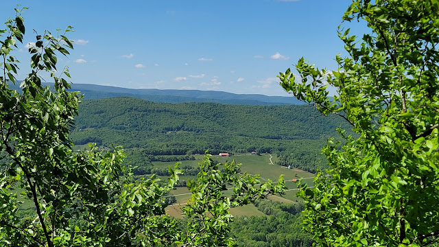
The hike is literally climbing steps, as big stone steps are carved out of the hillside. We are rewarded for our efforts with beautiful views off both sides of the ridge.
 |
| A turnstile in front of the Keffer Oak |
 |
| The Keffer Oak |
At around 4 pm we pass the blue-blaze trail to Sarver's Hollow Shelter. We stopped for a second to confer with each other and just to make sure we are both on board with dry camping tonight. GG and I still feel like staying on the ridge, especially after carrying all this water uphill for a couple miles, so we now need a suitable spot. I would like to hike another 2 or 3 miles so we have less to go tomorrow, but GG said she is done and wants to set up ASAP. The hiking spirits manifest her desire, and a couple of camping spots materialize 15 minutes later.
We set up feet from the trail in established camping spots. The ridge is narrow here, and I tie my tarp down tight because the wind could get wild tonight up her on the ridge. A couple hikers pass by as we set up and eat dinner. Down the ridge to the west, someone is shooting a lot of rounds, and we hear the staccato of gunfire until dark.
Today's Stats: 13 miles, 3793 feet gain, 2592 loss
Trail Stats: 683 miles, 161K feet gain


No comments :
Post a Comment