Well, that didn't last long. I went home expecting to be done with the AT for 2024, but had a change of heart. My dolt of a husband didn't take off work for us to take the long road trip we have been planning for the last 3 months, so I decided to come back to the trail and get a few more miles in before I have to go back to work next week. Plus, the weather forecast for the next few days is positively delightful!
Rory from Stanimal's shuttled me to Route 60 and I will hike southbound back to the James River, where he will pick me up in three days. I certainly didn't pick this route expecting to encounter many south bounders, rather this is the preferred method for many hostels. It will be much easier for me to arrange a ride from the bridge back to my car than it would be to arrange a pick up from here in three days.
Speaking of three days, Rory is surprised that I won't get back by tomorrow night. I certainly could, as this is only at 23 mile section, but it's almost 2 pm now, and it's getting dark at 7:30 pm. I promised my husband I wouldn't night hike as much as I did the last two weeks. For some reason it bothers him...
I am at the trailhead by 2 pm as two young men are emerging from the trail. They are Sobo but getting off at the next road crossing to go into town. Their names are Hippo and Bronto (like Brontosaurus). We chat for a few minutes and they tell me they hiked through lots of Nobos until they hit Pennsylvania. We talk about Platinum Blazing, and they are all for it. They take off down the trail, eager for a town day. Almost immediately I find several clusters of wild grapes hanging directly over the trail. A sign that I picked the right route!
I am hiking downhill from Route 60 along a stream that is flowing downhill in a narrow valley. Several signs along the trail tell the story of the people that lived and farmed this area after the civil war.
The land along Brown Mountain Creek was purchased by a slave who was the son of a wealthy land owner. Born to a slave, the man was able to work for money, which he saved until he could purchase 220 acres along this creek, making him one of the few former slaves who was also a landowner.
The family who owned the land rented out homes and sharecrops to other former slaves, and the community grew. The commerce centered upon a gristmill, and the town included a school, a church, and several smaller mills. The town was abandoned when the City of Lynchburg purchased the land to construct a nearby dam and wanted to protect the watershed surrounding the dam.
Now the only remains are the occasional chimney and some random piles of stones.
I stop at the Brown Mountain Shelter for a chia protein fresca, enjoying the beauty of the woods on this lovely fall day. The shelter is very old and looks like a party place for some wild mice, but the camping areas surrounding the shelter would be a lovely spot to spend the night.
 |
| Brown Mountain Creek Shelter |
I plan on spending more time the next couple days to explore the local flora and even do some mushroom picking, which I haven't taken the time to do recently. I have several field guides to wild plants and mushrooms on my phone, but it can be time consuming to look things up when I need to get up the trail. Thankfully, this trip will be more of a walk in the park than a punishing hike.
I cross the creek on a log bridge and continue winding my way down the little valley. The hike the rest of the way along the creek is divine. I even stop and soak my feet in the cold stream, enjoying having all the time in the world to do what I want. There are lots of little minnows that nibble on my toes. They must decide I taste rather unappetizing. I am too freshly washed! They will like the way I taste in a few days...
Two Sobo Flip-Floppers roll in while I am soaking my feet. We talk about how delightful this area is, and I tell them about my experience with the lack of water sources south of here. They say goodbye and I put my socks and shoes back on. I have been walking along this creek for over five miles, but I need to head up a hill and find a campsite for the night.
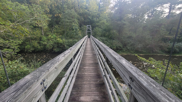
I walk over a large swinging bridge to start walking uphill for the next three miles. I am not going to be picky about my campsite, and I plan on being set up well before dark. I spot a place in the woods under some spruce trees, which are my favorite to camp under. The smell is just divine! I spy a campfire ring, and although I have no desire to start a fire, it just makes the site seem a little more homey.
I set up camp and watch a movie on my phone for 20 minutes but I'm too tired to continue. Coyotes are howling all around and there are huge ants all over the ground. I'm going to have to shake out everything really well tomorrow!
Goodnight!
 |
| The Dam and Reservoir |
 |
| The Pedlar River Bridge |
Today's stats: 9.8 miles, 2000 feet elevation gain, 1940 loss
Trail Stats: 797 miles, 176K feet gain


No comments :
Post a Comment