Nav Bar

About     ♦   Foraging     ♦   Backpacking     ♦   Trail Food    ♦   Wild@Home    ♦    Links    ♦   Demeter's Wild @ Home Store

Emergency Essentials/BePrepared

Appalachian Trail Day 162 - Imp Campsite to Stealth Camp (Mile 1,891 to Mile 1,902)

I slept like a log last night for nine hours. I woke up a couple of times to cold spots on my shoulders but I adjusted my quilt and snuggled back into blissful slumber. I'm really excited to be able to spend my last month on the trail in my hammock every night, except for the few times I go to town to shower. 

I wake a little later than my usual at 5, and by the time I get packed, brush my teeth, collect the bear can from the bear box, and hike back up the side trail,  I'm back on the Appalachian Trail at 7am, just as the sun breaks over the mountain ahead.

There's a chill in the air this morning; not surprising in the mountains of New England. I hike with my fleece on for a little while but I'm soon shedding layers as I start climbing up to Mount Moriah. 

The sky is blue and clear and the sun is shiny brightly. There's a light breeze blowing just enough to stir the plants.  It's promising to be an absolutely gorgeous day. 

The climb up Moriah is steep over the next thousand feet, but it's usual by White Mountain standards. Along the way I stop to take in the breathtaking views. I can see The Northern Presidentials from Mount Washington to Mount Madison behind The Carters which I climbed yesterday. It's so amazing to look out and see what I've accomplished for the last two days.

I have cell service and I sit in the sun on a rock ledge to send pictures to my family chat, as well as to Buttercup and Martian. I hope they had views like this when they hiked through here. This is the last mountain of the Whites, and this is the perfect send off.

The descent down Mount Moriah is very steep.  I will lose a total of 3,300 feet over the next six miles, but the bulk of that will be in the first two miles. Thankfully the rocks are nothing like coming down off Carter yesterday. I am able remain upright and step down on boulders most of the way, although it's really hard with one pole, so sometimes I have to reach down with my free hand to hold on to rocks or grab trees to prevent a fall.

I pass a woman with a day pack hiking up the trail towards me. She stops and asks me a lot of questions about my hike and she is curious as how old I am. When I tell her that I will be 57 in two weeks she tells me that I'm amazing and this is something that she wants to do and I'm an inspiration.

I continue down the mountain buoyed by her kind words. I have a couple of rocky stream crossings which are quite easy, and the trail becomes so much easier! I'm actually able to enjoy a walk through the woods instead of worrying constantly about about each step, something which I have done almost every minute of hiking for the last two weeks. 

The woods are beautiful birch and beach and spruce. The ground under foot is soft with leaf litter and spruce needles, although there are still plenty of rocks to walk around. It's easy going and I send Dad a message that I should arrive by 1pm at US Route 2.  This will be the only road crossing for the next 31 miles, so he is treating me to a town day and a room!

The trail crosses the Rattle River, which looks to be quite low judging by the huge smooth boulders in the river bed, but even at low water the river has a number of amazing pools that would be perfect for an afternoon dip on a hot day.  The trail then walks directly up to the Rattle River Shelter; a standard no-frills forest service shelter, but it's well maintained with a fresh coat of paint. 

The next two miles passes quickly on the very easy and almost level trail, and I am at the Rattle River Trailhead on time at 1 pm. Just before the parking lot I see a cooler with trail magic and a congratulatory sign for making 1,900 miles! Less than 300 to go!

Dad is waiting for me and he takes some pictures before I load up into his truck for the trip into town to take a shower and resupply for the next three days. He spreads towels on the seats for my dirty backpack and my dirtier body.

The drive into town is short and we go to lunch at a riverside restaurant where I eat an entire pizza and some chicken wings before going to his hotel room to shower while my electronics charge. I  pack three days of food in the bear can before loading up and returning to the trail. 

I am dropped off at the trail head parking area where he picked me up and we say goodbye. I am not sure where I will camp tonight,  so I will hike until I find a suitable spot.

The trail is a road walk for the next mile and it's unseasonably hot in this part of New Hampshire. Loaded with 3 days of food and four liters of water,  I am struggling with the weight of my pack in this heat. 

Soon the trail enters the woods but the trail then goes straight up the mountain for a thousand feet over the next 2 miles. I have to stop a couple of times to catch my breath. I consider sitting in the shade for an hour or two for the heat to dissipate, but there are no boulder climbs, so I press on. 

Three miles from where I hopped back on the trail I come to a flattish area in the woods that looks like it floods frequently, so it is relatively open. There is no rain in the forecast tonight so this looks like a great place to call it quits for the day. 

I get set up and have a half hour to sit on the edge of my hammock and update my blog and played Sudoko, which for some weird reason tends to calm my mind for bed. 

I am out 20 minutes after sunset.

Today's Stats: 10 miles, 2,200 feet gain
Trail Stats: 1,902 miles, 385K feet gain

Appalachian Trail Day 161 - Pinkham Notch to Imp Campsite (Mile 1,878 to Mile 1,891)

I woke up and took a shower before texting Dad that I'm ready to get packed up.  He came right over and took me to grab some coffee before going back to the hotel so I can organize my things.

There is not another road crossing for 20 miles, so I plan on camping out tonight and meet him tomorrow at the next road crossing to resupply before I head back into the woods.  Getting supported is quite a luxury, and I'm so thankful that he is doing this for me. Town chores like grocery shopping and doing laundry takes precious hours out of time that I could be hiking or just relaxing in camp after a long day of hiking.

Packing up takes a little while because my stuff is spread out in various containers in his truck. I have ziplocs in one container with cleaning supplies and food in another, with blocks of cheese In the cooler.  I leave my dirty hiking clothes from yesterday with him and he'll launder them And bring then back to the trail for me tomorrow to have clean clothes to change into.

I'm packed up and he deposits me on the trail at 7 A.M after a quick fast food stop for breakfast. I say goodbye and he says he will follow me on my Inreach website, that shows my live track as long as I have my device turned on, which I always do when on the trail. 

I head up 19-Mile Brook Trail which is the continuation of the detour for the Appalachian Trail. The first mile or so is a slight incline on a nice easy pine duff path. I gain a few hundred feet while going upstream against 19-Mile Creek. The water level is a little low in the creek but there's still some really nice small cascades and waterfalls along the way.

It's fairly humid this morning after yesterday's rain and the temperatures are in the mid 60s in the valley. It's overcast and there is a small chance of rain in the mountains today. I start sweating even though I'm not working very hard.

About the two mile mark the trail starts to get noticeably more rocky and a little steeper. I stop to take a short break at the trail crossing for Carter Dome and a man walks up with a day pack. He is moving fast and sweating profusely. He stops and we chat for a few minutes. He is a teacher and has to go back to school next week so he is enjoying his last week of vacation by hiking In the mountains. He gives me a high five before he heads up the trail.  I shoulder my pack, getting ready for the steep ascent to the Carter Notch Hut, where the detour ends and I will rejoin the Appalachian Trail.

The trail continues uphill for the next two miles. I stop to take a break on a nice and big flat rock, where I can keep my pack on and lean back for a chair of sorts. A tall young man walks up and we chat for a while. I joke about how I am having a leisurely day on the trail, and he gives me a fist bump when we depart and says "God bless you. " I'm not sure if it was simply a parting goodbye, or a prayer for divine intervention because he thinks I need someone to watch over me, haha.

The trail merges with the AT just above gorgeous lake dotted with water lilies sitting in the shadow of the Wildcats. I could sit here all day,  but I have only hiked one-third of my miles and I want to stop at the hut.

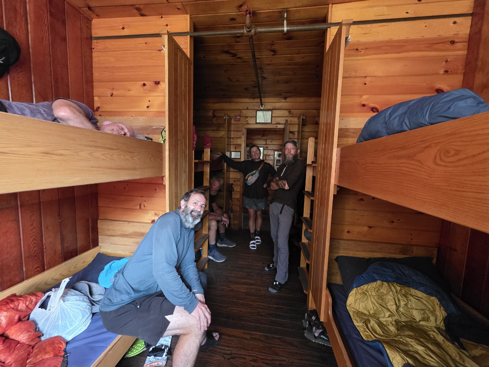
I take the blue-blazed trail to the Carter Notch Hut. I leave my pack outside and go in to grab a baked good, which are always delicious. There are no guests and the Croo is chatting amiably in the small dining area. 

Their packboards are on the tables, packed with boxes to be carried down the trail to Punkham Notch. I then realize it's Wednesday,  which is resupply day for all the huts. The Croo will take non-compostable refuse down the mountain and each return with 50 pounds of food and supplies. 

A young woman is on the floor trying to stuff all of her things into a huge backpack that is already bursting at the seams. From their conversation I make out that she is leaving her position In the hut, her summer with the Croo coming to an end. Many of the Croo are students, and with school starting soon they will be switching out staff for the fall season.

I refill my water bladder and select a piece of coconut cake from a baking sheet. It is amazingly good but falling apart so I take it outside in order to not make a mess; there are no napkins or paper towels in the huts. 

With my water replenished and my hunger satiated for the moment, I shoulder my pack and start down the trail. As I reach the Appalachian Trail the Croo walks by with their packboards, singing in merriment and shouts of "Goodbye Carter Notch Hut" echoing around the small lake.

Leaving the hut, I prepare myself for the the hard day ahead. I still have to summit five peaks over the next five miles, three of which are 4,000' feet. Additionally,  there is no water on the ridge, so I'm carrying an extra seven pounds of water. 

The ascent up to Carter Dome is very steep, and like all the trails In the Whites thus far is rocky, requiring huge steps up the boulders, difficult with a pack weighing almost 30 pounds. I have to Work hard to keep my Balance so that my heavy pack doesn't pull me backwards up the steep incline.

The good thing about steep climbs is that I gain altitude quickly, climbing almost 1,600 feet over 1.2 miles, with most of the gain in the first half mile. 

A rock ledge looks out over Carter Notch and the mountains to the south and east. Wildcat is to the south and I can see the hut far below next to the lake.  Wildcat is a great visual reference,  asI know that Carter Dome is 400 feet higher than Wildcat, so it gives me a good idea of what the rest of my hike will look like, and I can see that I still have a lot more climbing to do. 

Another half hour and I am finally above Wildcat. I can see Mount Washington behind it, although the peak is obscured by clouds. Now that I am above Wildcat, I'm getting some lovely cool breezes. The wind is coming from that direction and the mountain was blocking the breeze until now. I'm at 4,500 feet altitude and the humidity has finally evaporated. 

I get to the summit of Carter Dome and there is no view from the top but a rather large cairn. I follow the trail to the site of an old fire tower that was dismantled some time ago. There are many cool little campsites tucked into the trees up here.

I follow the white blazes and see a viewing area right off the trail. There's a really cool view of the north, and the wind is howling from that direction.  Within seconds I'm shivering, my clothes wet from the exertion of the climb, so I return back into the shelter of the thick spruce forest.

One mile later I summit the second peak of the day when I reach Mount Hight. The view from this mountain has everything that Carter Dome does not. It's absolutely gorgeous, with commanding views in all directions. I can see the entire Presidential Range from Jackson to Washington to Madison. To the north I see the next two mountains, and I see I still have quite a bit of climbing to do. I've done 3,700 feet already,  and my legs are still feeling the strain of the 6,000 foot descent of yesterday. 

The descent from Mount Hight is a doozie! It's extremely steep and I have to throw my poles down several times so I can sit and boot scoot down some of the boulders. At least it's short. I get to the bottom and take a break at a trail junction before I start climbing again toward South Carter.

The 500 feet climb up South Carter is not so bad, but I'm losing steam from all the climbs. I pause on the way up to drink some more electrolytes and I need another snack, even though I just ate. 

At the top of South Carter the trees are too high for a decent view,  but I can just make out Carter Dome and Mount Hight to the south.

As soon as I go start to descend the short distance from South Carter, I get a glimpse of the sky to the north. It is very dark, and looks ominous. I'm not really sure if I should hunker down and put out my tarp or continue on. 

I decide to go for it and keep walking. Just because the sky is dark doesn't mean I'm going to get dumped on; mountain weather is so fickle. It ended up being the perfect decision because all I get are a few sprinkles as I summit Middle Carter, where there aren't any views.

The view is the same for North Carter. I'm getting really tired of all these Carters, which require a lot of work for no view at the end.  

I then start straight down the most harrowing and difficult descent of my life.  
Indeed, the elevation profile on FarOut does show this being straight down for the next half mile, with 400 feet of altitude loss. I didn't look at the comments for this peak before now; there are too many waypoints along the trail to read up on each one. But as I sit here on a rock, I flip through the comments to see a whole lotta hate for the AMC for this section. 

The rocks are extremely steep, and in some places 10 to 20 feet straight down.  At one particularly confounding 30-foot scramble I toss my poles down and they start clattering and rolling the entire 30 feet, without any rebar for handholds or steps. 

I am really glad I purchased my Hike Safe card; the $25 cost funds the New Hampshire Fish and Game department,  who are the people who conduct backcountry rescue operations.  The card is insurance so the rescued doesn't get charged for a rescue endeavor,  which can run into the tens of thousands of dollars. 

Hoping against any injury, I go to use my poles for one small section and the tip breaks clean off at the shaft. It's no surprise since I had them wedged in between rocks frequently when coming down Madison yesterday.  I'm actually surprised it took this long for one to break, but now I'm going to be even slower descending with just one pole. It looks like I will just have to crawl down most of this.

After what seems like an eternity, but in actuality about an hour, the trail levels out into a mile of a series of bog bridges. I have a few new scratches and scrapes on my arms and legs, one of them bleeding. 

The bog bridges run through the muddy marsh for over a mile when I reach the turn off for the Imp Campsite. It's three-tenths of a mile off the trail but I really have no choice but stop here; the next water source is four and a half miles away.  It's a good place to stop for the night anyway; I am worn out from today. I did 5,000 feet of elevation gain and that ridiculous decent. And my body was already tired from the hike down from Washington yesterday. 

I make my way down the rocky side trail to the campsite. I check in at the caretaker's cabin and he introduces himself his Yogi and when I tell him that I have a hammock, he tells me that he has a great secluded spot. He can't tell me where it is because it's difficult to describe so he slips on his shoes and walks me past the privy and group tent platform and up a hill through the woods. It's a beautiful and big spot hidden in the trees with no widowmakers overhead. This is going to be perfect place to camp tonight!

The campsites have very strict rules on where you are allowed to camp and eat. There is no cooking anywhere but in the kitchen area. I set up camp and grab my things and head that direction. First I have to get water which is but a trickle. Filtering three liters of water takes me quite some time I'm starving.

I head over to the kitchen area, which sounds much nicer than some logs set in a square underneath a tarp, and hydrate my dinner, which is chicken pasta Alfredo whkle talking to a man who is doing an overnight of Mount Moriah.  The campsite kitchen is on the edge of the mountain and faces northwest. The trees are cleared out in front and there is a bench with an amazing silhouette of the mountain ridges. It's very hazy, but I watch the sun set behind the ridge.

After the sun sets, I deposit my bear canister in the bear box and go straight to my hammock and right to bed. I am positively beat.

Today's Stats: 9.7 miles, 4,723 feet gain, 2,670 feet loss
Trail Stats: 1,891 miles, 383K feet gain

Appalachian Trail Day 160 - Mount Washington to Pinkham Notch (Mile 1,865 to Mile 1,878)

I am so excited and also so anxious about continuing my hike today. I went home for a few days and met my work requirements to keep my job. I was able to relax a little bit with Rich, and Madi drove down to see me while I was home.  Morgan is out of town on a work trip so I didn't get to see her or the grandbaby,  but I had a wonderful time going to a nearby beach on the boat.

I know my acclimatization will continue to improve even if I'm off the trail for an extended period of time, but whenever I get off the trail for a few days I tend to be pretty sore afterwards. It's amazing how fast you lose your trail legs when you're not hiking everyday. On the other hand, I really needed a break, both mentally and physically; three weeks straight without a day off had really taken a toll.

I spent hours reorganizing and replenishing my supplies for the next 22 days on the trail, which will should get me to the 100 Mile Wilderness in Maine before I have to return back home the first week of September for a wedding, even with my lower mileage expectations. 

Dad is fully recovered from his ordeal in Massachusetts and is returning to the trail to support me through the rest of New Hampshire and Maine. The Expedition is packed to the gills with a cooler, and Rubbermaid totes filled with food and camping supplies to get me through the next three weeks. The drive yesterday took us about 11 hours, and we spent the night in Gorham, New Hampshire.

I pack everything I will need for the day which thankfully isn't very much. I was originally planning on camping on the trail tonight, but realized that the road is just a couple miles from where I intended to camp, so it makes more sense for me to slack pack today with a very light pack and meet him at the road crossing tonight. 

The reason that I am anxious for the hike today is that while the ascent today is only 2,000 feet, the descent will be extremely difficult and long. I will have a 2,000 foot descent from Washington along the ridge to Mount Madison, but after climbing Madison I will have an almost 4,000 foot descent down to the road crossing! And it's a rough one, with the hardest section on steep boulder fields for over a mile. I've donebit before, and it is HARD! This is why slack packing is way more appealing for me today. I won't have to carry a 25 lb pack down the mountain, saving my knees in the process!

We go to breakfast at the Depot, where I fuel with eggs Benedict,  corned-beef hash, and hash-browned potatoes before we drive to the Cog Railway Train for my return to Mount Washington. 

The first train doesn't leave until 9, so I won't get on the trail until 10 at the earliest,  much later than I would like to start, but better late than never! And much better than hiking up the three miles and 3,500 feet from here to the summit. Dad bought our tickets in advance,  and the train is full of tourists excited for the trip.

We depart at 9 am sharp and take a leisurely 45-minute ride up the mountain. The little kids on the train are thrilled when the conductor blasts the horn at the trail crossing near the top. We file off the train go straight to the trail, where we get a picture together in front of the white blazes. Dad gives me a hug and I set off down from Mount Washington at 10 am.

The trail is extremely rocky but not too steep for the first mile. Shortly after leaving Washington I cross the railroad track and walk down the ridge paralleling the tracks until the trail veers away from the tracks towards Mount Clay.  The trail is still very rocky with huge boulders mixed with much smaller rocks scattered between.  I can't take my eye off the trail for a minute for fear of a fall or twisting an ankle .

I'm hoping that I will be able to wave at Dad's train as he makes the descent, but after Mount Clay the trail goes between the saddle of Clay and Jefferson, and I lose sight of the railroad.

The spur trail around Jefferson is really slow going. The rocks are small and jumbled together In such a way I have to take very small steps and use my poles to balance.

After hiking four miles I am going towards Mount Adams. The trail Is ridiculously rocky and it's very different difficult to stop step flat footed on much of anything. I am trying to negotiate a particularly bad pile of rocks when my toe gets caught on a rock and I almost face plant. My poles go flying but thankfully I'm able to arrest my fall. My hands get a little skinned up but the worst part is I think I might have pulled something in my back in the process.

As I start walking I realized that everything's okay other than feeling a little beat up from these rocks. I continue up towards Mount Adams and I am almost to the top when I trip a second time. My poles go flying and Iand on my elbow and skin my leg. A hiker in front of me heard the clatter and stops to ask if I'm okay. I reassure him that I am fine but these rocks keep jumping up and grabbing my feet!

I stop for few minutes to recover, sitting on the side of a rock and eating a snack. I don't stay long because dark clouds are starting to roll in over Madison, motivating me to get moving. I really don't want to get caught out on this ridge in the rain, but more importantly I don't want to make the descent from Madison on wet rocks.

A short time later I come to a huge cairn marking the intersection of five different trails. Even though each trail is well marked with signs, the trails are very close together.  I realize very quickly I am not on the right trail. I only walked a few extra steps, so thank goodness I caught it when I did.

I arrive at Madison Springs Hut around 3 P.M and join a rather large group of thru hikers on the front patio. A couple are southbound and tell us about the trail ahead and the long water carries due to dried up streams through the rest of New Hampshire. 

I go into the hut and redeem a free bakery item for a piece of peanut butter cake with thick chocolate icing. It is delicious and I sit on the patio and eat it while hanging out with the other hikers. Many of them stayed at Lake of the clouds Hut last night in the dungeon, and they said it was just as awful as all the comments describe it; dark and covered with mold and stinking of the composting toilets adjacent to the shelter. I'm so glad that I didn't have to stay there!

We all leave at the same time to climb Mount Madison and then the painfully steep and long descent down. Thunderstorms are threatening, and the clouds are getting thicker overhead. 

The climb up Madison is 600 feet of rock scrambles. It's easy to lose the trail here as the cairns are pretty far really sparse and spaced far apart, but I can follow the other hikers to see which way they go.

I cross Madison and prepare myself for the long slow rock scramble down the mountain. It's very easy to lose the trail here, but it's also rather easy to gain it again if you get off the trail. I boulder hop for much of the hike, which is something I was unable to do the last time I was here because it was raining. A few times I have to throw my poles down and shimmy. 

My first mile down the mountain takes an hour, which I expected. I'm not too far behind two of the girls and we are all traveling at around the same speed, so that makes me feel better. 

My second mile down the mountain goes slightly faster at 50 minutes. Just as I reached the tree line I start hearing patterns of rain on the fir trees around me. The trail is dark under cover of the trees with to the heavy cloud cover enveloping the mountains.

Only minutes later the pattering turns into a deluge. I don't hear any thunder, at least. I am drenched within a matter of minutes. Thank goodness I'm below tree line but that doesn't mean the trail is any easier. The rocks are still formidable and now there is just enough dirt and duff in between them that they become quite slippery in the rain.  

Water starts sluicing down the middle of the trail and a couple of times I step in puddles that go over the tops of my shoes.  I catch up to one of the young hikers that was ahead of me. Her name is Incline and we sarcastically laugh about how awesome this is.

I pull ahead of Incline; it was hard to talk to each other over the noise of the falling rain.  About a half mile later of knee-pounding descent I arrived at the trail junction for the Osgood Tent Site and the Osgood Trail. There is a bridge out on the Peabody River and the detour is well marked with white blazes tacked to the trees.

I have a little bit of service so I call and talk to Dad and give him my ETA. I only have 400 ft of descent over the next two-and-a-half miles so I'm hoping to be at the trailhead by 6:30. He's only 12 minutes away so he will meet me then. 

As I'm walking down the Osgood Trail I hear some loud crashing in the woods that could be a branch falling, but could also be a bear, so I stay alert. I don't see anything, but a very short time later I step across a big pile of very fresh moose scat.

The trail becomes significantly easier to hike and the Motrin I took at the hut was definitely a good idea. Even with that on board my hips and my knees are really hurting, and I have badly bruised the ball of my left foot at some point in all the rock pounding today.

The two and a half miles on the Osgood and Great Gulf Wilderness Trail are some of the most amazing that I have encountered since entering New Hampshire. Not only is the trail the best blazed portion of the AT that I have seen In 100 miles, but the trail is relatively flat, and while there are plenty of roots and some rocks, it's still delightfully easy. I am hiking 20 minute miles even on tired legs.

I cross the river on a suspension bridge and arrive at the parking lot at exactly 6:30. Dad is waiting for me being his goofy self at the trailhead. I change out of my soaking wet clothes and we head into town. I'm really glad that I slack packed this section today, as it would have been so much more difficult on all the rocks with a full pack. 

I am whooped and I know I will sleep well tonight!

Today's Stats: 10.2 miles, 1,900 feet gain and a staggering 5,700 feet loss
Trail Stats: 1,878 miles, 378K feet gain

Appalachian Trail Day 159 - Mizpah Springs Hut to Mount Washington (Mile 1,859 to Mile 1,864)

I don't think anybody slept very well last night except for Beagle and Tiki. I only know that because I could hear them heavy breathing/snoring every time I woke up. Not that they woke me; their level of night time oral emissions is way lower than what I am accustomed to - my husband is way more obnoxiousat night. 

Rather, I forgot to close the door to the bunkroom when I went to bed, as did the others in the room, and at 10:30 pm I was awakened by some people walking and talking loudly in the hallway since my bunk was next to the door. Guess they didn't know about the quiet hours, and the Croo wasn't awake at that time to tell them to shut up. Then I was up at 2:30 for quite some time; my mind is thinking ahead - I'm anxious about how I'm going to get down from Mt. Washington and how I'm then going to get to my car from there. Finally I get my brain to chill so I can go back to sleep.

At 6 am, bleary-eyed from a week of non-interrupted sleep, I grab a cup of coffee and wait for the 6:30 wake-up so I can pack.  The Croo sings a silly song about why milk comes in a can in the huts, and the hut bursts with activity. I pack quickly, as does the other thru hikers, and we wait outside until we can sit for breakfast.

Our small group of hikers sits with Trail Angel Kevin and the six of us enjoy breakfast together. The Croo does a little skit about the usual morning chores. After goodbyes to Kevin and the other guests we met, Fallout and I hit the trail at 7:40.

.
The weather is amazing this morning as we head up the ridge toward Washington. It's currently 44°F, but the highs will be in the mid- to upper-50s, with southwest winds of five to ten miles per hour. There is a chance of thunderstorms in the afternoon, but that's usual for these mountains.  At least there is no air quality alert today, so that's a bonus!

Fallout and I hike together for the first 1.5 miles to the top of Mount Pierce.  Less than a mile from the hut we've gained an easy 500 feet and we have phone service so we can call home. We can't see Mount Washington at first, but then as we're standing there the clouds move away and we can see the top! We take a picture and Fallout goes ahead while I stop to shed a layer.

About a half mile later I reach the spur trail for Mount Eisenhower. When doing the Presidential Traverse, I took the spur trails up and over all of the peaks, but today I'm going to stay on the Appalachian Trail. I follow the trail around the east side of Eisenhower. I've already gained a thousand feet over the last couple of miles, and I am making better time than I thought I would so far! My last mile was in 30 minutes, with which I am ecstatic, although I know it's going to decrease as I gain altitude. Currently I'm About 4,700 feet elevation.

I get peeks of Washington as it moves out of the clouds for a brief moment. On the ridge it's starting to get much chillier and I stop and put a layer back on. The next mountain on the ridge is Mount Monroe. I go around it on a very narrow trail, trying not to snag my fleece on the sharp fir trees branches.  The trail is either small, wobbly rocks or sticky mud, but the views are awe-inspiring and keep me walking on sunshine,  even though there is no sunlight shining through the clouds.

I have been hiking for a little over two hours and I've covered four and a half miles. gaining almost 2,000 feet of elevation when I come to Lake of the Clouds Hut. It's a very popular spot, given the close proximity to Mount Washington. Many people staying in the hut walk up the Ammonoosuc Trail or ride the cog railway up and then hike the mile and a half to the hut, staying the night. The hut is the largest and busiest hut in the Whites, and one of the hardest to book. The last time I descended on this hut the wind was 40 to 50 miles an hour and I was getting pelted by icicles of freezing rain.

I pass by the hut, as I've been there several times before. I see Fallout's pack outside on a bench.  She said she was going to stop in for a minute, and I'm sure she'll catch up with me shortly. Even though her legs are much shorter than mine, she can move them a whole lot faster!

The trail from Lake of the Clouds up to Mount Washington is more of a suggestion and a general direction marked by cairns then a trail. The path is a mere jumble of rocks, many of which shake when you step on them. The going is slow because I have to take small steps up the rocks, so even though I'm continuing to gain elevation, I don't really get an opportunity to work hard or get out of breath.

As the trail winds up the mountain, the clouds roll in thick, and the view of the radio towers on top of the mountain are obscured until I get a half mile away. 

As I make my final press towards the summit I see Fallout waiting for me. She already had her picture taken at the Summit but she came back to meet me! She is so sweet!  

We wait in line at the summit with the folks that took the road or railway up, and we get a picture together. I give her a big hug and we exchange phone numbers because I may not see her again. I will be heading home one way or another for a few days; I need to work a shift every four weeks to keep my job at a hospital I love and have worked at for the last 22 years. I will drive 20 hours round trip to work 8 hours. I'm ready to see my family, but leaving for even a few days means I will lose all of my new trail friends that I've gained over the last three weeks.  

After our picture, I go into the Mount Washington Visitor Center, where I purchase a one-way ticket down the mountain on the train, which is set to depart in 15 minutes.  The ticket clerk tells me there are only 10 seats left, so I really lucked out. Everything is falling into place! Now I just figured have to figure out how I'm going to get to my truck, parked 6 miles from the train station at the bottom of the mountain.

Everyone on the train going down the mountain from here has an assigned seat, so I have to wait at the side of the queue until everyone with a ticket from the station at the bottom gets on the train.  I make small talk with a few people as we are getting on the train. I am trying to look pleasant and happy and worried that my smell will deter people from wanting me to sit next to them. I'm really hoping to beg a ride off of one of these families when we arrive at the bottom of the mountain.

A man in line says he has no sense of smell and is happy to sit next to me. I think I may have found my ride, as the train leaves Mt. Washington and descends to the station,  three miles down the mountain. The cog railway is the oldest cog railway in the world, and the second steepest. It goes up and down a cog system, which is similar to a sprocket and chain on a bicycle. 

When we get to the station at the bottom,  I ask if anyone can give me a ride to Crawford Notch and the gentleman that offered to sit next to me says he's on vacation with his friend and has no plans so they have plenty of time. There is a saying on the trail that the trail provides and I am thankful that it seems to be true!

I'm dropped off at my truck 10 minutes later and shortly after noon, I am on my way home for a few days! 

Today's Stats: 6.2 miles, 3,000 feet gain
Trail Stats: 1,865 miles,  376K feet gain 
Miles to Katahdin: 329

Appalachian Trail Day 158 - AMC Highland Center to Mizpah Springs Hut (Mile 1,852 to Mile 1,859)

I was so comfortable in my bunk with real sheets and blankets. The mattress was way too hard and thin for my liking, but it was fine, nonetheless. Unfortunately I woke up at 1am and couldn't go back to sleep until 2:30, so I worked on my blog and played Sudoko and finally felt tired again. 

At 6:30 a.m. I get up and head over to the Highland Center for coffee and breakfast. I have a huge plate of scrambled eggs, fried potatoes, sausage, and fruit, and talk to the ladies who I had a glass of wine with last night.

After they depart, Morse Code walks up and asks if he can sit with me. I tell him I would love the company, and we chat about our upcoming hikes. After I finish, I check out the small camp store looking for an extra pair of wool socks. They have some Darn Tough socks with raccoons on them! I buy them and head back to the bunk house to pack.

I pack up quickly so I can wait for the shuttle. I'm still wearing my sleeping clothes of men's boxers and a t-shirt because I can't stomach the thought of putting those nasty clothes back on. I am wearing my fleece hoodie for modesty; it's pretty long and I don't think anyone can tell that I'm wearing underwear, LOL.

I'm sitting in front of the lodge waiting for the shuttle when I get a message from Ladybug saying she is in Gorham, not too far ahead of me. I guess that's what happens when I haven't taken any days off for almost a month; I get a little caught up, even though I'm doing lower mileage.

The shuttle driver arrives, and I am the only one on the southbound shuttle. I have the most delightful conversation with the driver. He is funny and tells me stories of animal encounters in the area.  He asks me a lot of questions about hiking gear and nutrition, and the next hour rolls by very quickly.

When I get to my truck, I change my clothes and drive back to Crawford Notch,  replace the essentials that I've used the last few days, and I am on the trail at 11:40. The weather is nice and sunny, albeit a little on the warm side. At least the haze is starting to lift a little and I can better see the outlines of the mountains I will be hiking.

From Crawford Notch I hop on the Jackson Webster Trail, where I will join back up with the AT a lot earlier than if I take the Crawford Path. The Crawford Path is much easier,  but I just want to be back on the AT proper as soon as possible, so I can get all the great views I can.

The trail starts out like so many other trails out of a notch; it just goes straight up. The good news is that it's easier than a lot of the other trails I've done thus far, and I am able to easily exceed my extremely low bar of one mile per hour on the ascent. If I have really low expectations I'll feel really good if I exceed them! I hike the first mile in 35 minutes and after one-and-a-half miles come to the Jackson Webster split.

 I can go straight up to Mizpah Hut, which is only 2.9 miles from here, but will cut out a portion of the AT and the summit of Mount Webster. I'm feeling great and I still have plenty of time to get to the hut, so I decide to go towards Mount Webster and then head up Mount Jackson. It will add an extra mile to my hike but I will be on the AT sooner.

I guess the trail wanted to teach me a lesson about being cocky, because I immediately go sharply downhill on some big rocks and it slows me down. At the bottom I am thrilled to see a beautiful little waterfall falling into a deep clear pool. The water is a little brown from the tannins, but still clear and beautiful. 

I see something hopping on the edge of the rocks and realize it's a tiny frog. It's so small and brown that I have to look for it until it hops again. I see several more, all the same size. I wonder if they are babies, or if this is the mature size of this species. It's the size ofnthe tip of my hiking pole. I can barely make it out in the picture. 

The hike up to Webster is more boulder climbing,  but at least I get to hike through a spruce forest. The trees are so close to the trail that every time you brush by them they release some of their wonderful fragrance.  BTW, all of my candles at home are Christmas scents because I love the smell of spruce.

I arrive at Mount Webster after an hour and 45 minutes of climbing over the 2.75 miles with over 2,000 feet of elevation gain from Crawford Notch. I am super happy with that number! I have exceeded my very low expectations! The view from Mount Webster is spectacular even with the smoky haze that still permeates the air.

To the west I can see the mountains I hiked the last few days. South Twin Mountain, that I climbed yesterday, is across the chasm of Crawford Notch. In the other direction I can see the Appalachian Trail as it extends up towards Mount Washington, which is currently shrouded in fog.  I can see Mizpah Hut three miles away but it looks so much closer. I still have to go over Mount Jackson to get to Mizpah, but I already made most of my gain for the day, so it should be easy.

On the ridge, Mother Nature finally turned on some air conditioning. The temperature usually drops around three degrees Fahrenheit for ever 1,000 feet of altitude. I am about three thousand feet above Crawford Notch, and the air is chilly. I may have to pull out my fleece here in a minute.

Now that I have gained the ridge the hike is going to be considerably easier over the next three miles. I still need to gain about 700 feet, and I still have a few silly rock scrambles, but they are few and far between and blessedly short compared to what I've already done through the Whites. 

I make good time even in the copious mud on the ridge, and arrive at Mizpah at 4 p.m.. I am checking in when I hear someone call "Trash Panda!" It's Beagle and Tiki Bar! We chat for a few minutes,  then I beg off to grab a bunk. 

I am in bunk room #4, and arrive to find all the bunks but one are occupied.  A woman in the room rejoices at having another woman in the room, as she is the only female here. I joke abouthow I don'thave as much estrogen as I used to. I am talking with her and her busband, when Beagle, Tiki Bar, and Four-Three walk in. We all laugh when we see we are in the same bunk room. 

We are cutting up and telling stories when someone calls out "Trash Panda!" from down the hall. Fallout is here! I give her a big hug. She says a man gave her his daughter's bunk; his daughter is sick and couldn't make the trip, so she gets to stay for free! We thank him and tell him he is a trail angel for his act of kindness.

The six of us sit together at the same dining room table for dinner, eager for some homemade food. The soup course is black bean soup, one of my all-time favorites. Bread and olive oil is served and we all greedily plow through our bowls in time for salad. We don't talk much because we are too busy eating. 

The entrĂ©e is BBQ pork with rice, and I have seconds, as do the men. Fallout is more petite than me, and eats a little less than the rest of us, but she still does a number on her plate! Dessert is apple spice bars with cream cheese frosting. There will be no leftovers from this table; with each course, we pass empty plates and serving platters back down to the head of the table. 

After dinner we hang out for a little while, but I am eager for an early start tomorrow and I'm the first one out at 8:30 p.m.

Today's Stats: 5.7 miles, 2,700 feet gain
Trail Stats: 1,859 miles, 373K feet gain
Miles to Katahdin: 335