Nav Bar

About     ♦   Foraging     ♦   Backpacking     ♦   Trail Food    ♦   Wild@Home    ♦    Links    ♦   Demeter's Wild @ Home Store

Emergency Essentials/BePrepared

Appalachian Trail day 143 - Big Branch River Campsite to Clarendon Shelter (Mile 1,674 to Mile 1,692)

I slept so amazingly well last night! The chilly temperatures were perfect for camping, although I did wake up a few times to adjust my quilt when my shoulders got a little chilly.

I slept until almost six, which is great considering how late I got to camp last night. The sun is rising over the valley, and I get up and pack quickly and I'm on the trail 30 minutes later. 

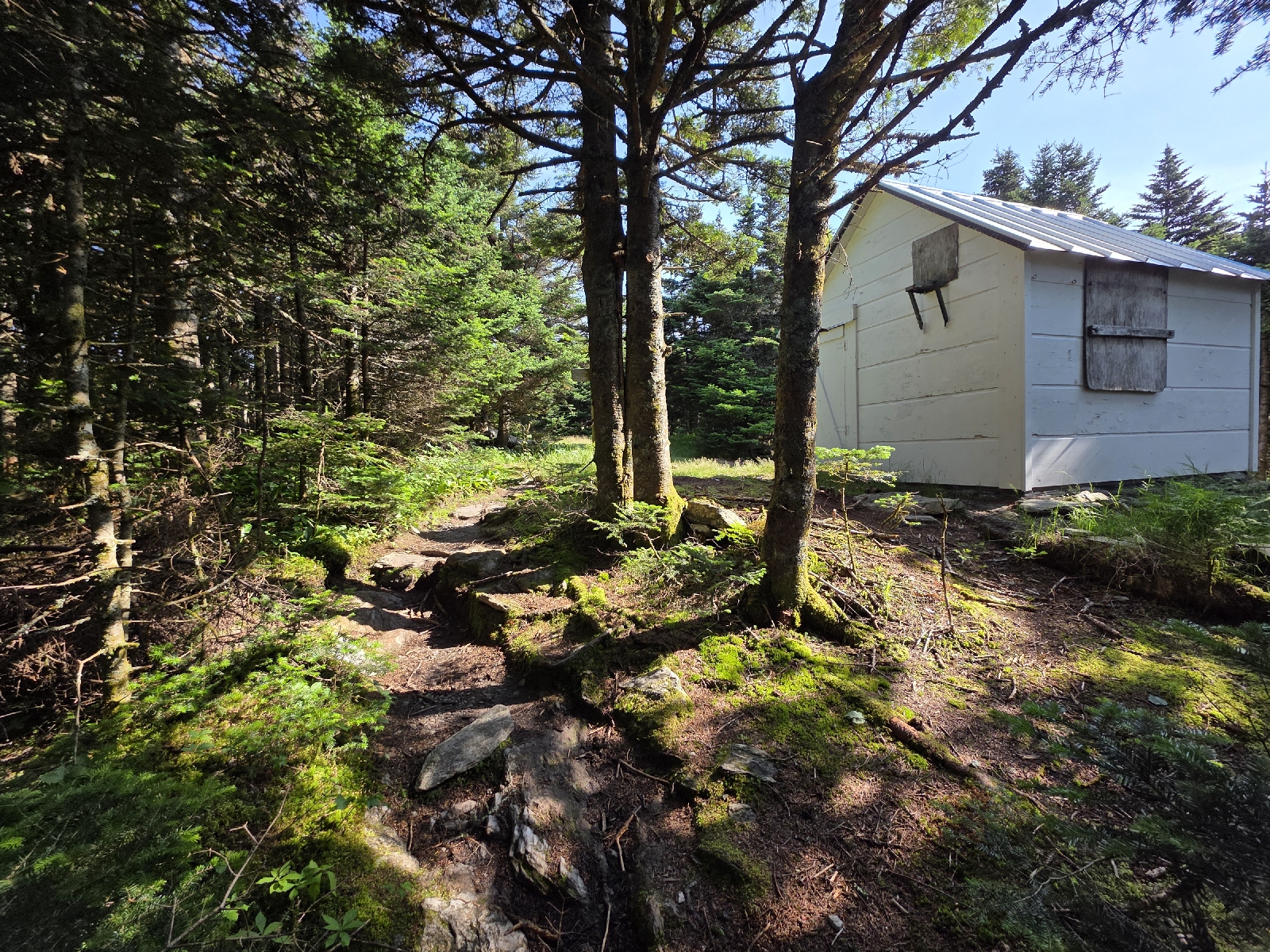
Almost immediately I pass the Big Branch Shelter. The shelter is perched over the river, but it's old and dark, and I'm thankful that it didn't rain and I was able to camp out in my beautiful spot.

The weather this morning is delightful, in low 70's with tolerable humidity. I am literally bouncing on the relatively flat trail for the next 1.5 miles, as I listen to music.  

The trail follows USFS Road 10 and crosses a bridge over the fast-moving Little Black Branch stream.  I remember this area from the last time I hiked this section, where, after a downpour the night before, Becky and I spread out the entire contents of our packs all over the parking area to dry in the sunlight. 

I turn my phone off airplane mode and I'm delighted to see that I have service as long as I stand in the middle of the bridge. I call home and talk to Rich, and then call my parents to talk with my aunt and uncle who are visiting. 

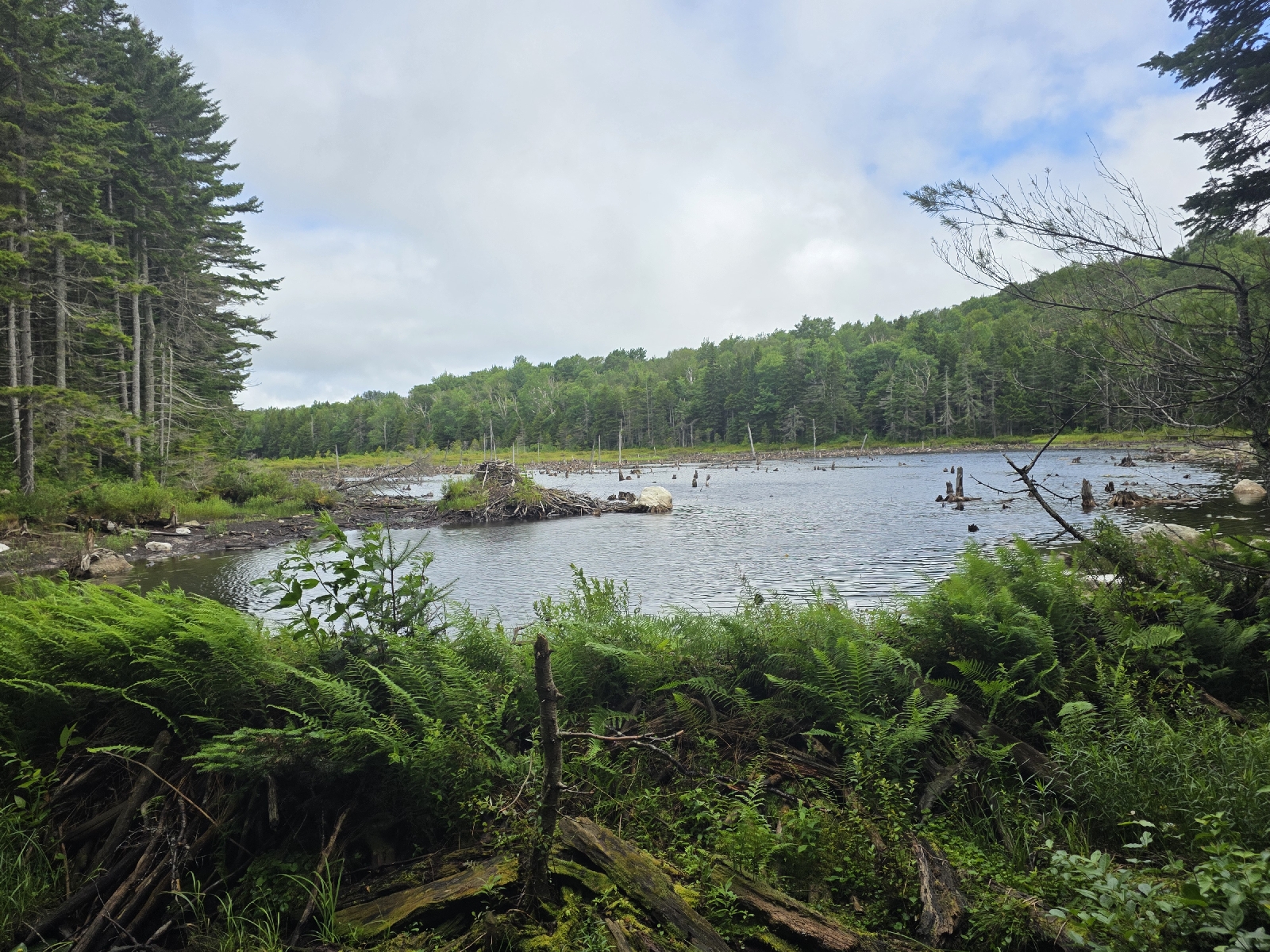
After reassuring everyone back home that I am alive and well,  I continue on the trail for lovely two miles of easy incline to Lottle Rock Pond. The pond, a very popular local destination, is dazzling in the morning light. 

The pond has beautiful campsites with a caretaker living on the premises, employed by the Green Mountain Club and the US Forest Service. I don't see any movement from their tent, so I turn down the volume on my music as I pass. Try as I might, I don't see any moose lingering around the pond.

The next four miles is a steady climb 1,000 feet up White Rock Mountain. The top of the mountain is studded with beautiful white rocks, of which many have been stacked artfully into tall cairns. I remember the last time we were here the cairns were so large and prolific they were almost obscene. 

The trail is delightfully soft underfoot it winds through a large spruce forest for the next mile. Just before starting a steep descent, I am greeted by the sight of another rock garden. The cairns have been a source of great debate in the hiking community, with some hikers feeling the need to deconstruct the unnatural stacks of rocks. 

The trail then loses 1,000 feet of elevation over the next mile as I drop to Bully Brook, where I stop to take in some small but pretty cascades and waterfalls.  I stop to filter water since this is the only water source for the next five miles that isn't right next to a road. I also indulge in a huge portion of trail mix, making it a lunch break.

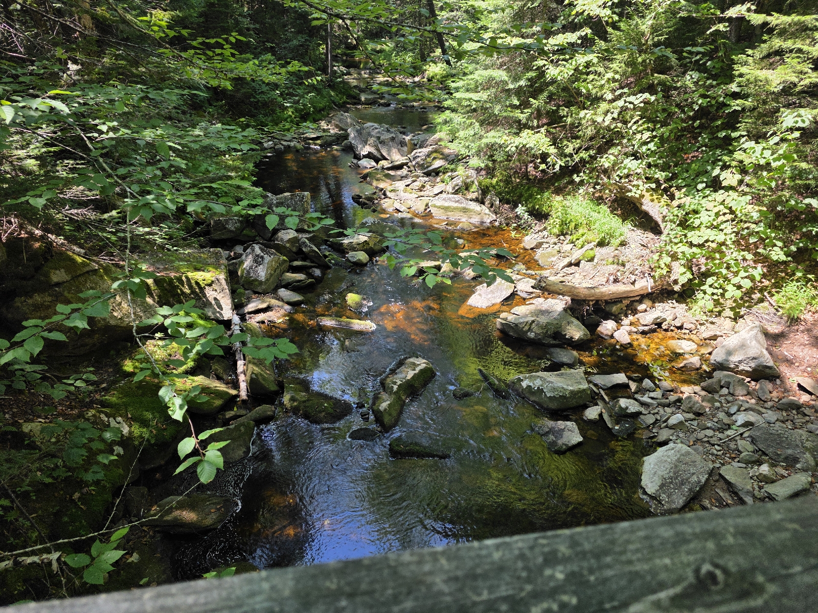
 The trail follows rolling hills for the next mile, when I cross Russell Road with another beautiful stream.  I take a quick picture but I really need to keep moving in order to make the miles that I would like to hike today.

Just past Russell Road, I crest a small hill approaching Vermont Rte 140 when I see the strangest thing ever on the trail. A sign warns of the vortex, and another sign behind it with a chime and a hammer attached saying to give the bell a good whack. The hammer is quite heavy and I do my best to give it a good whack as requested.  I'm holding my poles so I don't think I do a very good job,  but then the hammer bounces and actually rings quite loudly. I continue around a bend in the trail and come out at a parking lot with some wonderful trail magic.

I don't have time to take off my pack before two men are offering hot dogs and soda. I'm really bummed that I ate not too long ago and I request one hot dog and take a bag of chips and a Dr. Pepper.  Trail Magic is the only time I ever drink a sugary soda! Before I sit down a man offers to charge my electronics at a mibile charging station and I plug in my cell phone, thrilled for the top off.

I spend entirely too long enjoying the respite; almost 45 minutes. I had really planned on trying to go without stopping until I reach camp, so I'm going to be getting in late yet again!

I say goodbye , and I'm glad I didn't eat too much because the trail leads immediately uphill to gain 1,100 feet over the next two miles. I still manage to do a decent pace, probably energized by the food and the sugar.

When I start to come down the other side of the hill I pass the Minerva Hinchey Shelter. I can see someone sitting inside the shelter reading. I have hiked over 14 miles, and as much as I would like to, I can't afford to stop at this point because I still have four more miles to go to my intended destination and it's already 4:30 PM.

I climb 600 feet over the next ridge and the trail levels out for a little.  I'm relieved to be in flat ground, but I'm walking on a narrow path between thick stands of stinging nettle on both sides of the trail thigh high in places. I do manage to find some that hasn't yet flowered and I nibble on the leaves as I walk. I'm glad to see that the younger plants are still quite tender so I can add it back into my diet as a fresh vegetable source.

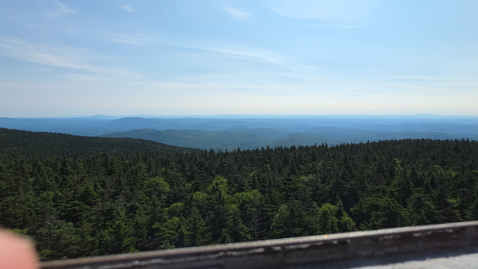
I go up another 500 feet to a nice  view that looks west to the Taconic Range of New York. A small airfield is nestled in the valley between me and the mountains. 

The climb down from the mountain is quite steep and slippery with pine needles, and it really slows me down. I've done 16 miles so far, and my legs are starting to feel a little bit like Jello.

At the bottom is the magnificent Clarendon Gorge. The trail crosses the gorge via a suspension bridge. The bridge swings unnervingly as I cross, with rapids crashing below. The water level is relatively low, but the chasm of rushing water is crazy beautiful,  nonetheless.

The trail then crosses Virginia Route 103, which takes me a few minutes to cross as cars are loterally whizzing by. The road to the right is on a curve, so when I see a clear spot I run across as fast as possible. 

I knew looking at the elevation profile that this next section was going to be steep but sheesh, it is a crazy rock scramble over a jumble of canted boulders.  I gain 400 feet of elevation in three tenths of a mile. Now my legs are really screaming!

15 minutes later I'm at the Clarendon shelter. I set up my camp behind the shelter, where there are seven or eight people congregated. I walk up to the shelter to sit and eat dinner in front of an impressive fire in the fire pit.

A woman looks at me and says "I know you!" I look at her thoughtfully; she looks familiar but I can't place where I met her. She says she met me in the Smokies. My first thought is she must be mistaken, since I haven't hiked the Smokies in a few years. But then she says her name is Croft and I remember her! Oh my gosh, I spent one of the worst nights of my life on trail at the Brown shelter with her, Kelly, and GG!

I can't believe that in all the places I could run into somebody that I met several years ago it would be at this shelter on this night!  Kelly and I even talked about that crazy night just recently, as it was trauma bonding at best. 

We were caught in a terrible rain which raged all afternoon and all night, dumping over three inches of rain. We made it to the Brown Shelter, which was absolutely disgusting, and where we sheltered from the rain crammed together like smelly sardines. Poor Croft got stuck camping outside of the shelter as there was absolutely no more room inside. The shelter had a huge hole in the middle to prevent porcupines from entering, but the smell made it obvious that past residents had used the hole as a urinal. 

We chat for a while. Croft is doing a section hike with her son and another woman and her son. She is planning on continuing solo after Killington.  I promise to stay and exchange numbers in the morning, as I am dead on my feet.

I say good night and on my hammock at 8:30 PM.

Today's Stats: 18.1 miles, 4,003 feet gain
Trail Stats: 1,692 miles, 329K feet gain


Appalachian Trail Day 142 - Route 11 to Big Branch River (Mile 1,658 to Mile 1,674)

I wake up a few minutes before my alarm went off and transferred all of my belongings downstairs so as not to wake Mama Turtle, who is still sleeping, as is everyone else in the house. 

I strip my bed, make coffee a cup of coffee in the Keurig, and I am on the road at 6:20 for the hour-long drive to Killington to meet Christine. 

Christine arrives at eight. Another hiker needed a ride from the same location this morning and we wait a little while for the other rider to arrive. I don't mind waiting, as Christine is funny and easy to talk with. Plus, I am just happy to have a ride back this morning. Flash pulls up shortly and loads his stuff up and we are on the road.

Flash is a very nice retired gentleman from New Jersey who is section hiking the trail. He plans on doing the next stretch back to his vehicle (55 miles) over the next five days.

Christine and I have a fun time chatting on the way back, and the trip goes fast. I realize that I forgot to refill my hand sanitizer in my toilet kit and I ask them if they mind if we stop somewhere so I can pick up some. As we pull into Manchester, Christine's phone rings. It's a hiker at the Hampton Inn in Manchester. He's looking for a ride back to the trail.  Flash and I don't mind: at this point what's an extra 10 minutes?

I run into Walgreens and pick up a large hand sanitizer so I can squeeze some into my smaller bottle and I leave the rest as a donation for Christine to keep in her vehicle.  We pick up EZ at the Hampton Inn and we are all at the trailhead and donning our packs at 10:30. I get a quick picture with Christine since this is probably the last time I will see her, although she reminds me that she will be slackpacking two ex-Marines through this next section over the next five days and she is here to help us out if any of us need anything.  She's such a wonderful person!

I settle into a comfortable hiking speed up the hill, and for a while I am following EZ, letting him pace as we gain elevation toward Bromley Peak. I stop for a pit break but catch up in a short time later when EZ stops to talk to a southbound hiker. 

The trail reaches a turn off to the Bromley Shelter.  I look at my map and realize this is our last reliable water for the next 8 miles. We both decide to take the blue-blazed trail to the shelter to top off our water.  The trip takes a little while, as the water source is a ways down a hill beside the shelter, which is lovely and open, unlike some of the dark and nasty shelters along the trail.

We hike together the rest of the way up to Bromley Peak.  The trail is steep in places, but not too difficult. For the last quarter of a mile we crest the mountain on a ski slope and emerge at the most amazing view! 

A huge fire tower is next to a Ski Patrol lodge. Flash is sitting in front of the building. He is surprised that we are behind him, but we explain that we had stop to get water at the last shelter.

I go into the ski patrol lodge which remains unlocked year round for hikers to seek shelter in bad weather. The outlets work and I plug in my phone to charge while I eat lunch.  I visit the privy In the woods across the ski slope, and then climb the fire tower to take advantage of the gorgeous 360-degree view.

After 20 minutes I say goodbye to everyone and continue north. The trail rapidly descends the heavily wooded mountain. The breeze is really chilly at times, and I hike fast to stay warm. 

The trail crosses Mad Tom Notch Road, a gravel forest road, before heading steeply uphill to Styles Peak. On the way up I meet two southbound thru hikers named Stinky and Turd. I kid you not. We talk enthusiastically for 10 minutes before I wish them happy trails.

At the top of Styles Peak is anther view. I take off my pack for a few minutes and EZ comes up to join me a few minutes later. We look at the FarOut and talk about our plans for the night. EZ is thinking about staying at the next shelter, but I tell him that I I'm going to try to get all the way down to the river, another seven miles from the shelter, and 10 miles from here. This will mean a long day tomorrow, but then I will be set up perfectly to summit Killington on Wednesday, where I would like to stay at the top so I can see a sunset that night and the sunrise Thursday morning.

EZ Says he wasn't intending on doing that many miles but it sounds like an awesome plan, so he may do the same. I say goodbye to hurry down the trail because it's already 3 P.M and I really don't want to hike in the dark. 

Three miles later I come to the Peru Peak Shelter. It's a lovely solid log cabin style shelter built by Civilian Conservation Corps in 1935. Bilbo and Frodo are here, and we talk about what an awesome place it is. There's a gorgeous stream roaring In front of the shelter. Bilbo says that Mile Marker left his toiletry bag, and he was planning on camping at the lake down the hill. I take it, hoping that I will not have to go searching for him because I don't have a lot of daylight left for the miles that I want to do.

I get to Griffith Lake, which is absolutely gorgeous, and walk towards the tent sites. Thankfully Mile Marker is in the first tent site that I come to. I give him his toiletry bag, and he didn't even realize he had left it.
My good deed accomplished, I get back on the trail. I make the next six miles to Big Branch River fairly easily, as I only have to climb about 500 feet after leaving the lake. 

I make it across the suspension bridge and find the hidden campsite described in the app by 7:30 PM. I set up my camp quickly and filter water to heat for dinner. As I finish eating the sky darkens rapidly and I am in my hammock At 8:45.

I can't believe I got as far as I did with the late start this morning on the trail, especially with the amount of time I spent relaxing on top of Bromley! I am exhausted and exhilarated at the same time.

Today's Stats: 17.6 miles, 3,419 feet gain
Trail Stats: 1,674 miles, 325K feet gain


Appalachian Trail Day 141 - Spruce Peak Shelter to Vermont Route 11 and the Green Mountain Hiker Hostel (Mile 1,655 to Mile 1,658)

I woke up at 5:00 and decided to have a chill morning. I surf social media for a little while. Chilling only lasts until 6:00 a.m. when I get up and get moving because I can't stop thinking about food. Today is a town day, and I'm dying for a good breakfast. 

The birds are an overdrive this morning, as if they know there are going to be thunderstorms this afternoon, so they need to get all their chatter out this morning while they can. Bird song accompanies me the entire way to the car at the next road crossing. The only other wildlife I see is a young buck taking a stroll on the trail,  just like me.

I am so glad that I did Stratton yesterday, with the fabulous weather. Today is super overcast and I know there would be no views for many of the mountains. I'm also glad to be doing a Nero despite my compunction yesterday to get more miles in today.

The hike from the shelter is very easy and obviously very short. I go up and down a series of small hills and have one very small hike uphill lasting only 350 feet of elevation gain.

I cross several small streams, the rocks covered with thick green moss, and have a couple small muddy areas, but nothing major to report.

I make it to my truck at 7:30 AM, and I am pleased to see everything is in order. I always have a moment of anxiety every time I leave my vehicle at a roadside trail parking area.

I Google "top-rated breakfast near me," and pick a spot called "Up For Breakfast," only 15 minutes away in Manchester. One of the beautiful things of hiking with so many ski resorts nearby Is the plethora of 5G cellular towers on top of the mountains. Like most of my trip through Vermont so far, I have excellent service. 

30 minutes later I am tucking into an amazing breakfast of Eggs Benedict, home fries, and a huge plate of homemade corned-beef hash.

I can't check into the hostel until noon,  so I have three hours to burn. Manchester is a very upscale town, with a very expensive grocery store. A quick search tells me that Bennington, 30 minutes to the south, has a Wal-Mart and Aldi, so I set off to Bennington. 

I get the supplies I am running low on, as well as lots of fresh fruit and salmon and shrimp for dinner tonight. I am in the mood for a home cooked meal.

I take a very slow ride on back roads and arrive at the hostel promptly at noon. Jeff, one of the owners,  meets me and gives me a tour and runs down the house rules.

The hostel will be bustling once the other guests arrives, so I shower, do laundry,  and explode my pack all over the room I will be sharing later. I sit in front of the TV and get caught up on current events while working on my blog.

Guests start arriving and by four the hostel is bustling with activity. I finish packing my pack for tomorrow's early start, then prepare the food I purchased earlier.

While I am cooking, a woman walks in. She looks familiar,  but is haggard and trail weary. She comes down a short time later and we talk. She says her name is Mama Turtle. Now I realize that I met her at the Eagle's Nest Shelter 400 miles ago in Pennsylvania,  when I stayed there with Kelly.  She Is a flip-flopper who was hiking with Tad and his daughters when they first started.

During our conversation it's readily apparent that she is emotionally spent. We talk about the mental challenges of the trail, and I share with her my downs of the last weeks, telling her that I scaled back my mileage in an effort to have more fun and make it seem less like work. I am now enjoying my experience so much more.

I eat most of the pound of shrimp while I prepare a dinner of a pound of salmon, a bag of spinach, a half-pound of mushrooms, four garlic cloves, two lemons, and an entire stick of butter served on angel hair pasta. I top the whole thing with several ounces of olive oil. 

I offer some to Mama Turtle and she accepts a small portion,  since she already purchased some food in town. She has decided to zero tomorrow and stay another night in the hostel tomorrow night. She says that she needs the break to try to fix her phone battery problems and rest. 

The rest of the evening, seven of us sit around the hostel table, and share stories of the trail. We laugh a lot and I love the camaraderie we share. Some of the hikers here are Sham-wow, Mile Marker, Bilbo, Frodo, and another hiker from Quebec doing the Long Trail.

At 8:45 PM, Mama Turtle and I retire to our shared room, where we talk a little more. She thanks me for lifting her spirits, and we exchange phone numbers, hoping to catch up further down the trail. 

I go to sleep soon after.

Today's Stats: 2.9 miles, 375 feet gain
Trail Stats: 1,658 miles, 322K feet gain


Appalachian Trail Day 140 - Kelley Stand Road to Spruce Peak Shelter (Mile 1,640 to Mile 1,655)

I wake a few minutes before five. The bunkroom was warm last night and we left the windows open, but it's now quite chilly and I have goosebumps!  I strip my bed and gathered my belongings as quietly as possible, moving everything out into the dining area to make some coffee. I brush my teeth and get dressed and I am on my way to Manchester at 5:30.

The sun is just starting to rise over the lower nearby ridges in the distance and the temperature gauge reads 46 degrees! Perfect camping weather!  I need to remember to grab my gloves for the chilly mornings ahead. 

I arrive at the Route 11 Appalachian Trailhead just outside of Manchester promptly at 6am, and Christine is waiting for me in her car. I grab my things and throw on my shoes, making sure everything is tucked away in my truck so as not to invite any thievery In my absence.

The drive to the Kelley Stand Trailhead takes about 45 minutes. We arrive at the trailhead and I am on the trail a few minutes before seven.

The trail is a very popular trail with locals and the trail is wide and easy to hike, although it's still quite rocky and rooty with mucky mud thrown in for good measure. I am obviously the first one up the trail this morning, as I web walk the entire way up the mountain. 

About two hours after I left Kelley Stand Road, and 1,780 feet of climbing, the trail emerges into a clearing on the top of the mountain. A locked caretakers cabin is just off the trail, with no caretakers in sight today. 25 yards further I reach the Stratton Mountain Fire Tower, an active tower that is open to the public.

I typically don't do fire towers. I'm not fond of heights, and the rickety steps terrify me. The last time I tried to climb one was in Smokey Mountain National Park, and I succeeded in climbing only two of the six flights before chickening out and descending. 

However today I am feeling exceptionally daring by my standards, and the steps look sturdy enough, so I drop my pack and place my phone in my waist pack to climb the five flights up to the top.  Unlike that tower in SMNP, this one has railings on both sides of the steps, and I make the ascent without difficulty, emerging into the four-foot sided square tower.

The tower landing is very narrow, with half the floor open onto the staircase. Many of the windows inside are broken out. I disturb several birds which are inside the tower, and they buzz my head, with one brushing my hair, before they make their escape out the broken windows. The wind is blowing through the empty windows, making an eerie whistling sound.

View from the tower is unbelievable.  I have a 360° view of the top of the lifts at Stratton Ski Resort and Bromley Mountain to the north, the Taconic range of New York to the west, Mt. Greylock to the south, and into New Hampshire to the northeast.

I carefully make my way down the steps and back to terra firma, where I  throw my pack back on to keep hiking. The trail descends 1,500 feet for the next three miles, when I see a sign for Stratton Pond.

I take a blue blazed side trail to the pond, which is worth the effort, as the pond is insanely gorgeous. The fifteen acre pond is the biggest one the Appalachian Trail in Vermont, and the blue sky is reflecting off the water, framed by the lush green of the surrounding woods. 

I take a seat on an empty canoe rest and just sit and enjoy the serene beauty of the pond. A stiff breeze is blowing from across the pond and the water laps the shoreline in front of me.  I am eating a snack when a loon blasts it's mournful wail nearby.

After a very leisurely 45 minute break, I leave the pond and continue my trek. The next two miles is rolling hills through beautiful yellow birch, ash, and beachwoods. 

I stop at the Winhall River, which looks like a big rocky stream for another snack break and to filter water. Eagle Eye and Speedy cross the bridge. They spent the night at The Stratton Resort and took the gondola back up to the mountain top. They are continuing on to camp on top of Mount Bromley. 

The next three miles are easy hiking and relatively level.  I keep on the lookout for moose and bear, both of which have been spotted here recently, but the only wildlife is chipmunks and birds.


The trail then follows a very rough forest road for over a mile until the trail veers uphill. I look at my map and realize Prospect Rock is of the trail to the left.  I walk through some hemlocks and see Speedy and Eagle Eye taking a break at the view,  which looks down on the town of Manchester below. Mount Equinox stands sentry on the other side of Manchester. Eagle Eye and Speedy say there are a bunch of scouts who are staying at the next shelter who just left the lookout.

I consult my map, and see that my truck is parked only 5 miles away. I could have slack-packed today's hike if only I had the foresight. I check my booking app, but there are zero hotels available within 50 miles that are less than $300 per night. Of course, it's a gorgeous Saturday in the mountains! I contact the Green Mountain Hostel where I have reservations for tomorrow night,  just in case they have a cancelation,  but they are booked. I guess I will have to stay in the woods tonight and have another Nero day tomorrow!

Two miles later,  I am walking down the blue-blazed side trail to the Spruce Peak Shelter. This shelter is one of the few enclosed shelters on the trail with four walls and a sliding barn door.  It even has an old wood stove to keep people warm in cold weather. 

There are indeed scouts and troop leaders here.  They explain that they are working on their beginner camping badges and will be camping in the tenting area and not in the shelter. I think it's wonderful,  and reassure the leaders that they won't bother me,  and I set up my hammock in some trees on the other side of their location. 

The kids are running around filtering water and setting up their tents while I boil water and hydrate my dinner. A leader and her son chat with me and ask me about hiking the trail. I overhear the boy excitedly tell the other hikers my name and that I'm hiking to Maine.

After dinner I am retiring to my camp and tying out my tarp when a leader walks up just to let me know that she'll keep the kids quiet tonight. I tell her it's really no bother and that I will have my earplugs in and hear absolutely nothing!

I am out before 8 PM.

Today's Stats: 15 miles, 2,612 feet gain
Trail Stats: 1,655 miles, 322 K feet gain


Appalachian Trail Day 139 - Kid Gore Shelter to Kelley Stand Road (Mile 1,632 to Mile 1,640)

I slept restlessly, but overall think I slept really well for the nine hours I was horizontal in my hammock. Unlike the last four days, I had zero cramps all night. My alarm goes off at 4:55, and I jump up, hoping to catch the beautiful sunrise in front of the shelter. Alas, all I am able to see was a glimpse of bright pink underneath the violet clouds that predominate the sky.  No sunrise view, but still an awe-inspiring sight.

I get packed up and grab my bear canister from the bear box. Lefty, Righty, and Awkward Silence are making coffee and eating breakfast, and Speedy and Eagle Eye are almost ready to hit the trail as I shoulder my pack to head out. My plan is to hike to the next road crossing and get a ride back to the Wicked Waystation for a Nero (near zero) day, so I have a little pep in my step. 

The trail is a little muddy from the rain last night, but not unmanageable. The ground has been so dry that it just sucked the water right up in many places, and the profusion of pine needles creates a carpet of sorts between the muck and my shoes. There's still a lot of rocks that are slippery, and every time the wind blows a fresh shower of water falls down to the ground, so I tred very carefully. 

The trail is undulating up and down and around and over rocks. Several trees are down in the middle of the trail and create a little bit of a maze.  A couple miles into my hike I realize that I'm having a lot of fun today. My malaise of the last several days has abated, and I'm actually enjoying the trail again, looking for an adventure instead of dreading the unknown.

Part of the explanation for my shift in mood is the cooler temperature . I am two miles from the trail when I decide to take off my pack and put on my Alpha fleece; I am that chilly. 

Righty and Awkward Silence catch up while I am stopped, and I follow behind them for a short time, until Awkward Silence gets enough of being caught between our conversation and begs off, leaving Righty and me to chat for the next couple of miles to Story Spring Shelter. On the way we pass the most impressive beaver bog I have ever seen, with the dead tree stumps testament to the landscape-changing power of the beavers. I believe that the Army Corps of Engineers has nothing on a couple of beavers.

When we arrive at Story Spring Shelter, I arrange for a shuttle from Sloth to meet me at the next road crossing. I then visit the privy (dark and scary but I leave the door wide open), eat a snack, and filter water from the spring behind the shelter, before saying goodbye to my recent hiking partners. 

A couple miles from the shelter, as I near yet another scenic beaver bog,  I see moose tracks In the mud In the middle of the trail! Two sets; one large and another much smaller. Now I am on a mission to see a moose, and I keep my eyes peeled for the huge forest denizens.

I don't see any moose, but the trail is beautiful nonetheless. The remainder of the hike is quite easy, and I arrive at Kelley Stand Road by noon. 

Sloth is in the parking area and waves to me as I approach. Nearby I see Speedy and Eagle Eye enjoying some trail magic provided by a gentleman who has a small pull behind trailer attached to his car. They ar sitting on camp chairs, readying themselves for the hike up to Stratton Mountain where they will take the ski lift down to the resort where they're staying for the night.

We exchange goodbyes as Sloth drives me to Wicked Waystation,  where I will stay for the night. When he drops me off he refuses payment for the shuttle,  saying he lives right down the street.  I thank him profusely and head inside to clean up.

I now have all afternoon free to explore. Stratton Mountain is very close by. I will be hiking over the mountain tomorrow, and the resort offers free transportation down the mountain to the village via the gondola, but it doesn't open until 10 AM. I was hoping to be well over and down the mountain by then,  but I have serious FOMO about exploring Stratton.  So I decide to take the truck over and check itBlog,

I take the gondola ride up to the top of Stratton Mountain and walk around for a few minutes before heading back down. In the village, I order a Stella Artois and some nachos with steak birria and dig in. The weather is perfect,  and I hope this continues for a while!
I head back to the hostel where I get my backpack ready for tomorrow morning, work on my blog, and I am out by 7:45 PM.

Today's Stats: 8.3 miles, 1,191 feet gain
Trail Stats: 1,640 miles, 319K feet gain

Appalachian Trail Day 138 - Route 9 to Kid Gore Shelter (Mile 1,618 to Mile 1,632)

I wake up before my alarm and jump up so I can get packed.  I walk around on my swore feet gingerly, but thankfully I feel no evidence of the cramps that have plagued me for the last three days. I grab a one pound breakfast burrito from the freezer and pop it in the toaster oven to cook for an hour while I pack. I settle my tab via Venmo and head outside.

I'm sitting on the tailgate of my truck munching on the burrito when Sloth, the shuttle driver, pulls up a few minutes before 7 and we are off. Sloth is affable and easy to talk to, and the 45 minute ride back to Rte. 9 passes quickly.  When we arrive at the trailhead,  he offers me a Gatorade. I drink half and pour the rest into my Talenti jar cup for later, and say goodbye.

The hike today is going to be a 10 mile grind up Glastonbury Mountain. I'm glad that huge breakfast burrito is sitting well as I leave the parking lot and cross the stream on a bridge to start my hike. 

The first couple of miles is steep but I feel really well - probably the best I've felt since getting sick, but I'm only minutes into my day. I try to pace myself and take slow steps up the incline, not wanting to burn out early like I did the last few days. 

After 0.7 miles the trail travels through a large split rock, called interestingly enough "Split Rock."  I'm glad to see it's not another pack-destroying Lemon Squeezer, and walk through. This is the flattest the trail has been since leaving the parking lot. 

I stop a mile later to filter water in front of the Melville Nauheim Shelter. A man and woman hike up together and we chat while we all filter water. When we exchange names, the woman says "Trash Panda! I've heard of you!" A hiker I met last week named Gravity, who is from Switzerland,  apparently got such a kick out of my name that he has told other people about it. So far, the Europeans I meet tend to literally guffaw at my name. 

We talk briefly as we continue up the mountain,  but they quickly outpace me as we gain more elevation,  and I slow down to continue to conserve my energy.

Four hours later I am nearing the top of Glastenbury  Mountain. The hardwoods of the lower elevation has gradually shifted to spruce and fir trees.  I am enjoying the dark, quiet forest when I arrive at the Goddard Shelter. A woman is filtering water from the Spring pipe that runs alongside the shelter, and we talk animatedly.  Her name Crochet from Australia, and she started Sobo the first day the trail was open for the season, the same as Meal Mode.

So many hikers are now on the trail. I love it!  It brings a sense of comfort knowing I am not out here all by myself, as well as a sense of community; we are all our here trauma bonding in our own special way. 

I enjoy a break inside the shelter, actually welcoming the warm sunlight that filters through the trees,  as the air is appreciable cooler up here. A couple walks up with impressively-sized backpacks and sits down and we chat for a while. Her name is Speedy, and his is Eagle Eye. They are hiking from North Adams to Killington over eight days. 

I am uncertain what to do. I feel really good right now, and feel like it's too early to stop, but don't want to push myself into exhaustion. I'm looking at the FarOut comments and the next shelter - Kid Gore -  is reported to have a gorgeous sunrise in the mornings with the easterly facing view. It's only 4 miles away and another 700 ft of elevation gain, something I feel like I can easily do.

I say goodbye to the couple and continue on up to Glastonbury Peak . At the top is a fire tower still in service . Signs are liberally posted stating that it's closed, but the comments make it clear that hikers don't take closed signs at face value. Many hikers shimmy up the first 10 feet in order to climb to the top which is supposed to offer amazing views. I take them at their word and continue on. 

One thing notable about these woods, and in stark contrast to other woods I walked through thus far, is the lack of lusty birdsong. I hear occasional chirps and tweets but not nearly at the level that I am accustomed to. I do see lots of frogs jumping out of my way as I head up the trail.

I arrive at the Kid Gore shelter at 5 PM. No one else is here, so I have my pick of the campsites, but that's not saying much, because there aren't any decent sites to pick from. I do find a great hammock spot right behind the shelter and go to work setting up my camp. The trees are just the perfect size to fit my hammock and tarp. 

The view from the shelter is amazing. The sky is beautiful with thick white puffy clouds. I sit down to eat my dinner of freeze-dried sausage gravy and biscuits. I love having breakfast for dinner and I literally lick every last morsel from my bag. The couple that I met earlier at the Goddard Shelter arrives while I act like I'm a condemned person eating my final meal.

They set up and we are chatting under the edge of the shelter when it starts to rain. It's a light drizzle that quickly turns to a full-blown thunderstorm. I run to my tarp to make sure nothing is getting wet, as muddy runnels of water are pouring down the hill under my tarp. The wind is blowing so hard that I have to put out a couple more stakes to keep the tarp from collapsing into my hammock, and I have to adjust a few things that are under my tarp, but overall I weather the storm well.

I hear some other people walk into the shelter, and once the rain abates a little I walk back over to the shelter and see Righty! She looks a little shell shocked from the gale she just walked through. Lefty and Awkward Silence are close behind. I'm too exhausted to chat, and they look too weather beaten to talk so I say good night to everyone and retire to my camp.

I set my alarm for 4:55 so I don't miss the sunrise. I have yet to get an amazing sunrise or sunset since I've started the trail, and I am determined to do so! 

I put in my earplugs and pull my buff down over my eyes at 7:45 PM.

Today's Stats: 14 miles,  4,000 feet gain
Trail Stats: 1,632 miles, 318K feet gain