Nav Bar

About     ♦   Foraging     ♦   Backpacking     ♦   Trail Food    ♦   Wild@Home    ♦    Links    ♦   Demeter's Wild @ Home Store

Emergency Essentials/BePrepared

Appalachian Trail Day 6 -Low Gap Shelter to Unicoi Gap (miles 42.8 to 52.5)


Day 6: Low Gap Shelter to Unicoi Gap. We have 4 days of food but really need a rest day. We can call Lisa, the owner of Hostel Around the Bend, to pick us up at Unicoi Gap and spend the night at the hostel.

Blue Mountain Shelter is only a few miles before Unicoi, and an easy downhill all the way to the Gap. A young couple has obviously been living here. The two have piles of gear in the shelter, spread out in a way no one-night hiker would take liberties to do so. They are polite and kind to move some things out of the way so I can sit slightly out of the wicked wind. My face is chapped, and I am cold.

Made it to the Gap at 2:45, which is really good for us! Shower, laundry, a Brewery. Great day!! Total through day 6: 30,632' elevation gain, 63.1 miles! Still hitting our 10mile/ day goal!


We did 11.5 miles and 1785', but it felt so much better! We are getting our trail legs

Trail Days 2022 - Damascus, VA

We are back on the trail!  Trail Days in Damascus yesterday, with the obligatory dance around the bonfire, Bongo drums beating out ferverish rhythms while a flame dancer tosses his double flaming stick into the air and grabs it one handed then swirls it around his body.  No containers of alcohol are allowed, but that has not stopped the imbibing. Solo cups are everywhere and the smell of weed permeates the air.


Penny met a hiker she has been following on Youtube. New Shoes, harmed for his habit of burning through more shoes than anyone has seen on the trail, chronicles his story via a Youtube Vlog.

We circle the bonfire a couple times then head to our much quieter corner of the park for the night. Sleep is slow coming, as the drums can be heard until midnight.

The next morning we pack up. The shuttle driver we secured to drive us the 2.5 hours to Hiawassee has backed out at the last minute!!  Frantic, I scroll through my emails to find another.  Kate. I text her, explaining the situation.  Very last minute, but this getting desperate!  There are shuttle drivers aplenty, but they are always booked in advance. Finally Kate gets back to me with a hefty price. I jump on it!

We spend the morning checking out the vendors. Penny loves looking at the wares and chatting up the owners.  We make some minor purchases and put our names in for many of the raffles offering free, normally expensive gear.

We cover miles of ground walking from one side of the town to the other, returning to the camp to heat up one of our freeze dried meals to
save money for our shuttle.  We caught some cute Iittle pouches at the Gregory Pack giveaway. Headed over to main Street for the hiker parade. This is a tradition where hikers raid the local thrift store for the silliest clothes they can find. After they wear them for the weekend, the clothes are returned to the store to be resold to next years hikers. There are a lot of men in dresses, frilly blouses, and big
hats. The town residents started the tradition of soaking the stinky hikers with hoses and water guns in order to rid them of the stench of 400 miles of trail.

Appalachian Trail Day 5 - Neel's Gap to Low Gap Shelter (miles 31.3 to 42.8)

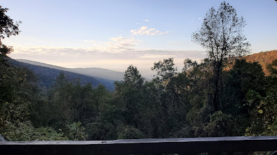
Sunrise at Neels Gap

Neels gap sunrise
The view from the balcony


Neels Gap
Lots of packs waiting to go on a hike


Day 5 of Amy and Penny's Amazing Appalachian Trail Adventure (A&P's AATA)!  We spent the night at Neel Gap after the most amazing shower and clean clothes! Because of our shower and spending spree we had to set up in the dark up the hill from Mountain Crossing store. We were able to charge our phones and batteries for the next 3-4 days of backpacking.

Appalachian Trail Day 4 - Woody Gap to Neel's Gap ( Mile 20.5 to 31.3)

We woke up from a lovely warm night's sleep and packed in the dark.  Woody Gap is a large parking area off a busy scenic highway running through Chattahoochee National Forest.  One benefit of the close proximity to a road is the pit toilet. The downfall of being so close is the noise. Normally, mornings along the Appalachian Trail are relatively quiet and relaxed.  This morning, however, car doors have been slamming, groups have been heading north for the last hour, and the occasional horn beeps to alert the departing hikers that their car door is indeed locked. Since further sleep is out of the question, we get up and break camp.  

The sun breaks over the ridge around 7:30 am, and we hit the trail with the sole intention of making it to Mountain Crossings before 5pm.  The Crossings is a full-service hostel and store directly on the trail. We can shower, wash clothes, and resupply without hitching into town.  We are almost out of food and fuel.  Penny really needs a new pack.  And we all really need shower and clean clothes. The thing is we have to hike 11 miles over Blood Mountain!

Preacher Rock
Preacher Rock, Georgia

Appalachian Trail Day 3 - Hawk Mountain Shelter to Woody Gap (Miles 8.1 to 20.5)

We are up and packing at sunrise, which is 7 am. The Hawk Mountain shelter area is on a ridge, with dappled sun shining through the sparsely leaved trees. The best alarm clock ever!  The sky is cloudy, the temp cool, and the wind, which howled through the night, continues to blow. Penny is the first one up and halfway packed. I pack quickly, moving fast to stay warm. Within 20 minutes I am ready to head down the trail, as the other hikers start emerging from their tents.  Woody Gap is 12.4 miles down the trail. 

Hawk Mountain Shelter
The sun cresting the ridge at Hawk Mountain

Appalachian Trail Day 2 - Springer Shelter to Hawk Mountain Shelter (Mile 0 to 8.1)

SPRINGER MOUNTAIN! We are at SPRINGER freaking mountain! The Start of the Appalachian Trail! 

Let me say first we are thrilled beyond belief to be here,  however the outdoor camping experience last night was less than ideal. Lightening, thunder, and wind-driven rain so hard that water splashes a foot up against the down quilt under the hammock.

Last night I was up almost every hour until 3:30 am. Then I passed out 2 whole hours. Nobody up at 5:30 am. Back to sleep. 6:30 am - Penny is up but she takes an hour longer than me to pack up. Back to sleep. 7:30 am, everyone else is up and I'm the last one out of bed! Everyone was sluggish and slow to start, probably because of the stormy weather until the wee hours. The only dry items in my camp are my clothes I wore to bed and my top quilt. 

But we are elated! We have officially started the Appalachian Trail! We are AT Backpackers! The elements tested us and we are worthy!! Time for coffee!! 

Springer Mountain shelter appalachian trail


But first, we must pee in the trees where the other campers won't see us, filter water from a stream that is little more than a mud-soaked trickle, put on yesterday's wet and very cold hiking clothes, and break camp. All of this takes about an hour. 

Amy and Penny's Amazing Appalachian Trail Adventure - Day 1 - Amicalola Falls State Park to Springer Mountain (Mile -8.1 to 0.2)

Penny and I had a wonderful pre-hike night at Hostel Around the Bend. After getting settled in our shared private room, we drove the 10 minutes into town for a burger and a brew at the aptly named Hiawassee Brew. The burgers were great, the beer even better.  

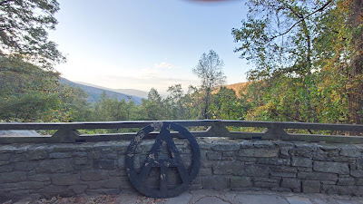
We were giddy with excitement for the start of our hike.  After a restless night of sleep, our shuttle arrived just as we finished loading our packs. Our driver, Frank, is a nice guy who gave us an informative drive of the area to Amicalola Falls State Park. We made a couple of stops (motrin and a replacement charging box for the phones) and arrived at the park around 11 am. We registered at the office, then took the obligatory pictures at the arch for the approach trail. 

Amicalola Falls State Park approach trail Georgia
The start of our approach trail in Amicalola Falls State Park, Georgia

The approach trail is 8.6 miles to Springer Mountain, which is the official start of the AT. One doesn't have to hike the approach trail - the option is to start at the Springer Mountain parking lot, which is about one mile north of the official start. Then one would have to hike south, spend a moment at the start, then backtrack the mile back north. Penny and I opted to get the whole experience by doing the extra 8.6 miles so we could look back at pictures and reminisce on our complete AT adventure. 

The trail started pleasantly enough. We ambled for all of one-quarter mile through woods on a gentle-sloped dirt path which paralleled the woods. Our amble quickly turned to a slog uphill on 675 wooden and stone steps. The weather was overcast and cloudy, and while the falls WERE beautiful, we joked about a better plan would have been to have Frank drive us to the park for a look and then to Springer for an easier start to the AT.  While we were suffering up the hill, all the other day hikers looked in wonder and amazement at the old ladies climbing up the hill with loaded packs. 

Appalachian Trail Section Hike
Amicolola Falls, Georgia

Penny had to stop and adjust her pack several times, as the pack was a recent purchase with a different suspension system than her other packs. The design was really cool, but she learned quickly that the pack was not going to work fully loaded for a multi-night backpack trip. We briefly visited the lodge at the top of the falls. We should have stayed here! The lobby is stunning! However, I hear the nightly rate is just as stunning, so maybe the hostel was better, after all! 

The lobby of Amicalola Falls Lodge

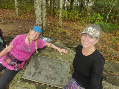
The sky turned ever more dark and cloudy, with a haze of fog turning to steady sprinkles for the next 5 miles. We followed the blue-blazed trail, climbing steadily to the Springer, excitement mounting. Finally, after 3,000 feet of elevation gain, and soaked to the bone, we crest a hill. Wait! The blazes ran out! We took a few minutes of scratching our heads before we realized we made it to the top! I was expecting lots of people milling about a small bald, appreciating the views of the distant valleys, however I as a little downtrodden to see a plaque set into the rock in a wooded copse. However, we celebrated the moment with a picture and entry into the logbook. 

The Southern Terminus of the Appalachian Trail, Springer Mountain, Georgia


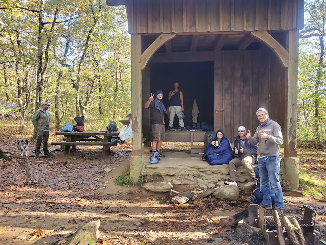
We continued the 0.2 miles to the Springer shelter. The shelters are curious respites from the vagaries of the trail, usually consisting of three sides, open to the elements but a shelter nonetheless. Most shelters also have a fire pit, water source (spring or stream), a privy set away from the water source, and picnic table. Other campers were already set up in and behind the shelter. Penny and I set up camp, then hung out in the shelter proper with the other 10 or so hikers which were in resident that night.  Some of the campers had been there 2 nights, making it a weekend. We enjoyed a roaring fire while eating our freeze-dried dinners and some campfire conversation until 9 pm, when the skies opened up. The rain and wind were amazing! 40 mph winds whipped the mountain all night, coming in sideways under the tarp. 

The Southern Terminus of the Appalachian Trail, Springer Mountain, Georgia
Springer Mountain Shelter the day after the deluge


Sign up to follow along as Penny and I continue our adventure!

Todays stats: 8.8 miles, 3117' elevation gain