

Dad drives me an hour back to East B Hill Road and I am hiking up the trail at 8 A.M.
The trail starts immediately uphill, but the elevation profile doesn't look too bad for the first part of the hike this morning. I will climb 2,400 feet over the next four miles, so a fairly mellow hike compared to what I've been doing the last couple weeks. I will then do another 1,000 feet over the second half of the hike.
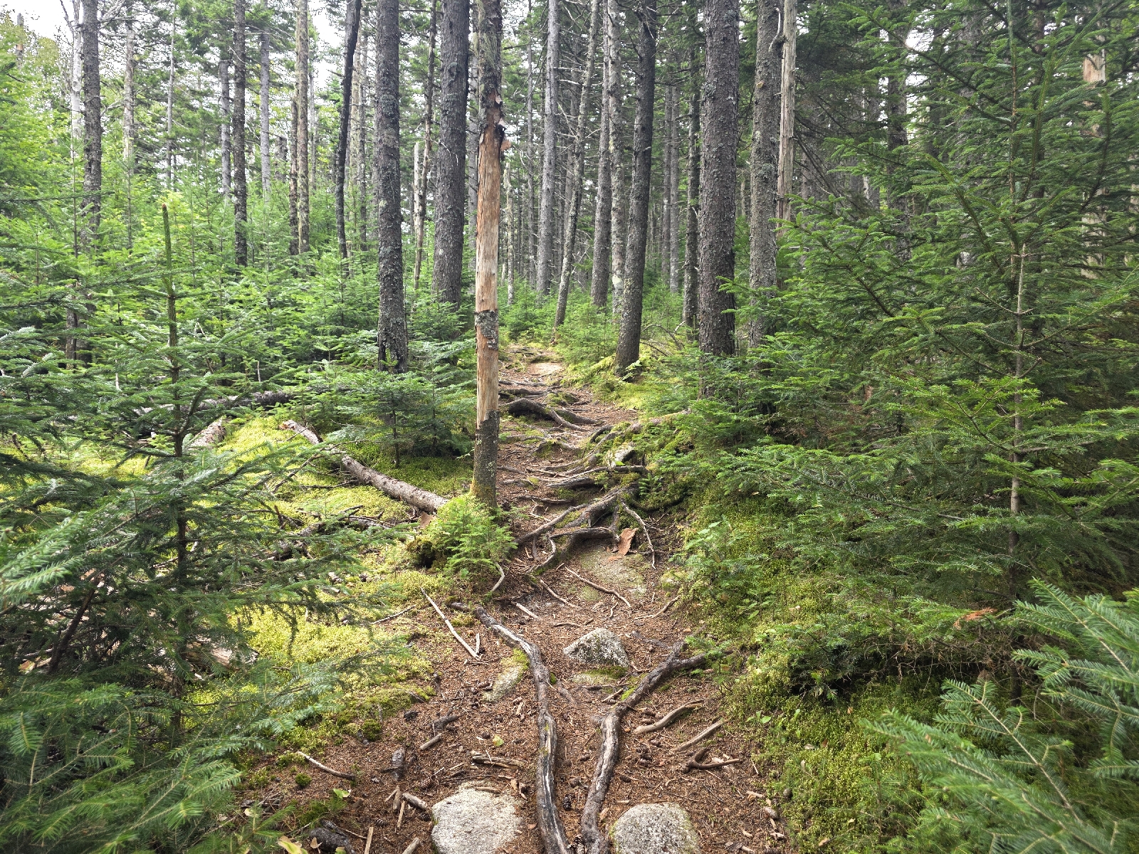
The trail is a dirt path, which makes me giddy with happiness. Of course, there's a lot of roots, but I think this is just going to be par for the course in Maine. I have to watch out for these roots because my toes get stuck and I almost trip in spots. I have to learn to pick my feet up higher for the rest of the state so I don't face plant.
There are lots of piles of moose scat on the trail but most of them are look pretty old and dried One of these days hopefully I'll see one. As I'm climbing up the hill southbounder heads towards me. His name is Jonesy. He thinks he is way behind other Sobos, but I let him know that he's not far behind many of his fellow hikers. This is definitely a late start group who are just now getting through Maine. It's cold getting cold and they will have some winter weather to contend with soon.
The trail goes up for about 800 feet over the next mile and a half on fairly easy inclines and comes to Surplus Pond. I look for a moose but I don't see any. I'm really going to have to try to camp next to pond while I am in Maine to try to see one.

The trail leaves the pond rather abruptly and then crosses Surplus Pond Road before heading uphill once again. The woods change quickly from predominantly hardwoods of beach and birch to spruce, which is so thick that the trees thankfully blocks the wind. Along the way I start seeing pile after pile of moose dung, and some of them look pretty fresh.
Occasionally I can make out a game trail and see more fresh piles. Unfortunately the only wildlife that I see other than chipmunks and squirrels are grouse, that I disturb as I hike through the woods. I jump when several grouse launch into the air from the thick undergrowth.
After five miles and 1,800 feet of relatively easy climbing, I crest Wyman Mountain. The summit is wooded, but just a short hike down is a nice view to the east of the Andover Valley to the distant Ellis Pond.

I'm getting hungry but decide to wait until the next shelter. I hike downhill from Wyman another 1.3 miles to the Hall Mountain Lean-to. While I am hiking I can hear someone hiking behind me, but they don't catch up until I reach the shelter.
I drop my pack and get it the ham sandwich and blueberries that Dad packed for me and sit next to the fire pit to eat. A man emerges from the trail and he sits on the shelter platform and we talk while eating. His name is Expendable. He hiked with his son, who needed to finish last week to get home for a new job. His son is much faster than he is and he let the son go ahead and he flipped up to the Hundred Mile Wilderness to summit with his son, then came back to Gorham to finish his hike.

We finish eating and leave at the same time. He steps aside to let me go first, saying that I was going fast up the hill to the shelter. I tell him to go ahead because I'm going to be a lot slower on the descent. I want to rest my knees and take it easy. I never thought that I would think going downhill was harder than going uphill until now.
I'm glad I let him go ahead because the next mile and a half is pretty steep in spots. The trail descends 1,500 feet, with some rocks but mostly dirt, which is loose and slippery on the steep Traverse.
At the bottom the trail crosses an old forest road and a wide, mostly dry stream bed. The stream is flowing though, and the water is clear and looks beautiful. I should have enough water in my bladder to last me through the rest of the hike, but I can't resist filtering some and drinking a half-liter of the fresh water. It's cold and refreshing.

From the stream the trail goes straight up a rocky climb where I gain 1,300 feet over a mile to the summit of Moody Mountain. Thankfully there are several rebar ladders attached to the rocks in the really steep sections.
At the top is a small and limited view of the same valley I saw from Wyman. I don't stop, as I am meeting Dad at the next road crossing, 2 miles and 1,000 feet down Moody Mountain.
I make good time on the descent and reach the road crossing at 2:30 p.m. Dad is entertaining two thru hikers, who are sitting in the grass behind his truck. He is given them snacks and sodas from the cooler, and is joking that he's giving them all of my food.

While I am packing my backpack with everything I will need for a night in the woods, nine more hikers show up. I am soon going through the truck finding snacks for all the new arrivals. The cold sodas are gone but I have some warm Frescas and the hikers take them gratefully. I also find an unopened box of Nutter Butter packs and pass them out. Dad sees how much everyone enjoys the sodas and snacks and puts them on his shopping list to keep on hand. I recognize one of the hikers. It's Planet Caravan! We hug in greeting and he says he fell behind due to a leg injury.

All the other hikers are waiting for shuttles to local hostels, but I plan on going back in the woods and trying to get a little farther up the trail to make tomorrow's hike a little easier. I have exchanged my summer quilt and sleeping pad for my heavier cold weather gear. I also top off my water because I will be dry camping tonight; the next water source is 5 miles away and I am definitely not going to make that until tomorrow morning.
I give Dad a hug goodbye and he takes off. I say goodbye to the hikers and shoulder my dreadfully heavy pack and head back uphill on the trail. The wind is howling and coming out of the north. I pass a likely campsite near a view, but it is really cold and windy here. The comments say there is another campsite a half mile up so I continue on hoping that it's more protected from the wind.

I hike a mile and gain 1,000 feet since leaving the road when the trail veers to the opposite side of the mountain. I come to a campsite in a mixed woods and I'm delighted to see that the wind is not nearly as bad in this location.
I drop my pack and set up my camp and eat dinner. It is now 7:15 as I write this and I am about ready for bed. I'm really thankful that I brought my colder weather gear because it is quite chilly with a breeze as the sun is setting behind the mountain.
Today's Stats: 11.5 miles, 4,416 feet gain
Trail Stats: 1,952 miles, 402K feet gain
Miles to Katahdin: 242
No comments :
Post a Comment