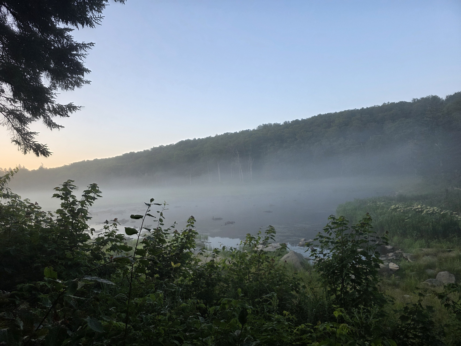
I woke at 5:30 and took my sweet time in camp packing, and I did not get on the trail till close to 7, which is very late for me. As much as I love camping near water, I don't love how damp everything is when I'm packing it up in the morning. On a bright note, the mist blanketing the pond is beautiful in the morning light.
The temperature is about the same as yesterday, and humid with no breeze. I prepare myself for another blistering hot day.
The hike starts out with the non-manicured, rough trail going over a hill for about 500 feet elevation gain over the next mile. After a couple miles the trail actually opens up Into something resembling woods and not an overgrown mess liked I hiked through yesterday. The only time there are views is when I pass a beaver bog, as the rest of the time the vegetation is so dense I can't see more than 50 feet in either direction.
About four miles into my hike the trail travels next to a large, beautiful rocky stream for a quarter mile. I stop and filter some water. The water is very warm and brown. This must be more bog runoff, but it's okay because it's water! I take a little break and look at the map. I have 25 miles remaining to get to the Wicked Waystation to resupply. It's going to be grueling today, but I have to be in town tomorrow evening because I will run out of food otherwise.
The hike continues along the ridge and after a couple miles I pass the Congdon Shelter, which is vacant at this time of day. The woods around the shelter are thick with lots of side trails and I get a little bit turned around and have to hunt for the AT, which ends up running behind the shelter.
The hike up hill from the shelter is really rock strewn and muddy; it looks like a creek bed. The mosquitoes are really thick and I pass a couple of men with bug nets who are complaining about how bad the bugs are. They asked me if the mosquitoes are better down the trail and I remark that they are slightly better but not much.
I take a break on the side of a forest road crossing to mix up and drink some electrolytes. I'm still sweating like crazy but I'm trying to stay on top of it today. My legs feel like lead weights! At least I'm not cramping very much at this point.
The trail emerges on to an amazingly beautiful opening on the ridgetop called Harmon Hill. I would say it's a bald, but there are still little stands of trees spotting the landscape. The mountainside is thick with waist high ferns in every direction. A view looks down on the valley to the west. I perch on a rock and enjoy the view For a little while. The stuff breeze feeling delightful and even giving me goosebumps.
I start down the mountain to the next pass. The trail becomes very steep and rocky, and while I am stepping down I'm noticing that my left hamstring is cramping. It starts as a little gnawing ache, but gets worse with each step. My body is revolting and needs more time to recover from my recent illness.
I sit down on a rock and consider my options. It's pretty obvious to me that at the rate I'm going I'm not going to make it to my next resupply point before I run out of food. Once I descend to the road and go up the other side there are no other road crossings for another 18 miles and about 6,000 feet of climbing. At this point it's really stupid for me to continue.
My only option is to get a ride at the next road crossing, but once I go down much further I won't have cell phone service. I can take my chances and get a hitch to Bennington, or I can try to get a shuttle back to Wicked Waystation where my truck is parked and I can resupply out of the route if food I have there. I consult FarOut and call a couple shuttle services, and finally get through to a taxi company out of Bennington that can take me back to the Wicked Waystation for $80. I arranged for the driver to meet me in an hour and a half, which is the earliest they can do.
The remainder of the hike down to Route 9 is knee punishing, with huge rock slabs forming steps down the steep mountainside. I am thankful for my hiking poles as I traverse the descent fairly easily. My hamstring which was giving me fits a little while ago has quieted, like a positive affirmation of my decision to get off the trail early.
At the bottom of the hill across the busy highway to the parking area. I have 45 minutes to burn so I walk down to the stream and take off my disgusting shoes and socks and soak my equally disgusting feet in the cool and clear water.
Two hours later I am back at the hostel. I have decided that I've come too far to give up, and hope that the way I'm feeling right now is just a setback. I'm going to take it easy through Vermont and if I only can do 10 miles a day then that's what I will have to do. When I run out of time I will be done hiking the trail whether or not I make it to Katahdin. I can do this.
Today's Stats: 9 measly miles, 1,200 feet gain
Trail Stats: 1,618 miles, 314K feet gain


No comments :
Post a Comment