I am doing a short shakedown hike this week before I set out in earnest next week. I have no work commitment for the summer, and my intention is to hike all the way to Maine, almost 1400 miles, before the mountain closes for the hiking season due to weather in September.
I haven't used my equipment in a long time, so I plan on a short section to make sure everything still works for me, and I have my gear dialed in for a months-long hike.
I dropped off my truck at the Tye River parking lot on the other side of Priest Mountain (mile 835), only 25 trail miles away. I had an extremely difficult time finding a shuttle, but after calling literally every single shuttle driver on every list I could find, I finally found someone to agree; there may have been a little begging involved on my part :-)
I didn't get on the trail until 4 pm, so I am not sure how many miles I can go tonight. Right out of the gate I have a 2,000-foot climb. The weather is pleasant enough: 75F degrees, overcast with a slight chance of rain this evening, but the clouds to the west look a little dark.
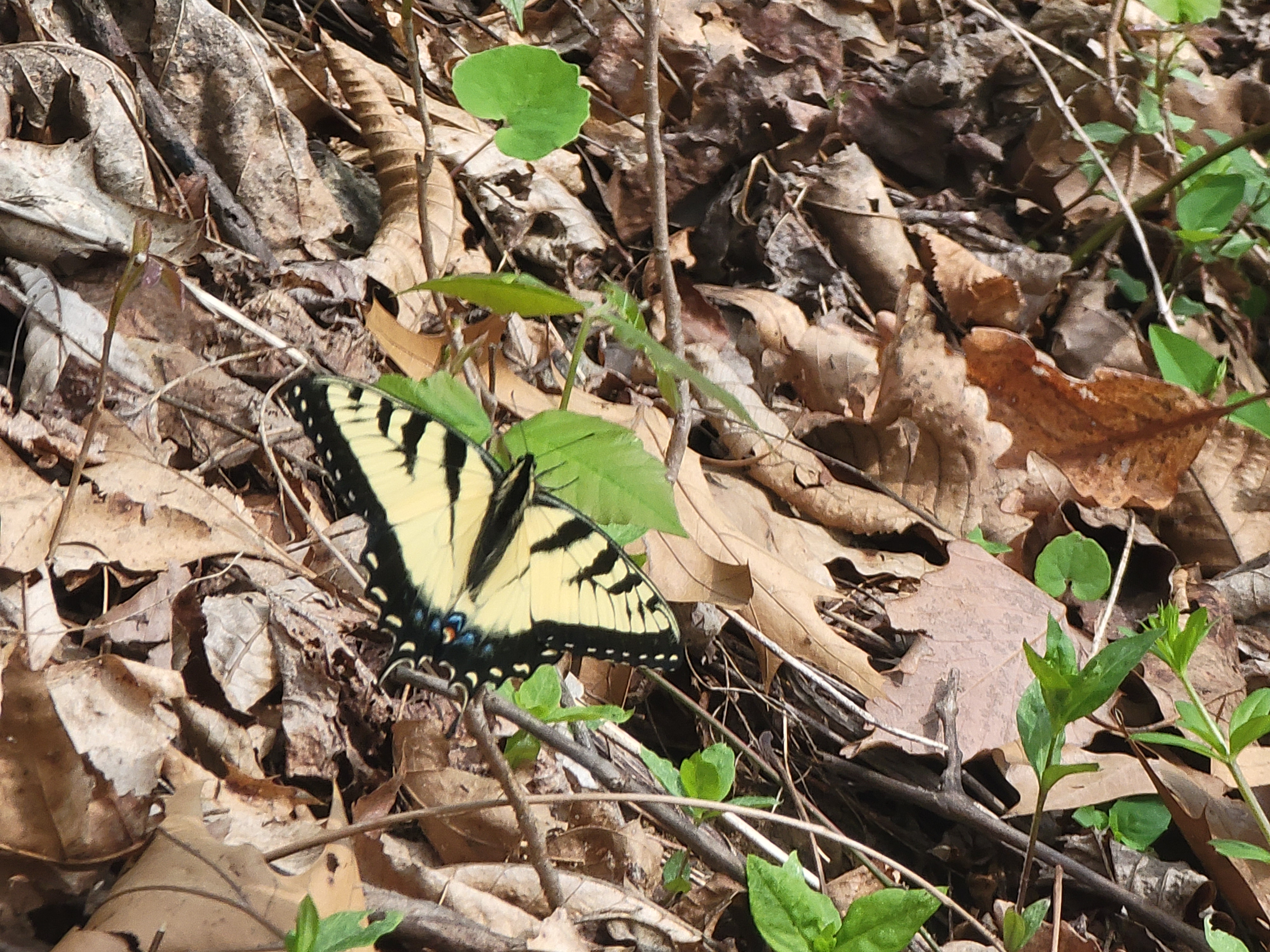
Almost as soon as I get on the trail, a swallowtail butterfly flies ahead of me for a distance. I take this as a good omen!
The climb is challenging, as they always are with a pack. I tried to stay in shape over my hiatus from the trail with regular 6-mile hikes at a local state park and weekly longer distance hikes of 10-12 miles. Unfortunately, I live in an area where the highest point in the county is the trash dump, so I can't really prepare physically for this trail. For me, the only way to train for backpacking is to backpack. I know the first two to three weeks will be rough, but every day will get easier.
After a little more than one and a half hours, I crest my first ridge of the hike. Bald knob is anything but bald. The woody summit offered few views. I take a short break to eat a snack and look at the map.
I cruise down to a saddle between Bald Knob and the next mountain and see a blue-blazed trail to the left; the turn off for Cow Camp Gap Shelter. I need to decide if I am going to walk down to the shelter for the night, where I can resupply my water. The comments on the FarOut app state the shelter is a long 0.6 miles off the trail.
The next water source is two and a half miles north and is 0.3 miles off the trail. I feel good and would prefer to get a little farther up the trail today, so I decide to push on, although I will probably have to hike in the dark.
I head up Cole Mountain and I am rewarded with views from a proper bald. A sign advises there is no camping allowed on the mountain, but even if I could, I wouldn't want to be up here with the rain that is in the forecast. The wind is already whipping, and I can see the sky is darkening to the southwest.
I pass over the first hump of Cole Mountain and encounter a large group of young adults hiking towards me. As I walk over the second hump, I see they have made a large camp of several tents. A down sleeping bag and piles of supplies are strewn between the tents. As I pass their camp, I can hear them hooting and hollering from behind. The rain is pelting them as they run headlong down from the first hump toward their shelter, trying to escape the rain. I don't want to say it serves them right for camping in a forbidden area, but...


I pull out my umbrella and reenter the trees as I descend. The rain is steady but not terribly heavy. The clouds and trees block the light and darkness falls quickly. I fish out my headlamp and pick my way carefully down the trail, which thankfully is relatively easy. I almost didn't bring my umbrella and grabbed it at the last minute. I am now so thankful I did!
I get to a forest road crossing and parking lot. A sign has directions with arrows, but I can't make out anything in the dim light. I don't consult my map because I don't want to risk getting my phone wet and I turn left down the forest road, thinking the spring was off the road. After about a half mile, I finally fished my phone out and realized the spring was right off the trail! Bonus miles once again. And in the rain and dark.

I rejoin the trail and turn north. I can see the illumination of a headlamp inside a tent just ahead, so this must be the right spot. I come to a sign pointing in the direction of the spring and follow the blue blazes down the hill. I pass two more tents as I walk downhill. At least I won't be camping out here alone.
I get to the stream but want to set up camp before I get water and cook dinner in case the rain gets heavier. I find a spot under some spruce trees and get set up fairly quickly for someone who hasn't done it in a while. It's now 9:30pm.
I filter water and I am getting really tired, and even consider skipping dinner, but I know I will probably wake up starving in the middle of the night. So, I rehydrate a freeze-dried meal and force myself to eat. By the time I eat and tuck into bed, it's almost 10:30 pm. I woke up at 5 am this morning, and I am wiped out. Goodnight.
Today's Stats: 6 miles, 2579' Ascent, 1000' Descent
Trail stats: 819 Miles, 186K' Ascent, 189K' Descent


No comments :
Post a Comment