

GG and I are both up at 6:30 am. My stuff is mostly packed, so other than dressing, and brushing my teeth, I only need to stuff my down quilts and sleeping clothes in my pack. I make some coffee in the kitchen and eat some breakfast.
My backpack feels ridiculously heavy from the fresh resupply. I now have five days of food in my pack. To compensate, I will carry a minimal amount of water to save some weight. Fortunately, water is relatively abundant on the next section.
 |
| Mountain Harbor Hostel |
I walk up to the Inn and make a peppermint cafe mocha and sit in a rocking chair on the porch, going through emails before breakfast. When we are called to breakfast, I am first in line and GG is second. My favorite dish this morning is a mushroom tart, made with the flakiest puff pastry and just the right balance of brie and gruyere. $15 for a breakfast this amazing is highway robbery.
GG, Kodiak, and I sit with Omen and Maybe and we laugh so hard over breakfast that my abdominal muscles feel the strain. This is going to be hard to once again say goodbye to friends we made, but I hope we see them again soon. Kermit eats a plate of food that is four inches high. I once again limit myself to one plate, but I did pile on the sausage gravy and biscuits... and the quiche... and the tomato salad. My plate may be three inches high.
GG, Kodiak, and I say farewell to Mountain Harbor and load up for the shuttle. GG and I get dropped off at FS 293, where we started yesterday. Kodiak started a couple miles closer to the hostel yesterday, at Walnut Mountain, so she will need to hike an additional three miles today. GG and I are off like a herd of turtles. We have to stop shortly after starting: GG to hit the ladies' room and I to adjust my pack.
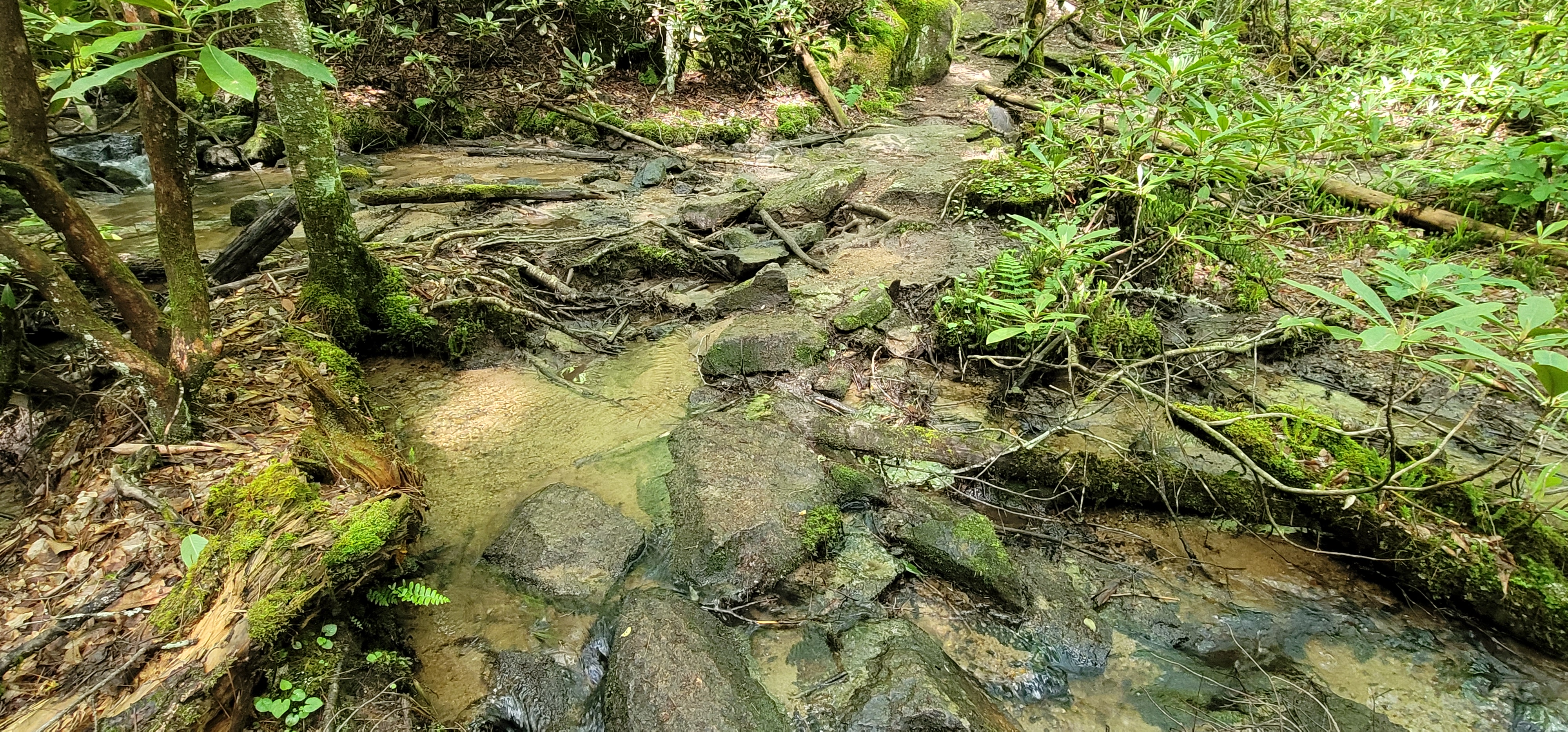
The next five miles are fairly easy; the trail ascends only 1,100 feet, with 700 feet of descent over a series of small hills, with each subsequent hill increasing slightly in elevation gain. There are a couple stream crossings, which are crossed by playing hopscotch on the small boulders. This isn't a smooth woodland trail, however: loose shale makes the trail slippery, and the rhododendron roots lay in wait, jumping up to snag the foot of the unsuspecting hiker.

I catch up to GG, Happy Feet, and Mayapple at the Moreland Gap Shelter. I decide to adjust my pack, since we have a 2,000-foot descent coming up and I don't want to take a tumble. The rain decided to make a brief appearance, and just as suddenly cleared and the sun peeked out behind the clouds. We continue our trek.
We are hiking west at this point. The trail doesn't run in a straight line; if it did, we would be significantly farther on our journey than mile 417. The driving distance from Springer Mountain, Georgia, to Mount Katahdin in Maine is 1,461 miles. Hiking between the two points on the AT, however, adds an additional 700 miles to the journey, usually by taking the hiker in a direction other than northeast. Since crossing Huges Gap four days ago, we have hiked a 35-mile, 270-degree semicircle: hiking east, then north, now west. I don't mind, since the Roan Highlands are beautiful to behold.


Yesterday, Kodiak showed me her Peak Finder app, and I am intrigued to try it out. I turn on mobile data and delighted to find we have 5G service. I download the app while enjoying the views. Once downloaded, I turn on my phone GPS and enable the app. I point the viewfinder toward the peaks, and the app shows the name of the surrounding mountains. I am looking right at Roan Mountain! I find it hard to believe we were up there three days ago! I love looking back at the trail already traveled: viewing the backs of the mountains we have climbed is so much more gratifying than looking at points on a map.


We turn to start our descent down the mountain, on the rocky trail which now turns north, taking us away from the Roan Highlands.
An hour later we pass by an old, rotted cabin near a field dotted with what looks like apple trees. There are small stagnant pools of water, but the area is quite idyllic, other than the parking lot which is visible through the trees.

We cross Dennis Cove Road where a sign to the left points to the famous Kincora hostel- owned by Bob Peoples, who is legendary on the trail for his years of service to the trail community. Kodiak is planning on staying here tonight. I'm surprised we haven't seen her since we left 293. I thought for sure she would blow past us.
Another sign points to the right for the Black Bear Resort "Full-Service Laundry, Pizza, and Beer!" We have been seeing sign for this place for quite some time. I hear it's lovely.
I would love to spend another night in a hostel enjoying the companionship of a big group of fellow hikers, but we need to go further than the 11 miles we hiked thus far. Across the road is a roaring stream on the other side of a large, flat pine-needle covered clearing with a large fire pit and downed logs for sitting. The area is picturesque, other than the numerous white trail lilies strewn about. Why do people think it's okay to leave their toilet paper out in the open? Gross.
We take off our packs and eat lunch. I am unapologetically predictable and eat a tortilla with salmon, mayo, and relish. I want nothing more than to take off my shoes and soak my aching feet in the cold water of the stream, but we need to get going or we will be walking in the dark, and GG does not like night hiking whatsoever.


The next mile we enter the popular Pond Mountain Wilderness. The pictures absolutely cannot do this beautiful place justice, and I later learn that this is considered one of the best scenic hikes of Cherokee National Forest. I swear we just hiked into the American version of Jurassic Park. Huge boulders covered in moss look like they just broke away from the hillside. Rhododendron grows in between cracks and crevices of fractured rock. The stream is thunderous in some places. We ascend up steps carved out of rock with the stream flowing swiftly away through a gorge.


A sign advises us that Laurel Fork shelter is only one mile away on a blue-blazed high-water trail. The Far-Out app comments, however, are grim. Reports of a large rodent nicknamed "Ratzilla," and several accounts of large spiders and even bats inhabiting the shelter deter us from wanting to stay anywhere near there.
We decide we will take our chances and camp on the trail when we find a nice spot, so we turn to the left to remain on the AT and follow the path down to the falls. I make a comment about how nice and easy the trail is, and we will be there in 20 minutes at this rate. Boy, did I speak too soon!
The trail down immediately turns steep and rocky, with steps of varying heights and depths carved out of the hillside and feels more like a rock scramble than a hike. If I didn't have hiking poles, I would certainly need to boot-scoot down this hill to save my knees. On the way down, a couple youngsters fly down the hill like we are standing still. Fortunately, the hike down is short, and we are soon rewarded with an incredible view of Laurel Falls.


The falls are a very popular hiking destination in this area. The falls, at 50 feet high, aren't the highest we have seen, but they are gorgeous. They are so loud that we take some pictures but then elect to continue down the trail to stop and admire the falls from a quieter distance. After a spell, we start to hike down the trail but then abruptly stop because we can't for the life of us figure out where the trail goes. The blazes appear to go straight in the water! Someone must be screwing with us! We walk up towards the rock wall only to stop and scratch our heads.
Thankfully, two youthful hikers come up from behind us and we allow them to pass so we can observe their moves. They walk to the left of the rocky promontory and disappear around it! Ahhh! Of course, we didn't walk close enough to the rock wall to see the trail continued around it. We inch along, because it looks perilously close to the rushing water. I now understand that the blue-blazed trail to the shelter is really a chicken exit.

 |
| I see a blaze on the tree, but where is the trail? |
 |
| Letting the other hikers show us the way |
We make very little forward progress for the next ten minutes. GG tries to go under a rock outcropping and gets her pack stuck on the rock. I'm trying to keep her from pitching sideways into the water and laughing hysterically the entire time. One of the young men in front of us tries to help her but not sure how to do so. She ends up having to slide down on her stomach to crawl under.


We are back on a real trail and having a good laugh. The last mile has taken us over an hour! God help us when we get to the Mahoosic Notch in New Hampshire! We are strolling along parallel to the stream when a clearing appears on our right. This looks like home tonight! We quickly set up and eat dinner. We hang one of the worst yet best-intentioned bear hangs and fall asleep to the sound of the rushing water.

Today's stats: 13 Miles, 2400 feet ascent, 3400 feet descent
Trail Stats: 422 Miles, 99k feet gain
No comments :
Post a Comment