Nav Bar

About     ♦   Foraging     ♦   Backpacking     ♦   Trail Food    ♦   Wild@Home    ♦    Links    ♦   Demeter's Wild @ Home Store

Emergency Essentials/BePrepared

Appalachian Trail day 176 - Caratunk, Maine to Pleasant Pond Lean-to (Mile 2,047 to Mile 2,052)

I thought I would sleep in this morning since I didn't go to bed until a little late last night, but I woke up around 4:30 and couldn't go back to sleep. My mind keeps returning to thinking about the food that I should pack, of all things. Finally I give up on sleep and decide to get up and start packing. Based on Maslow's "Hierarchy of Needs," my need for food obviously predisposes my need for sleep!

Around 6:30 Dad comes over and taps on the door. By this point I am 85 percent packed and I've uploaded a couple more blog posts. A short time later I am ready to go and we are at the trailhead by 7:30. I give Dad a hug goodbye and wave as he leaves the parking. 

A shuttle from the Sterling Inn, a mile down the road, has dropped off three hikers and then pulls up to drop off three more. I recognize a couple of them, who I have passed off and on for the last week. They are planning to get from here to Monson in two days. I, on the other hand, have set a very low expectation for my hike to Monson, planning on arriving in four.

My goal today is to walk a whopping six miles to the next shelter before the rain starts. I didn't want to sit in the hotel room and do a zero day today, although it would be much more comfortable than a mouse-infested shelter. I do want to keep making a little bit of progress and six miles will be a Nero day, then I only have to do 10 miles per day to reach Monson.

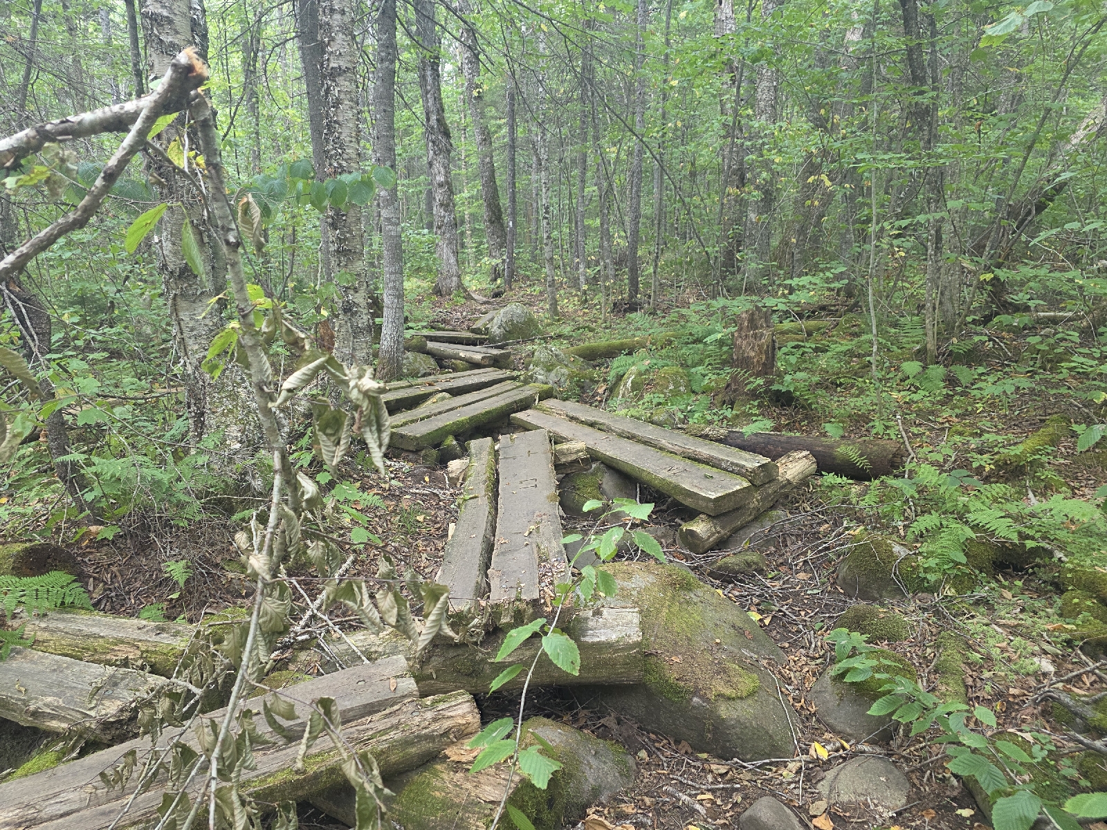
The trail starts out on a gradual incline after the initial steep uphill from the parking lot. I walk at a steady slow pace kust enjoying the walk in the woods.  My clothes are clean, and I am freshly showered, and there's no need to break a sweat today since I don't have far to go.

The sky is very overcast and gloomy and a few times when the wind rustles through the trees overhead I think the rain is starting, but it's just breezy. The weather report is calling for periods of heavy rain starting around noon today, and this area could receive over an inch in the next 24 hours. It seems that whenever there's heavy rain a shelter is never convenient, and since this is the one time that it is available, I'm going to take advantage of it!

The trail continues gradually up for about a mile and a half through beautiful mixed woods turning yellow with freshly fallen leaves carpeting the woods. I listen to an audiobook, getting lost in the story, and enjoying this lovely stretch of trail.

After too short of an easy hike, he trail descends sharply to a really beautiful stream that's flowing nicely. I can hear the water gurgling and cascading and it's so peaceful, with little pools that would be lovely to wade in were it warmer.

As I'm walking along the stream I pass a man coming from the opposite direction. He has a very full pack and when he steps off the trail we stop and chat. I ask if he's a thru hiker and he rests hisbhand on his stomach and asks if he looks like a hiker with a gut this size.  I laugh and he explains that his friend started from Harper's Ferry in early May. He says he is from the area and met up with a friend to hike with him for a couple of days, he says his friend is extremely slow and I do the math. It's a little over 1,000 miles from Harper's Ferry to here, so that means his friend is slower than me! I love to know that I'm not the slowest hiker out here. 

We say goodbye and I continue meandering upstream along the bank of Holly Stream. A light breeze is blowing and the clouds part to allow dappled sunlight through the trees. The weather right now is absolutely glorious, and I worry that maybe I will sit in this shelter on a beautiful day waiting for a rain that may not appear until much later than expected, but at this point it is what it is.

The Pleasant Pond Lean-to is definitely not fancy; it's small and an older shelter, but as long as the roof doesn't leak or I'm not stuck inside with Homeless Herman to keep me company,  I will be very comfortable here. The water source is near the shelter and actually flowing, and a brand new privy is nearby. 

I walk the two-tenths of a mile down to the pond, and it's quite big; more like a lake. The waves are lapping furiously at the small pebble beach, whipped by the wind. Houses, some with piers, are lining the shoreline. The comments on FarOut mention that the music can get rather loud on the weekends, and with Labor Day fast approaching,  I hope that isn't the case tonight. 

I have one bar of cell service if I stand right on the edge of the lake. I can't make a phone call, but it will let me send a text, so I text home that I made it to camp, before returning to the shelter. 

An hour later, while I am reading, I hear the slow roll of thunder, and it sounds rather close. Within 20 minutes the rain starts and it turns from shower to torrential downpour quickly. Water is pouring off the shelter roof in sheets, and the pings of hail on the tin roof are unmistakable. I look out and can see small balls of hail bouncing in front of the shelter, while thunderclaps roll overhead.  Right now I am very happy with my decision to hunker down early, because if I continued I would most certainly be in this mess while on the mountain top.

A hiker comes around the corner of the shelter in his rain gear. I move my things to one side while he takes off his pack and rain gear. He is hiking southbound and just coming down the mountain when the rain hit. He said the descent was rough, but he didn't get any hail, at least. 

We make and eat our dinner, and he is out early, by 6:30 p.m.. I am reading and playing games, trying to make it to 7:30 so I'm not up at 4 tomorrow morning. I end up going to sleep at 8 p.m..

Today's Stats: 5.6 miles, 1,100 feet gain
Trail Stats: 2,052 miles, 413K feet gain
Miles to Katahdin: 143

Appalachian Trail Day 175 - East Carry Pond Campsite to Caratunk, Maine (Mile 2,037 to Mile 2,047)

I slept incredibly well last night; I was asleep within minutes of my head hitting the pillow. I started waking around 4:00 a.m. but it was able to drift back to sleep until I finally get up at 5:20.

I stretch and walk to the pond to see if there are any moose, which there aren't of course, but it was worth a try. The air is chilly but the sky is clear and it looks like it will be a beautiful day.

My main objective today is to get to Harrison's Pierce Pond Camp, a lodge that is friendly to hikers and famed for its huge blueberry pancake breakfasts. If I want to indulge in the breakfast tomorrow I have to reserve a spot today. There's a limited number of spots, but because of my extra miles yesterday I should easily make it on the list because it's only six miles away.

I take my time packing up, wishing that I packed an extra breakfast for this morning.  I save time each morning by not eating a hot breakfast. Instead, I pre-mix protein powder, instant coffee, chia and flax seed that I can drink while I'm hiking. Then I realized that I remember that I have some instant coffee packets in the bear can. I also have honey, which isn't my sweetener of choice in my morning coffee, but I am in the wilderness after all! 

I sit in my hammock and heat the water and enjoy my first cup of hot coffee in camp in a year, other than the morning in Upper Goose Pond, and the time Carrot Cake shared some of his coffee with me at Captain Stash's house in Vermont.  I forgot how delightful it is to just sit and watch the woods wake up with a hot cup of coffee.

Energized by the hot coffee, I finish packing as the rising sun starts to take a little chill out of the air, and I am on the trail at 7 A.M..

The trail is pretty flat for the first couple miles and I make really good time, even with constantly having to step over and around roots and rocks, and walking through a bog. After three miles the trail starts to ascend slightly for what will be my only real elevation gain at one time today; a whopping 600 feet!

At the four mile mark I'm making such good time on this easy trail that I realize I could very easily make it to the Kennebec River crossing before the ferry shuts down at 2:00 p.m.. I would have to skip the Pierce Pond Lodge, but the idea of getting into town a day early and not having to worry about food is extremely appealing. I turn off airplane mode and I'm thrilled to see that I have one bar. I call Dad and let him know I think I can make it to Caratunk today.  He is going to move up my hotel reservation to tonight.

A short while later I am stopped on the side of the trail for a breakfast of anything left in my bear can. It looks like beef sticks and cheese along with a couple of sweet bell peppers for breakfast! While I'm finishing up Dad calls back and says he changed my reservation and asks if I would like to zero tomorrow and sit out the rain in the hotel room.

As appealing as it sounds, I'm eager to get done with this section and get to Monson so that I can be home in time for my birthday next week, and I'm dying to see my family. I haven't seen anyone except Dad for the last 3 weeks, so I pass on the zero tomorrow. There's a shelter only 6 miles from Caratunk where I can ride out the rain. I can Nero there and it'll give me a head start on the next day's hike.

I throw on my pack and hear two men coming up fast behind me. I'm surprised to see Doctor Silvercrotch and his silent sidekick.

"Good morning, Trash Panda," he says in greeting. Of course, Mr. Silent doesn't say anything word; actually, he doesn't even acknowledge my existence. Conversely, Dr. Silvercrotch is very amiable and the exact opposite. 

I'm surprised to see them; I thought they would be at the next shelter and eating the pancake breakfast this morning. Somehow they got behind me. They camped at West Carry Pond Shelter where I stopped yesterday afternoon. They motor on twice as fast as me, so I say farewell. I can't believe that I did three miles more than they did yesterday! 

The trail remains fairly easy the next mile, and I think at this rate, I will be at the Kennebec before noon. Just when I get in a comfortable pace, able to walk a normal stride, a hot mess of roots and rocks pop up, but I still make good time. 

I pass by and cross several dry stream beds, but there is one really nice spot where the water is still flowing. This would have been a beautiful spot to camp last night but there's no way I could have done 19 miles yesterday!  The good news is that because of the easier terrain, my knees and Achilles are recovering from the rough mountains of the last three weeks, they are less tender today and the least sore since entering the Whites.  I haven't even thought of taking ibuprofen today!

Six miles into my hike, the trail passes by the Pierce Pond Lean-to and I walk down to get a picture of the gorgeous pond. A boat is tied to a nearby dock, which must belong to the lodge.  This looks like a wonderful area for a picnic lunch, but not for me today. 

I get back onto the trail and a minute later I am at the bank of the Pierce Pond Stream, which is wider than most streams I've crossed without a bridge. There aren't any visible rocks to walk across, which means I will need to ford the stream. I don't have water shoes and the I can see some sharp rocky edges under the clear water. I debate on crossing in my hiking shoes,  but the thought of hiking in soaking wet shoes does not excite me. I check out the comments and realize I can take a blue-blazed trail that goes to Harrison's Lodge, where there is a bridge crossing the stream. I head in that direction and I'm so glad I did because I get a beautiful view of the cascades below the pond.

I am back on the A.T. only a quarter-mile later and then hike along the stream as it makes its way to join the Kennebec River three miles away. without a doubt this is one of my favorite stretches of trail so far on the entire A.T.. I absolutely walking along the cascades and through the thick spruce forest blanketed by a carpet of moss and ferns, even if the roots are a pain in the tush.

A mile later my love for this trail comes to a screeching halt. The roots and rocks get a little crazy and my pace is slowed way down for the next mile and a half.  The roots become so thick and twisted that I struggle to step flatly on anything,  and my Achilles starts nagging me with pain again. In addition, my left foot is bruised where I got it stuck between a couple rocks yesterday and the constant pounding on the sharp edges is really irritating the sole. 

I am getting close to the Kennebec and navigating a very steep and slippery dirt path when my phone rings. It's Dad and he's letting me know that he is on the far bank, waiting for me to cross. I let him know that I will be there shortly, thinking I still have a little ways to go. I'm surprised when as soon as I hang up I round a corner and see that I am on the river! 

Silvercrotch and his moody hiking buddy are crossing the river in the canoe with the ferry operator. The trip takes only a few minutes, and I barely have time to grab some cash from my pack for a tip before the ferryman is back to pick me up. He hands me a life vest and tells me I have to sign a release form before I can cross. I sign the form that says the ATC is not responsible if I die on the journey, and I don the life vest and help paddle across the river because of the wind. The trip is quick and smooth. The water looks deep even at these low levels and I can't imagine anyone wanting to cross in this chilly water. 

A few minutes later I am on the other side. Dad is Facetiming my mom, and she takes a screenshot of my arrival. I give Dad a hug and we go to Wolf's Lodge a few minutes away for lunch, where we met our friends Melissa and Pat a few days ago. We share chicken wings and I eat a monstrous cheesesteak sub and a ton of delicious hand cut fries. 

Absolutely stuffed to the seams, we head back to the hotel so I can shower and start to prepare for my next adventure tomorrow. A couple hours later I get a text message from Melissa saying that dad left his wallet at the restaurant. It's almost dinner time so we decide to eat there again once we drive back! 

We return to the hotel and I rub Voltaren on my aching feet and elevate my tired legs on a pile of pillows before turning in for the night. 

Today's Stats: 9.9 miles, 689 feet ascent
Trail Stats: 2,047 miles, 421K feet ascent
Miles to Katahdin: 147

Appalachian Trail Day 174 - Safford Notch Camp site to East Carry Pond (Mile 2,020 to Mile 2,037)

I slept surprisingly well given how chilly it was when I went to sleep. I had a couple of cold spots on my back but it was tolerable. The wind whipped all night in the tree canopy, but in this relatively sheltered location it wasn't a bother. 

I wake and start packing as quietly as possible, but the slope that I am camped on is so steep that I don't dare try to pack here, so I carry my things one by one to a more level area nearby and at 6 a.m. I am headed back to the trail.

I wait until I'm at the junction with the AT to change out of my clothes and pull out my morning snacks so I wouldn't wake anyone at camp. I look up and see the sun illuminating the rocky peak above, and it is glorious in the gloom of the spruce forest. I also take a minute to check out the hike for today.

The elevation profile for today's hike looks pretty easy. I will hike up to the last peak of the Bigelows to gain 1,000 feet over the next three miles, which is pretty tame.

The trail is rocky and very rooty in places but everything is going well until I am following the trail. There is a large deadfall tree spread across the trail and see that there is another path around the tree but then it dead ends. When I look at my GPS I realize that I'm off the trail but only by about 100 feet. I am trying to navigate back to the trail when I get a phone call from my Dad he's been watching my trek via my InReach and he wants to tell me that I'm off the trail! I'm thrilled that my parents are checking in on me during my hike! And I realize I forgot to put my phone into airplane mode to save the battery. 

The connection is poor and just then another hiker comes up from behind me, also off the trail. He is hiking with Dr. Silvercrotch who is on the right trail and they holler back and forth to each other, eventually getting both of us on the right path. I realize two things from this experience. One is that if I get off the trail I need to backtrack immediately so I don't get lost in the Maine wilderness,  and the second is that I really need to ask Dr. Silvercrotch how he got his Trail name.

Back on the trail I continue upward to the crest of Little Bigelow Mountain,  the last of the Bigelow peaks.  From here the trail goes downhill crossing some rocky ledges with gorgeous views of Carrabassett Valley and Flagstaff lake below, and in the distance I can see a large mountain. I pull out PeakFinder and see it's White Cap Mountain, which I will hike over at mile 2,125. Mount Katahdin is to the left, but I can't see it through the trees.

The descent is a little punishing on the knees as I lose 1,900 feet over the next three miles. Dad gives me his ETA to meet at East Flagstaff Road. So far he has not encountered any issues with his drive so I hope that's the case, because he tried another route yesterday but the access road crosses an Indian reservation and that route was closed to the public.

I arrive at Flagstaff Road at 11 am and there's no sign of Dad. The service is really spotty but I'm able to get one bar if I stand in the middle of the road. I can't reach him so I call home and talk to Mom.

She is finally able to get in touch with him.  The second road he tried is also gated and blocked. I feel terrible that he drove for hours and has to turn around, but I'm also really bummed about my food situation. By not meeting him for a resupply, the limited amount of food that I had packed for two days will have to last three and a half days. I guess now I'm going to have to ration what I brought.

The good news is that the harder hikes are over for now. From this point on Maine becomes much more mellow for the next 30 or so miles, though I'm sure it's still going to be challenging. I mean, it is the Appalachian Trail, after all!

Leaving the road, I am pleasantly surprised by the easy hike. If it weren't for the thick spruce trees and the occasional bog and mud walk, I would think that I was back in the Mid-Atlantic. The difference is that the trail here is full of roots but still a nice walk in the woods for a time. I have a 500 foot climb up a hill and I'm shocked to see that there aren't any rock climbs. If the trail is like this until Katahdin it will be cruising speed indeed. Maybe I can get back up to 15 miles a day!

Maybe my knees will heal; that's what I need. And for my Achilles to stop aching so much. A hiker comes up behind me. His name is Dig and he's from Tennessee. It ends up that he knows where I grew up. He's a little younger than me but we know all of the clubs that were open in the 90's. We spend the next half hour reminiscing. He remembers Captain Bilbo's, which was torn down long ago for riverfront condos, and he worked at Landry's at around the same time. We went to the same clubs like 616, Prince Mongo's Planet, and Newbies! 

We lunch by a stream. Rather he has a real lunch, heating water for a Mountain House meal while I filter water and eat a few snacks.  I'm not hungry but the thought of being hungry makes me want to dive into my bear can and eat everything inside. I'm bummed that it's fall here and not spring, otherwise I could find food on the trail other than digging up edible roots if I get hungry enough! 

After the lunch break we head up another hill. It's 750 feet to the top and easily graded. On the way up I stop for a pit break and Dig passes by. I wish bim good luck on his hike. He's going to try to make some rather big miles over the next week so he can get home before starting a new job In the middle of September.

I'm getting really tired by 4 PM when I arrive at West Carry Pond Lean-to.  It's next to a pond that's really a lake in size and it's a gorgeous location to camp. As I'm walking up I think I might just stay here tonight. When I arrive at the shelter however, there is a guy who is set up inside. He's wearing a buff over his lower face like a mask and a hoodie is pulled tight around his face, so that only his eyes are showing.  He's such a creeper that I sign the shelter logbook and carry on. He's probably harmless but there are a lot of people that come out here to hide from the law.  Later I look through the comments and see the hikers dubbed him "Homeless Herman," and he's been hanging out at shelters for the last month.

The next likely camping spot is near East Carry Pond, 3.5 miles away.  Thankfully I don't have any big inclines, because I am spent from the mountains of the last two weeks without a day off. 

I make it to East Carry Pond at 6 PM. There's a gorgeous sandy beach, and the water is crystal clear. I won't do any swimming here, however, because FarOut comments tell of a lot of leeches in the lake. 

The comments mention a campsite hidden in the trees just past the beach. When I go to check it out, there is a man setting up. Darn! I am striking out today! And it's a really cool campsite, to boot! 

I keep walking around the pond and come to some really high and narrow log bridges across some sharp boulders. I hold my breath when I walk across them because a couple are really unstable,  and I almost lose my balance in my tired legs.  

Thankfully I make it across without falling.  I've been working on my balance by only walking on bog bridge plank at a time, even when there are two of them, and I think it's the only thing that saved my bacon. 

I get to the point of the pond where the trail heads away from the pond and I check out a little path into the woods going away from the water. There's a really nice campsite in a spruce grove, and I drop my pack.  This is home for the night! 

I get set up and make my dinner with the last of my water. I go down to the pond and sit on a large rock next to the water to filter water and eat dinner. It's absolutely gorgeous and so serene. 

I head back to camp as the sun sets behind the trees, and I'm pleased to see that my camp is completely hidden from the trail.  

I'm tucked in my wooded retreat by 7:30 PM.

Today's Stats: 16.5 miles, 2,552 feet gain 
Trail Stats: 2,036 miles, 420K feet gain
Miles to Katahdin: 158

Appalachian Trail Day 173 - Maine Route 27 to Safford Notch Campsite (Mile 2,010 to Mile 2,020)

I had an awesome night's sleep last night, and wake up around 5. The lights are off in Dad's room so I don't disturb him. I start organizing my things and scrub the nasty Talenti jar and my spork, which I forgot to scrub the last time I was in town.

I get caught up on the news and drink some coffee in the process. I'm not planning on going very far today and I'm in the mood for a chill morning. So many times the town days turn into a crazy hurry to get back to the trail, but today I want this feeling of relaxation to continue. 

I hang my tarp which is still wet from yesterday's rain across the posts in front of the motel room. Hopefully nobody notices since it so early, and it shouldn't take too long for it to dry.

I've eaten quite a bit this morning, and at 8 I go to Dad's room to let him know that I am ready. He has another breakfast ready for me. There is no way I'm going to lose weight on this section with him pumping me full of food at every opportunity!

We drive an hour to Maine Route 27 where Dad picked me up yesterday.  On the way we can get some beautiful views of Sugarloaf and the Bigelows, which I will be climbing up today.

I wave goodbye to Dad and hit the trail at 9. The weather today is 70's in the valley, but right now it's in the 50's and a cool breeze is blowing, and it is chilly in the shade of the trees. 

The trail starts out relatively level with some easy ups for the first couple of miles. I pass a stream and decide to get a little more water for the hike up, since the next water source is in four miles and 2,000 feet climb up to the North Horn.

A short way up the trail I pass the 2,000 mile marker! At this point I'm actually at mile 2,013 so this was the 2,000 mile point at some time in the past. The trail length actually changes year by year because of reroutes. I take a celebratory picture since I was in fear of dying two days ago when I crossed this year's 2,000 mile point coming down Sugarloaf on the rocky screen slope.

The hike up the Bigelows is absolutely gorgeous. It is a little challenging in a couple spots, but I don't mind it at all. The spruce trees are tall and moss covers giant towering boulders. This is like a fairyland forest; very mystical and old. 

Just before reaching the first view today, I see a familiar face. His name is Rod Stewart and I met him about a month ago down the trail, bit neither of us can remember where. I'm think it's Vermont or lower New Hampshire. When at the view, I pull up PeakFinder and it shows that we can see the tip of Katahdin from here,  which is really incredible because it's 160 trail miles away!

I pull on my fleece hoodie because it is cold up here! Not far from the first view I come to another one that looks down into Horns Pond, and I can see people gathered on the edge of the pond, and people are swimming in it! Good gravy, it must be freezing!!

The trail descends towards the pond and at lean-to at least a dozen colleged-aged kids are in and around the shelter. They are part of a Tufts University orientation group camping out for the weekend, and they certainly seem to be enjoying themselves!

Immediately leaving the pond, I start up to the first of the five peaks comprising the Bigelows. The hike up the South Horn of Bigelow is really steep (633 feet over a half mile), and the wind is really blowing and cold. I consider stopping to put on a wind layer but decide against it until I get to the top because I don't want to get drenched in sweat. As I start descending I get a beautiful view of Saddleback and Sugarloaf Mountains, and see the North Peak of Bigelow which looks really tall from here.  

While descending, I hear a familiar voice with a distinct southern accent walking towards me. Around the corner I see Planet Caravan hiking with Rapunzel! They are doing a southbound slackpack, and I realize this will probably be the last time I see them because they're planning on an 18 mile day tomorrow, so they will be way ahead of me.

The climb up the third Bigelow Peak, West Peak, is a little challenging but after New Hampshire it's fairly easy. I think it's funny that before New Hampshire I would have thought this kind of a hike was nuts, but now it's just ho-hum and interesting. The wind is howling from the southwest and it's cold.

I summit the West Peak (4,145 feet altitude) and stunned by the views. I can just barely see Mount Washington to the south, and to the north I can see Mount Katahdin. I can also see some very dark clouds overhead. I don't think I'll get any rain but I need to get down off this mountain just in case.

I still have one more peak before heading off the high ridge. Avery Peak is lower than West Peak, at 4,088 feet altitude, and the hike up is much easier.

From here the campsite is only two miles away but almost 2,000 feet of knee-pounding descent. I only have one more mountain to hike this week and then it'll be flatter ground until the Hundred Mile Wilderness and Katahdin.  I hope my knees and my achilles heal once I finish all of this elevation change.

The dense spruce woods are getting really dark when I reach the turn off for the Safford Notch Campsite. The hike is really amazing; to reach it you have to go through woods filled with big boulders covered in moss and go through a cave! Thankfully it's nothing like Mahoosuc Notch and I don't have to take off my pack to crawl through it.

The campsite is spread over a wide distance with two streams at either end of the campsite. There are a ton of people here and I wander around looking for a nice suitable spot in the dimming light. I even pass by Rod Stewart, who says hi from his hammock. 

I finally wander towards the back spring, where I see the Madison tramily. They probably think I'm stalking them,  the way I show up after they are set up. I keep seeing the same through hikers over and over, which means we're all doing about the same mileage per day which makes me feel good about my efforts.

There's really no room here and I should probably go back to the other side of the campsite, but I am so tired and hungry and it's getting dark. I set up my hammock in probably the worst spot I've ever set up in my life; on the edge of a hill and next to a ton of small trees that will probably poke me all night, but I don't care at this point. The Bigelows really whooped me.

I get set up and by the time I eat and filter water the sun has set and it's 8:00. Everyone else is already tucked in their tent by the time I get in my hammock. I am out like a light in no time at all.

Today's Stats: 10.5 miles, 4,100 feet gain
Trail Stats: 2,020 miles, 417K feet gain
Miles to Katahdin: 174

Appalachian Trail Day 172 - Crocker Cirque Campsite to Maine Route 27 (Mile 2,002 to Mile 2,010)

I went to bed so freaking early last night that I was wide awake at 4:00 a.m. I stay for a while in my hammock listening to the pitter patter of raindrops. The rain started about 3:00 a.m., but it isn't heavy - just a steady sprinkle. 

I get up and start organizing my things and brush my teeth and get my food out for the morning. First Light is also awake and getting packed up. We are both as quiet as we possibly can be, trying not to disturb the sleeping hikers. The good thing about camping near young pups and being an early bird, is that they can sleep through World War III, so I don't think we'll disturb them much.

At 5:30 I leave the campsite by the light of my headlamp. I make a privy stop, thankful that I can't see around the privy in the dark, and since I'm not worried about getteing seen, I leave the door to the privy open while I do my business. 

I stop at the spring and fill up a cup of water for my morning electrolytes. First LIght passes me while I'm doing this and I wish him a good journey before heading up to Crocker Mountain. Soon there is enough ambient light that I put away my headlamp. 

Crocker is not a very difficult climb, but it is steep and rocky. I don't have to stop once to use my hands - I'm able to stay upright the entire time, which is a really nice change of pace for mountain climbing around here.

The trail traverses a narrow rock slide but the cairns and paint on the rocks are easy to see. The rain has stopped and I can see the clouds drifting across the mountain tops obscuring the summits.

As I near the crest of Crocker the wind picks up, so I put on my gloves and raincoat as a wind layer to guard against the chilly breeze and damp morning air.

The top of Crocker is mostly tree covered. I don't bother to take the little side trail to the view since there won't be anyone anyway with all the mist. The short spruce trees are shrouded in fog.

I descend down 500 ft and then up the next Crocker peak without much ado. I'm thrilled to not have to rock scramble this morning especially with the recent rainfall.

I go over the second Crocker peak and then start downhill.  The first 2 miles are steep, but thankfully the rocks aren't too slippery and I can find dirt to step around most of them. The next 2 miles are tedious; the ground is relatively level and it's on the edge of the hill and eroding, so I step carefully on the edge around a lot of big rocks but it's relatively flat.

I get a little complacent with this easy hike because the last mile down to Route 27 becomes decidedly steeper and rockier, and with the recent rain mixed with the falling leaves and the spruce needles coating the rocks, the trail is quite slippery.

Dad picks me up and we go to the hotel. I am in desperate need of a shower and he takes my clothes to launder them at the local laundromat. 

I get a text from a dear friend, Melissa, that her family is in Caratunk, finishing up their annual family vacation. I Google Map the address and find that it's only 20 minutes from my hotel!! 

Dad and I drive to the lodge and restaurant that is owned by her nephew.  We spend an hour with Pat, Melissa, and one of her daughters, and get to meet her extended family. Everyone congratulates me on making it this far and wishes me a happy hike. I am so thrilled that I get to spend some time with such wonderful people! 

Today's Stats: 7.4 miles, 1,939 feet gain
Trail Stats: 2,010 miles, 413K feet gain
Miles to Katahdin: 184

Appalachian Trail Day 171 - Sluice Brook Logging Road to Crocker Cirque Campsite (Mile 1,991 to Mile 2002)

Last night was blissfully quiet even with so many people camping in the same area. We are disbursed along the old road so it's not like we were right next to each other, but everyone was out at 7:30 and even with all the campers it was blissfully silent.

I woke a couple of times to water the leaves; not surprising because I was so thirsty when I got to camp that I chugged a liter of water, but I was easily able to fall back asleep and woke up at *surprise* 5:07 am!

I start packing up slowly, the light is very dim on this western facing slope of the mountain. At 5:30 a.m. I hear the alarm of the two men on the other side of me, and I know that's my cue to start really getting going. I finish packing and I am on the trail at 6:15, tiptoing around the tents on the edge of the trail. 

The trail starts uphill from the road but it's gradual and not rocky  The trail parallels Sluice Brook for most of the first mile, and it's absolutely beautiful with pools of water and small cascades. I'm sure that during periods of higher water it would be a fabulous place to hang out for a couple days.

By 8:30 I have already climbed 1,600 feet and hiked three miles! I have no views but I have good cell phone reception at the top of Lone Mountain (3,261 feet).  I call home and check in, standing in one spot so I don't lose cell phone service. Once I finish, I continue along the ridge another two miles until the turn off for the Poplar Ridge Lean-to, where there is a little spring on the edge of the trail.

I stop to pony up on water since there won't be another reliable water source for five miles. I also eat a heavy snack and drink some electrolytes. To do everything that I would like to do today, I'm going to need all the energy I can get!

From the spring the trail travels for 800 feet to Spaulding Mountain.  The trail Is a little rocky but nothing that requires climbing, and is more like Pennsylvania rocks, which is actually a really nice change.  Near the peak there is a blue-blazed side trail that goes up to the peak from the Appalachian Trail. I decide to pass by it and continue on because I should get some really nice views from the other mountains today. I'm currently at 3,900 feet.

From Spaulding Mountain the trail goes through a thick spruce forest where most of the trees are dead. There is deadfall everywhere across the trail! Many of the trees across the trail had been cut up, but there's some fresh deadfall that I have to slide under and go over. I'm watching the ground and not really paying attention above me as I step over a series of downed trees. My head hits a spruce tree where a sharp branch has been broken off and scrapes the top of my head quite hard. The sharp pain brings tears to my eyes! My head is oozing blood, but not seriously. I'm going to have to be much more alert going through this maze of downed trees. 

The obstacle course continues for about another quarter of a mile. A couple is heading towards me with very full packs and they say they heard chainsaws up here yesterday. They ask if I am headed to Katahdin. When I say yes, I ask them where they are going and they say to Springer. Wow! They're getting a really late start for southbounders. I wish them luck on their journey and I'm happy to see the trail chills a little bit with blow downs from this point, and even some pretty views. 

The next mile is really easy trail until a short way after the side trail to Sugarloaf Mountain.  The mountain becomes progressively rocky and the descent gets steeper until I feel like I am going literally straight down. The rocks underfoot are slippery with dirt and smaller rocks. Many times when I take a step I dislodge smaller quarter size rocks that bounce down the trail. I can tell a lot of people have slipped here on the path; the scuff marks are very apparent in the dirt. 

This would be absolutely awful to hike, if not impossible, in the rain tomorrow.  I'm so glad I'm going down this today. I originally planned on staying at the Poplar Lean-to to, but now I'm so glad that I got ahead yesterday so I could get past this today.

The trail crosses the Carrabassett River which is flowing beautifully. Two men from the camp last night are filtering water and I stop as well. I really don't need the water, but a nice long soak in a frigid stream would do my feet really good right now.  There's a 30% chance of rain in the forecast tonight, but we all agree that the clouds that are darkening pverhead sure look like we could have more than a chance of rain. 

They leave and I soak my feet until they are cold, then I cross the river on a big board and head up Crocker Mountain to the tent site 1.1 miles and 500 feet of gain away.

I arrive at the campsite at 3:15 and see the trail family that I have been seeing off and on since hiking down Mount Madison. There are also four other hikers here. The sky is darkening and the wind is blowing and it's getting really chilly. I pull on my fleece and set up my camp. First Light arrives and sets up his camp on the tent platform next to me.

I sit in my hammock with the tarp hung but not tied down, ready to stake it out if any rain starts. I boil water on the stove and eat dinner sitting comfortably, watching two sobos set up and move their camp when they realize there is broken glass on the ground. 

I am updating this as I sit here and the mileage hits me: I crossed the 2,000 mile mark some time during the harrowing descent from Sugarloaf! I am now less than 200 miles from Katahdin!! Woo Hoo!! I say something to First Light, and he says he saw a small "2,000" written on a log up the trail. I was too consumed by the rocky descent to notice.

At 5:30pm I stake out the tarp and I lay down in my hammock to stretch out my back. I only intend to lay down for a minute, but I am awakened when dad calls at 7pm. Wow! I am tired! Saddleback really took it out of me yesterday. The others campers are all tucked in their tents for the night. I get ready for bed and go back to sleep.

Today's Stats: 11 miles, 3,406 feet gain
Trail Stats: 2,002 miles, 414K feet gain
Miles to Katahdin: 192

Appalachian Trail Day 170 - Maine Route 4 to Sluice Brook Logging Road (Mile 1,977 to Mile 1991)

I wake before five and since I had packed everything up last night except for my food, we are out the door and on the road by 5:30. We stop at McDonald's and arrive at the trailhead at 6:30.

I pack up my food for the next two nights and 32 miles of hiking until the next road crossing and give Dad a hug goodbye at 6:45.

The climb up Saddleback starts off relatively easy with only 500 feet of gain and the first couple miles are in the bag within an hour. 

I stop at the Piazza Lean-to which is right off the trail. The tramily that I hiked up and over Madison is at the shelter. There is a gaggle of very active boys with their dads camped in front of the shelter. I ask how they slept last night and they said the kids went to bed rather early but they made a mess of the fire pit.

I hit the privy which is a two-seater with a cribbage board mounted between the seats.  I don't play cribbage,  but I can't imagine shutting in a stinky privy for any longer than is necessary to play a game. Anyone who has that kind of time on their hands needs to carry a pack of playing cards and do it at camp,  IMHO.

Leaving the shelter the trail the elevation for the trail looks much different than what I've just covered.  I'm going to gain over 2,000 ft the next four miles. My pack right now isn't too heavy even though I have three days of food because I'm only carrying a small amount of water. I know that's going to change when I have to camel up at a stream further up the trail. As soon as I leave the shelter,  the trail starts ascending steeply on some rocks for 500 ft before I pass a pretty pond and eventually reach Saddleback Stream.

The stream is very low but it is flowing (barely) and two other hikers are gathering water. It's going to take me a little while because I'm going to fill up my water bladder; the water next water source isn't for seven and a half miles and over 3,000 feet of elevation gain. The process of filling my bladder consumes over 30 minutes with the dribble coming off the moss.

Leaving the stream the first mile isn't too terrible; it's rocky and rooty but the elevation gain is about 500 feet. The next two miles is a different story. The trail gets really steep and I start climbing up stone steps mixed with giant rock slabs. The weight of my pack is ridiculous, more than 30 pounds, and I have to crawl up a couple of rocks in a rather ungainly manner keeping from falling backwards. The trail is so steep and my pack is so heavy that the two combined slows my pace to a crawl.

The trail mellows a little bit as I get above tree line. Warnings on the FarOut app mention that the next two and a half miles will be exposed and to exercise caution in poor weather. I'm very thankful that today is clear and fairly sunny.

The rocks continue up to the summit of Saddleback (4,120). The views are gorgeous but a little hazy in the distance. I can see Mounts Washington and Lafayette, 120 miles away! I also get a good look at the mountains that I will be hiking over the next few days, and they are going to be hard. It's still so crazy to believe that I am hiking in the Maine wilderness and that in a few more weeks this journey will come to an end.

But before I can think about what's to come I need to take care of what's at hand. The elevation looks like it goes straight down and it does. The rocks are crazy steep in places and I have to boot scoot frequently down from Saddleback most of the 500 foot descent. 

The hike up The Horn, the second Saddleback peak, is about as hard as the descent from the first Saddleback peak, with another 500 feet of gain over some tough and huge rocks. I am making a mile in a whopping 50 minutes, but I'm pretty happy with it, given the terrain. 

I stop a short way from the peak sit and eat the sandwich that Dad packed for me.  It's mushed and doesn't look anything like it did this morning when I put it in my pack, but it's tasty. 

I go up and over The Horn and can look down onto the next two mountains I need to climb today.  My feet are already sore, and my knees are zinging, but I need to keep going to get down the mountain. 

The descent from The Horn is ridiculously steep and difficult.  At least my pack is a little less unwieldy now that I have lightened the load by drinking most of the water I had to carry over Saddleback. 

Once down The Horn, I get about 100 feet of level ground before climbing the third, and last, mountain of the day. Saddleback Junior is 600 feet of more challenging rocks. I swear I've been transported back to New Hampshire!

By 2:30 I have hiked 10 miles, gained 3,800 feet, and summited three peaks, two of which are over 4,000 feet. I am only a mile and a half from where I was planning on stopping tonight, and even though I'm tired and I would love to call it a night at the next shelter, I feel like it's too early to stop for the day. 

Rain is in the forecast for the day after tomorrow. If I hike a little further today then I can get a little further tomorrow, and that will leave me with only seven miles to hike in the rain on Monday.  

I arrive at the Poplar Lean-to at 3:15. There are a few gentlemen here filtering water. I am almost out of water at this point, so I drop my pack to do the same. While I'm filtering water I think of a woman named Inchworm who disappeared shortly after leaving this shelter, never to be seen alive again. The search for her lasted for months, but it was a few years ago that her remains were discovered miles off the trail. She had left the trail to heed the call of nature, then got lost in the wilderness.  She survived 28 days before succumbing to starvation.  

A man walks up and he drops his pack. His name is First Light, and he says he is staying here tonight. We talk as I filter some water. I tell him about Inchworm and he says he remembers her story. I say goodbye and I think of her as I continue down the trail, hoping she is at peace and hiking the golden trails of eternity. 

To get my mind off her misadventure, I tun on some music and bee bop my way down the mountain.  I descend 1,600 feet over three miles to a beautiful and big stream. Two hikers are filtering water and say the camping is one-tenth of a mile up the hill, but they think this is where to get the water, so I do the same. Everyone is feeling the scarcity of water,  and getting it whenever possible. 

Just up the hill from the stream, the trail crosses an old fire road. It looks like a campground because there are already five tents set up on the road. I am delighted to see another stream with a nice pool, perfect for soaking my sore feet!

I set up near the water and hydrate my dinner before soaking my feet in the cold pool until they go numb before I eat.

I am in my hammock at 7 pm! As I write this, I can't believe how quiet it is at 7:30 pm with so many other hikers camped nearby. The term "hiker midnight" is for that time when hikers finish eating and hit the hay the minute the sun goes down. I am beat and I am asleep before eight.

Today's Stats: 13.8 miles, 4,200 feet gain
Trail Stats: 1,991 miles, 411K gain
Miles to Katahdin: 203